The Washington Area Bicyclist Association (WABA) and Greater Greater Washington are hosting a Ward 5 Council candidate forum on transportation on March 22, 2022, at 7:00 pm.
Ward 5 DC Council Transportation Forum on Transportation Issues in Washington, DC
All Candidates running in the 2022 primary were invited.
Issues included but not limited to: Vision Zero Bus Rapid Transit Buses (service and fares) Protected Bike Lanes Trails Parking Policing and Traffic Enforcement
Hosted by Greater Greater Washington and WABA
Co sponsors: Black Millennials 4 Flint, Moms Clean Air Force DC Chapter, The Coalition for Smarter Growth, DC Environmental Network, Citizens’ Climate Lobby – DC, Sunrise Movement DC
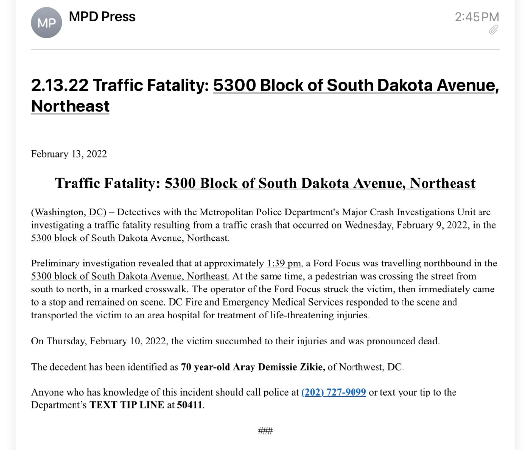
Catching up on some posts. Sadly, a pedestrian was struck and killed by a driver on South Dakota Avenue NE a few weeks ago. The police notice states that the pedestrian was walking in a marked crosswalk, crossing from south to north, when struck by a driver traveling northbound in the 5300 block of South Dakota Avenue. I asked MPD 4D Lt. Patrick Schaut about this at the single member district meeting of ANC Commissioner Damion McDuffie (5A01) on February 15, 2022. Lt. Schaut said this occurred at the intersection of South Dakota Avenue and Ingraham Street and that the hawk signal at that intersection had not been activated. Unclear to me how a driver traveling northbound South Dakota Avenue could hit someone walking south to north allegedly against the do not walk signal (according to one version of the police report), but MPD is still investigating. No other information was provided at the ANC 5A meeting on February 23, 2022. Condolences to the family of this individual.
Metro is soliciting comment on its proposed fiscal year 2023 budget, available at https://www.wmata.com/initiatives/budget. Complete Metro’s budget survey by February 15, 2022.
There will also be three public hearings, one each in Virgina, DC, and Maryland, February 7, 8, and 9. Metro’s budget site and hearing notice contain instructions on how to participate by video (advanced registration required) or in person. There are instructions on how to submit comments and view the public hearings, as well as a summary of the budget proposals. Some fare and service proposals are temporary changes that Metro made last fiscal year that it is now proposing to make permanent and others are entirely new changes. Metro is also proposing to close its sales office at Metro Center.
Town Hall will be held via Zoom on Thursday, January 27 at 6:00 p.m.
WASHINGTON, D.C. – Congresswoman Eleanor Holmes Norton (D-DC), chair of the Subcommittee on Highways and Transit, will hold a virtual town hall on Thursday, January 27, 2022, at 6:00 p.m. via Zoom. The town hall will focus on road safety for all users, including pedestrians, bicyclists, drivers, and scooter users.
The event will be open to the general public and media. To attend, RSVP by emailing NortonEvents@mail.house.gov by 5:00 p.m. on Wednesday, January 26.
Metropolitan Branch Trail Fort Totten to Takoma Public Meeting
(Washington, DC) – The District Department of Transportation (DDOT) will host the final design public meeting to discuss the design of the section of the Metropolitan Branch Trail (MBT). The MBT is an important transportation route, providing connections to neighborhoods where residents live , work, and play. Once fully completed, the MBT will be an eight-mile trail that runs from Union Station to Silver Spring, Maryland. The latest section being designed connects the Fort Totten Metro Station to the Takoma neighborhood. The preliminary design for this section was completed in 2016. A public meeting was held in February 2021 to update the public on the progress of the final design. DDOT is nearing the completion of the final design of this section. The key elements of the next section of the MBT include:
▪ New off-street and on-street trail segments ▪ Traffic calming features ▪ Storm water and low-impact development ▪ Traffic signals & Lighting ▪ Lighting & Utilities ▪ Maintenance of Traffic plans ▪ Landscaping plans
For more information about the project, please visit http://metbranchtrail.com If you have questions, please contact the PM Samer Alhawamdeh at metbrachtrail@dc.gov or Phone: (202) 369-4637.
WHAT: Public Meeting for the Metropolitan Branch Trail Fort Totten to Takoma Design Project WHEN: November 30, 2021 TIME: 6:30 p.m. – 8:30 p.m.
• Dial the US Toll – Washington D.C. Phone Number: +1-202-860-2110 • Dial the meeting’s Access Code: 2314 363 2000, followed by the # key. • The Webex system will prompt you for an Attendee ID, this is not required. Press the # key to join the meeting.
Can’t Make a Meeting?
Materials from this meeting will be made available at http://metbranchtrail.com within 24 hours of the conclusion of the meeting.
Do you need assistance to participate?
The District Department of Transportation (DDOT) is committed to ensuring that no person is excluded from participation in, or denied the benefits of, its projects, programs, activities, and services on the basis of race, color, national origin, gender, age, or disability as provided by Title VI of the Civil Rights Act of 1964, the Americans with Disabilities Act and other related statutes. In accordance with the D.C. Human Rights Act of 1977, as amended, D.C. Official Code sec. 2-1401.01 et seq. (Act), the District of Columbia does not discriminate on the basis of actual or perceived: race, color, religion, national origin, sex, age, marital status, personal appearance, sexual orientation, gender identity or expression, familial status, family responsibilities, matriculation, political affiliation, genetic information, disability, source of income, status as a victim of an intrafamily offense, or place of residence or business. Sexual harassment is a form of sex discrimination which is prohibited by the Act. In addition, harassment based on any of the above protected categories is prohibited by the Act. Discrimination is a violation of the Act will not be tolerated. Violators will be subject to disciplinary action.
If you need special accommodations please contact Cesar Barreto at 202-671-2829 or Cesar.Barreto@dc.gov 72 hours in advance of the meeting.
If you need language assistance services (translation or interpretation), please contact Karen Randolph at 202-671-2620 or Karen.Randolph@dc.gov 72 hours in advance of the meeting. These services will be provided free of charge.
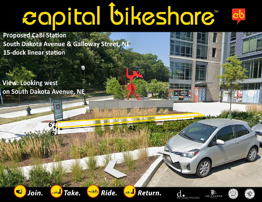
From DDOT presentation: Views of proposed location for new bikeshare location, South Dakota Avenue & Galloway Street NE
A 15-dock bikeshare station is slated for the northwestern corner of South Dakota Avenue and Galloway Street NE. District Department of Transportation (DDOT) Bicycle Program Specialist Greg Matlesky was on the agenda for ANC Commissioner Gordon Fletcher’s (5A08) community meeting on September 21, 2021. His presentation was cut short due to technical issues.
One note, the price chart on slide 5 in the presentation is now out of date. The new pricing/time restrictions, effective October 1, 2021, can be found here, reprinted below.
There is additional pricing information for ebikes on the website.
In a follow-up email, Mr. Matlesky stated that DDOT hopes to install the new station sometime next year, but he said that supply chain issues are affecting bikeshare installations so DDOT cannot say for sure (and also their efforts right now are focused on replacing original installations from 2010 and 2011). He said they hope to have a full network of bikeshare stations along the South Dakota Avenue NE corridor within a year or two.
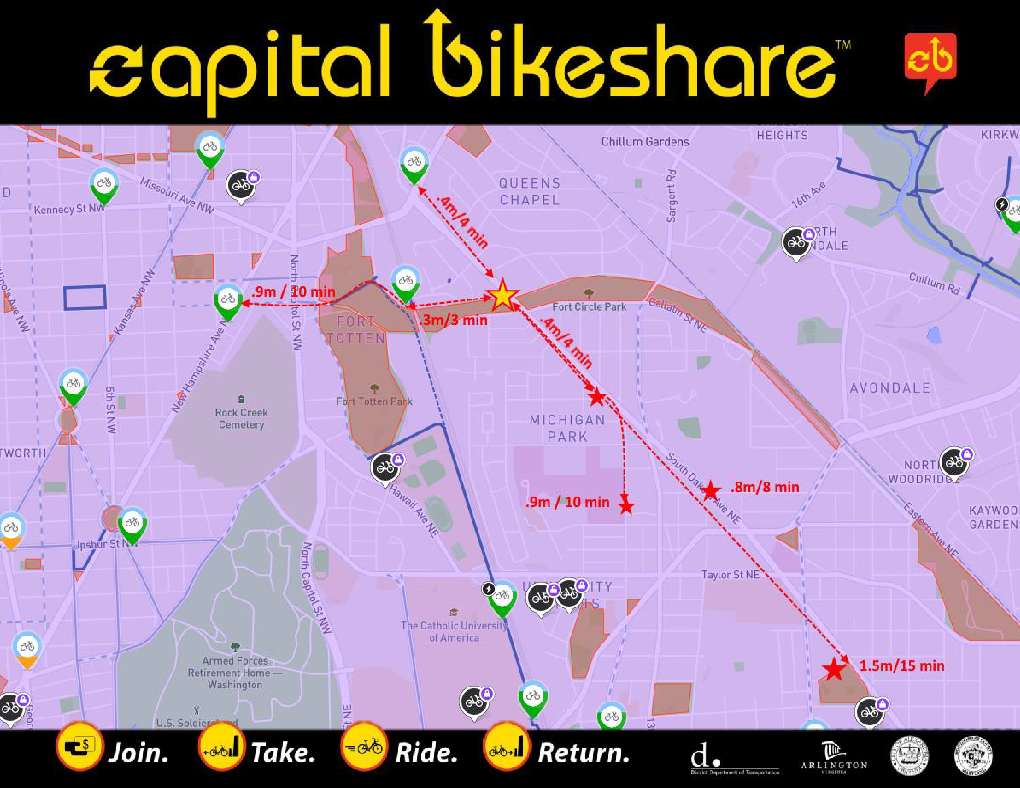
From DDOT presentation: View of bikeshare locations near South Dakota Avenue and Galloway Street NE
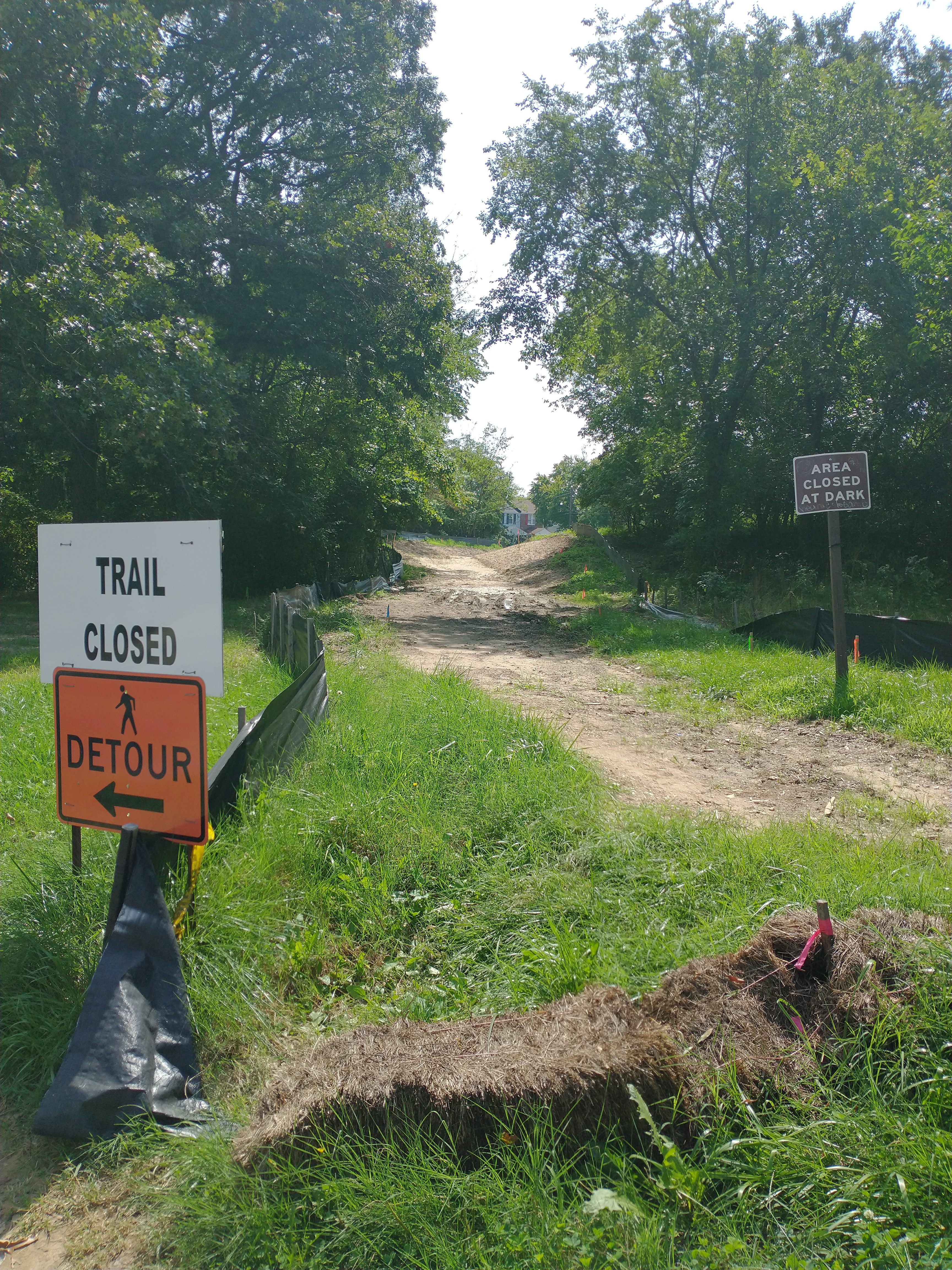
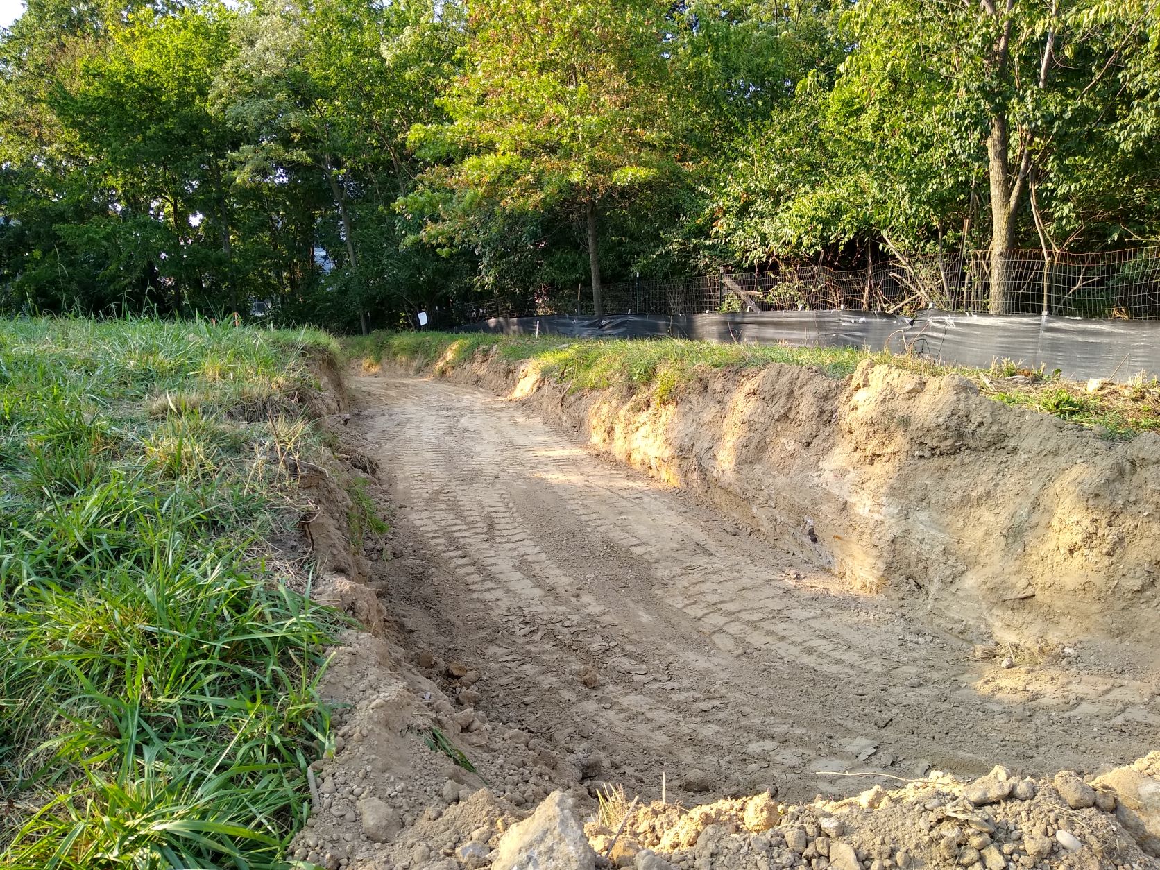
View of unfinished path from Galloway Street NE, September 8, 2021
Just when we thought things were finally back on track for construction of the North Michigan Park-Fort Totten pedestrian path between Galloway and Gallatin streets NE, ANC 5A sends word that the National Park Service (NPS) is halting construction again. And this time more indefinitely it appears. See the communication from ANC 5A below:
The National Park Service (NPS) recently paused construction of the Fort Totten pedestrian trail between Galloway Street and Gallatin Street, N.E. again.
During preparations to resume construction, the NPS discovered an underground infrastructure that may prohibit the trail from being constructed as planned. The NPS is surveying the site and considering other options for the trail that could include redesigning the trail or changing its route.
The site will remain closed for public safety as we explore these options.
We know this project is important to the community, and it is important to us, too. We will resume construction as soon as possible.
Please reach out to me at kym_elder@nps.gov if you should have any questions.
Color me confused. NPS does not indicate exactly what this “underground infrastructure” is.
This also makes me wonder if a path/sidewalk will ever get constructed on the south side of Galloway between South Dakota and 4th Street NE. That path should have been designed a long time ago. I was told by someone in the District Department of Transportation (DDOT) that after funding was finally budgeted for design, NPS designed a path that was six feet when it should have been 10 feet. Earlier this year in April, NPS wrote to me that “DDOT just transferred the funding to Federal Highway Administration to complete the design of the sidewalk from South Dakota Avenue NE to the existing DDOT/WMATA sidewalk along Galloway Street NE. We do not have a timeline at this point when the design will be completed.” So design of that path appears to be sitting in a black hole somewhere between NPS and DDOT. I remain confused about why all of this seems so hard.
In any case, it is not clear what the timeline is for next steps on the Gallatin-Galloway path or how and when NPS intends to rehabilitate the area where extensive soil has already been removed for construction. But hopefully the unfinished path will not just become an even bigger mud pit than it already was before this project got started.
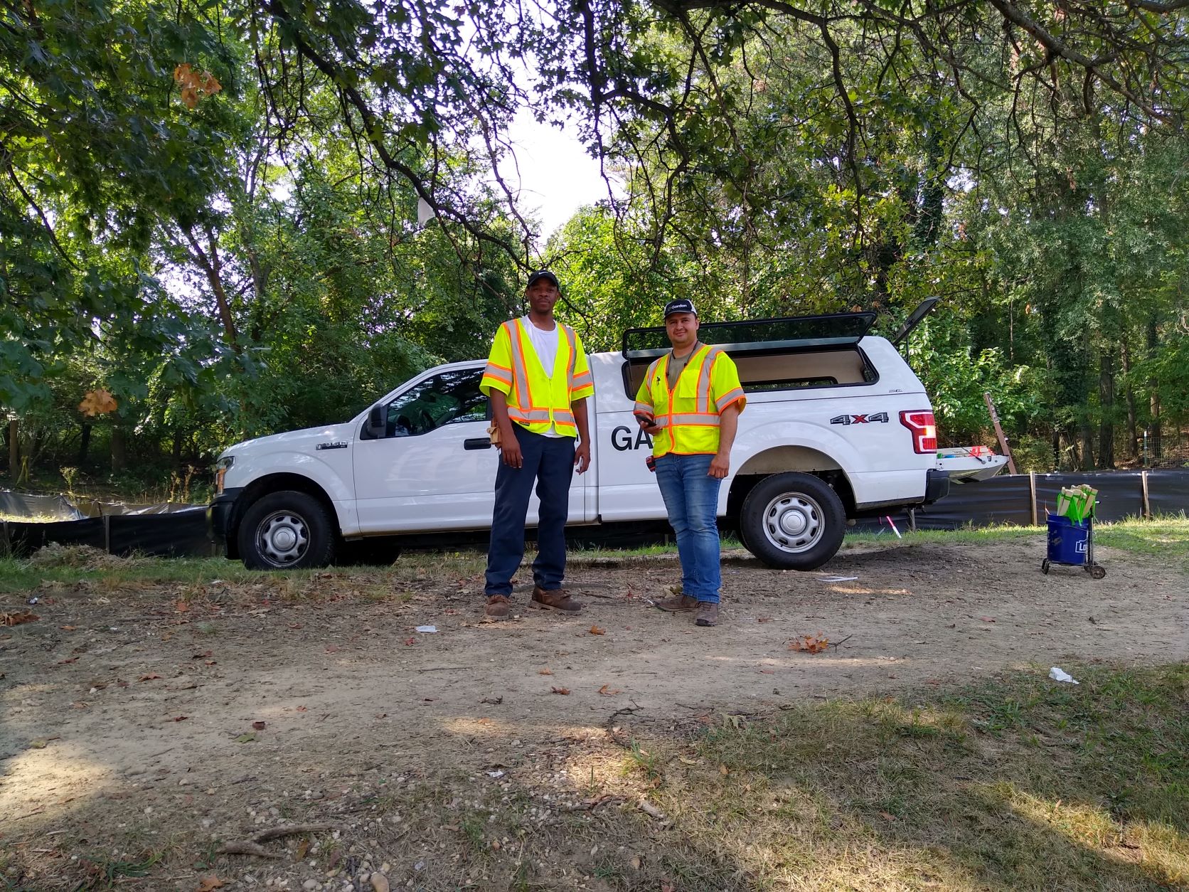
Construction activity has begun in earnest on the North Michigan Park-Fort Totten pedestrian trail after being halted in July 2020 due to the discovery of an unexploded ordnance on the trail. After testing the soil and getting negative test results, the National Park Service removed the fencing around the trail last month to resume work.
On Tuesday, August 10, 2021, surveyors surveyed and staked the trail a year after its closure.
Surveyor team, August 10, 2021. Photo credit: Robert Oliver
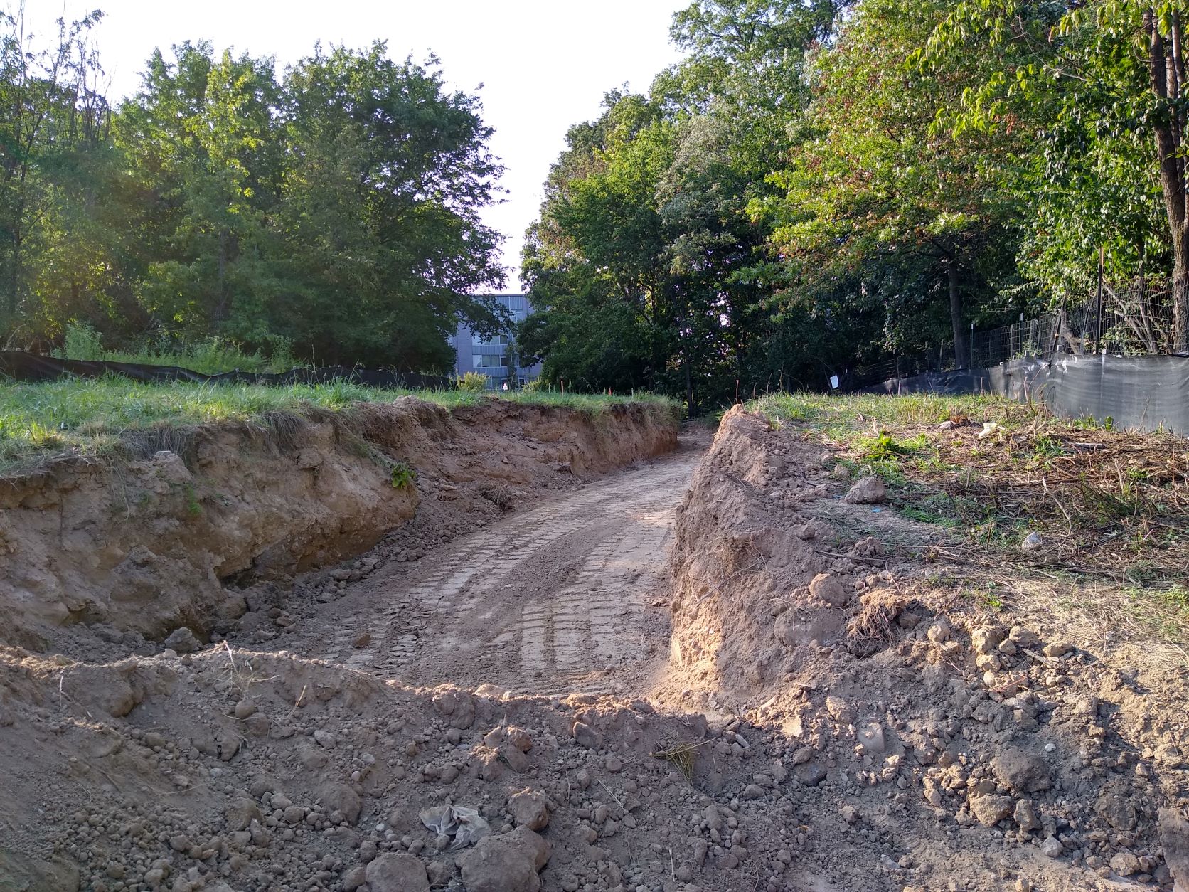
On Thursday, August 12, 2021, the Oak Hill construction team arrived to complete the job. Oak Hill is a subcontractor hired by Autumn General Contracting, LLC. Oak Hill’s construction supervisor stated work to complete the pedestrian path connecting Galloway and Gallatin streets NE across Fort Totten Park should take around six weeks. The crew began removing dirt to prepare the site.
Hauling dirt, August 12, 2021. Photo credit: Robert Oliver
View of trail construction towards Galloway Street NE, August 12, 2021. Photo credit: Robert OliverView of trail construction towards Gallatin Street NE, August 12, 2021. Photo credit: Robert Oliver
A reader asked for a status update on construction of a formal pedestrian trail between Gallatin Street NE and Galloway Street NE that will provide better access for North Michigan Park residents to the Fort Totten Metro station. I confirmed with the National Park Service (NPS) that construction will resume sometime this month in July. Trail construction began at the beginning of July 2020, but was halted just a few weeks later after the construction crew found an unexploded ordnance. Construction has been halted and the area closed off since then in order for NPS to conduct soil testing and figure out next steps to make sure it was safe to continue building the trail.
NPS previously communicated to a couple of residents in May 2021 that construction will begin again in July 2021. I confirmed with NPS yesterday June 30 that they still anticipate a July timeframe to resume construction. NPS stated in an email to me yesterday, “Yes, the trail construction is scheduled to restart later next month and the negative test results is allowing us to continue the work.”
I know that NPS has been giving various dates for resuming construction for a while now, but I think this July timeframe is the most realistic timeframe they have provided so far. So hopefully, residents will in fact see construction of the trail begin again soon.
And also a quick update on a separate, but nearby project, which is the sidewalk that is supposed to be installed on the south side of Galloway between South Dakota Avenue & 4th Street NE. NPS informed me at the end of April 2021, “DDOT just transferred the funding to Federal Highway Administration to complete the design of the sidewalk from South Dakota Avenue NE to the existing DDOT/WMATA sidewalk along Galloway Street NE. We do not have a timeline at this point when the design will be completed.” There have some been some design hiccups with this particular project. I have not followed up with NPS about this issue since that correspondence in April, but my understanding is that their posture is still the same at this point.
Residents in ANC 5A now have access to ParkDC Permits, a new system the District Department of Transportation (DDOT) is testing for managing visitor parking permits. With this new system, residents will be able to print out visitor parking passes from a personal printer (or from DC public libraries, DDOT kiosks, or DC police stations if you do not have a personal printer available). Visit https://parkdc.com/permits to register. Be sure to check out the FAQ page because it explains a lot. See DDOT’s notice below.
Dear Resident,
The District Department of Transportation (DDOT) is excited to announce the preliminary launch of ParkDC Permits, a new, centralized system for DC residents and their visitors to manage visitor, temporary, home health aide, and contractor parking permits via a single online portal.
ParkDC Permits is now available for live testing to you as a resident of ANC 5A in the Michigan Park and Queens Chapel neighborhoods. You can use ParkDC Permits for all of your visitor parking needs. All of the information you need to get started is available on the ParkDC Permits website. Check out ParkDC Permits Instructional Videos and the ParkDC Permits FAQs for more information about the system.
The digital portal will be available District-wide next month. For more information, read the May 2021 Press Release announcing the launch of DDOT’s new digital parking permit system.
If you have questions or need support getting started using ParkDC Permits, please use the feedback feature on the ParkDC Permits website, call our 24/7 Call Center at 202-671-2631, or email ddot.parking@dc.gov.
Advisory Neighborhood Commission 4B’s Vison Zero Committee will meet on Wednesday, June 16, 2021, beginning at 6:00 p.m. The Committee will be meeting virtually. Details about participating/watching the meeting are included below: For video participation via Zoom on a computer or mobile device, click this link: https://streetjustice-news.zoom.us/j/83166670715?pwd=V3RDR05ydlc0eFZZUC9EbmFBWkhPdz09
Meeting ID: 831 6667 0715. Password: 638567.
For voice-only participation on a telephone, dial (301) 715-8592. Meeting ID: 831 6667 0715. Password: 638567.
Summer platform reconstruction: West Hyattsville, Prince George’s Plaza, College Park-U of Md, and Greenbelt closed, May 29 – September 6
Rail Service Information
No Green or Yellow Line rail service north of Fort Totten.
Yellow Line trains will operate between Huntington & Mount Vernon Square.
Green Line trains will operate between Branch Ave & Fort Totten.
On all lines, trains will operate every 12 minutes on weekdays, every 15 minutes on weekends, and every 20 minutes after 9 p.m. Headways are subject to change based on additional weekend track work elsewhere on the system.
Travel Alternatives
Free shuttle bus service will be available at the closed stations:
Limited-stop service between Greenbelt, College Park-U of Md & Fort Totten every 6-10 minutes.
Limited-stop service between Prince George’s Plaza, West Hyattsville & Fort Totten every 6-10 minutes.
Local service between Greenbelt, College Park-U of Md, Prince George’s Plaza, & West Hyattsville every 15 minutes.
MARC Camden Line trains will continue to operate at Greenbelt and College Park-U of Md to Union Station.
Customers may also consider the regular-route bus service detailed below to get around the construction areas. Metrobus timetables are available here.
Greenbelt
Metrobus G12 & G14: service to New Carrollton Station
Metrobus R12: service to College Park-U of Md & Deanwood stations
TheBus 16: service to New Carrollton Station
College Park-U of Md
Metrobus 83: service to Rhode Island Ave Station
Metrobus 86: service to Prince George’s Plaza & Rhode Island Ave stations
Metrobus F6: service to New Carrollton, Prince George’s Plaza, West Hyattsville & Fort Totten stations
Metrobus R12: service to College Park-U of Md & Deanwood stations
Prince George’s Plaza
Metrobus 86: service to Prince George’s Plaza & Rhode Island Ave stations
Metrobus F4: service to Silver Spring & New Carrollton stations
Metrobus F6: service to New Carrollton, Prince George’s Plaza, West Hyattsville & Fort Totten stations
Metrobus F8: service to West Hyattsville & Cheverly stations
Metrobus R4: service to West Hyattsville & Brookland stations
TheBus 13: service to West Hyattsville Station
TheBus 18: service to Addison Rd Station
West Hyattsville
Metrobus F1 & F2: service to Takoma & Cheverly stations
Metrobus F6: service to New Carrollton, Prince George’s Plaza, West Hyattsville & Fort Totten stations
Metrobus F8: service to West Hyattsville & Cheverly stations
Metrobus R4: service to West Hyattsville & Brookland stations
TheBus 13: service to West Hyattsville Station
Parking Information
Beginning Saturday, May 29, parking at Greenbelt, College Park-U of Md, Prince George’s Plaza and West Hyattsville stations will be free for the duration of the closures. Regular rates will be charged at other Metro parking facilities.
Advisory Neighborhood Commission 4B’s Vision Zero Committee will meet on Wednesday, May 19, 2021, beginning at 6:00 p.m. The Committee will be meeting virtually. Details about participating/watching the meeting are included below:
For voice-only participation on a telephone, dial (301) 715-8592. Meeting ID: 831 6667 0715. Password: 488799. To watch (but not participate) via YouTube: https://youtu.be/PbHxKWu8X0s.
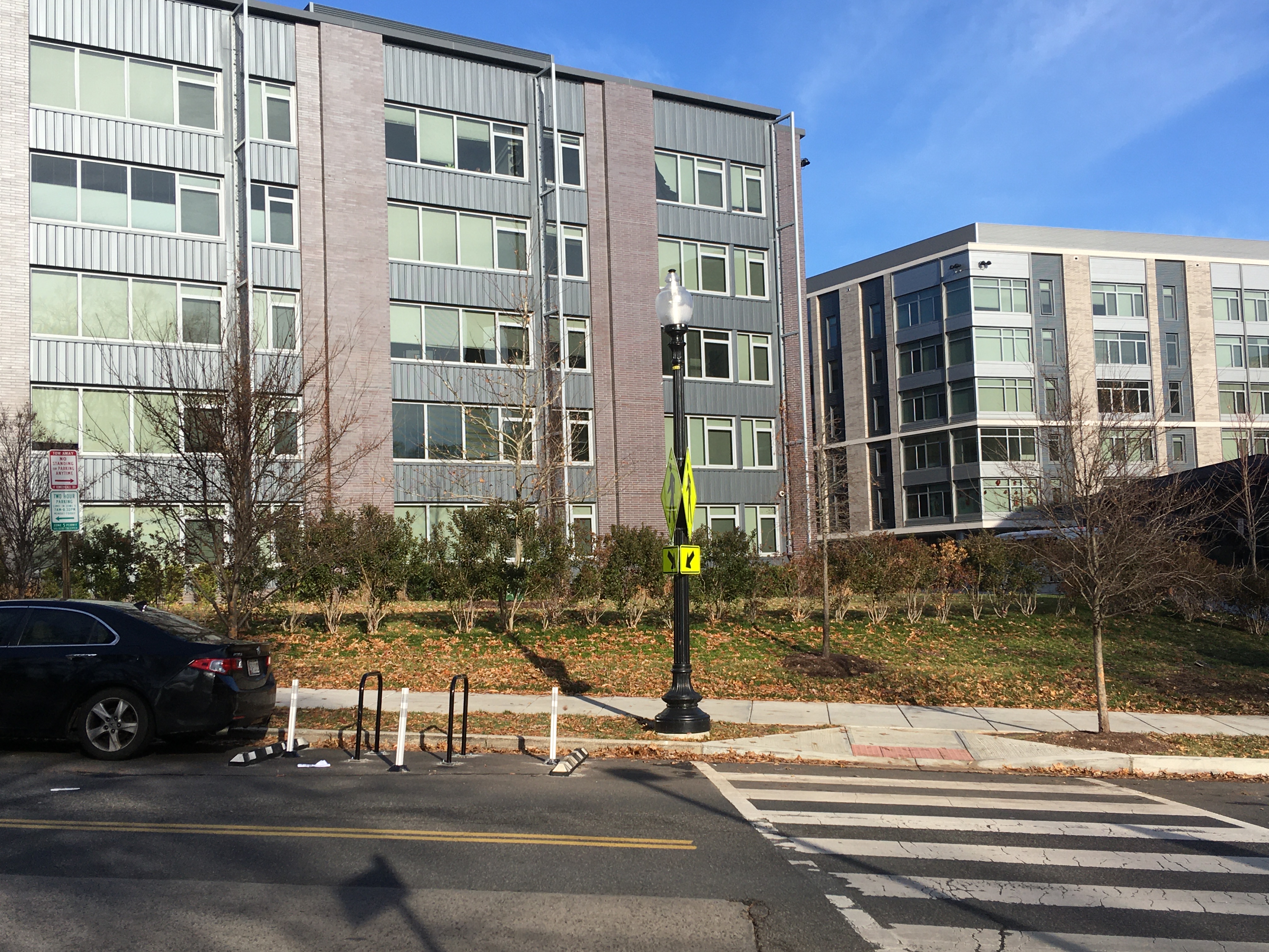
Flexiposts installed 400 block Galloway Street NE near the Modern
After years of 311 service requests, email exchanges, pictures, and letters to the Council during performance oversight season, the District Department of Transportation (DDOT) informed me on March 25, 2021, that they approved installation of flexiposts behind the crosswalk in the 400 block of Galloway Street NE near the Modern at Art Place. DDOT installed the flexiposts earlier this week. This is great news for those of us who have been nagging DDOT about the crosswalk near The Modern and the fact that drivers continuously parked in a way that blocked the sightline of pedestrians and drivers (see this post, for example).
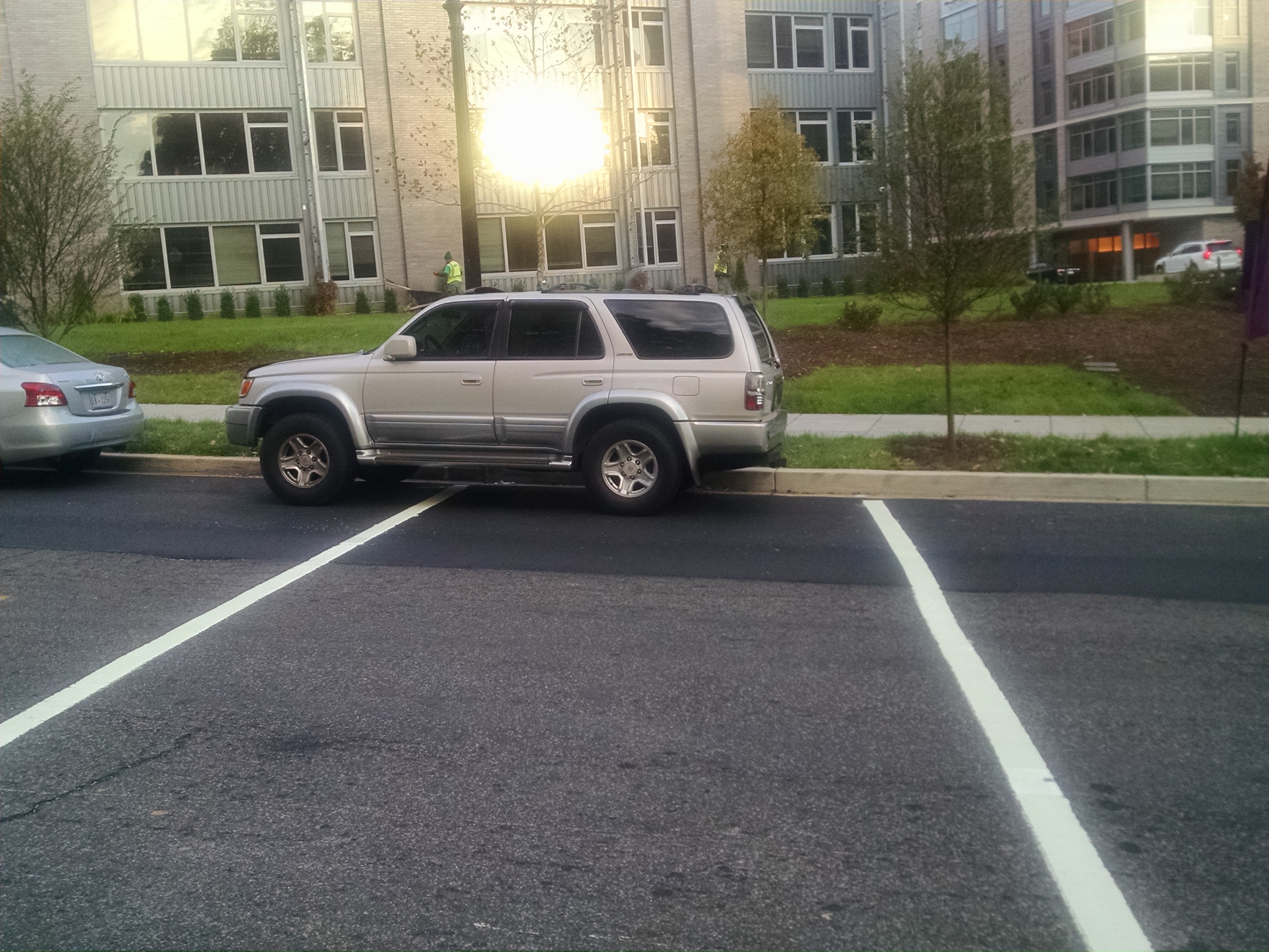
The story of this particular crosswalk is a 3.5 year saga. Before the Modern was built in 2017, 4th Street NE used to be a through street between Galloway and Kennedy. There were marked crosswalks at the intersection of 4th and Galloway. This is important because there is not a sidewalk on the south side of Galloway Street across from the Modern. Some residents choose to walk up the inclined, wooded path on the south side of the street, but many also choose to use the sidewalk on the north side and cross at 4th Street to walk to Fort Totten Metro station.
View of dirt path on south side of Galloway Street NE
During construction of the Modern, the crosswalk that was at 4th and Galloway was removed. After the Modern was built, 4th Street was permanently closed between Galloway and Ingraham, basically becoming the apartment community’s private driveway. Immediately after the building opened in fall 2017, we asked that the crosswalk in the 400 block of Galloway be reinstalled because again there is not a sidewalk on the other side of the street, and just because 4th Street was now closed, that did not mean that the crosswalk had to be removed.
At first, DDOT wanted us to submit a service request for a new crosswalk. We all know how long it takes the agency to install a new crosswalk though. We argued that it was not a new crosswalk, and we had already submitted a service request to restripe the crosswalk. The developer should have been required to reinstall the crosswalk that had previously been there. In the interim, we were also told that DDOT in fact instructed the developer not to reinstall the crosswalk for reasons, but who knows. Anyhow, thanks to Google street view and intervention by Ward 5 Councilmember Kenyan McDuffie’s office, we were able to send DDOT photographic evidence showing that we were not making it up that a crosswalk existed there for many years. So DDOT ordered the developer to install a crosswalk. But then no curb cut was installed because remember neither the developer nor DDOT intended for there to be a crosswalk. So drivers would literally park in the crosswalk all the time because I guess they thought it was an option to do so.
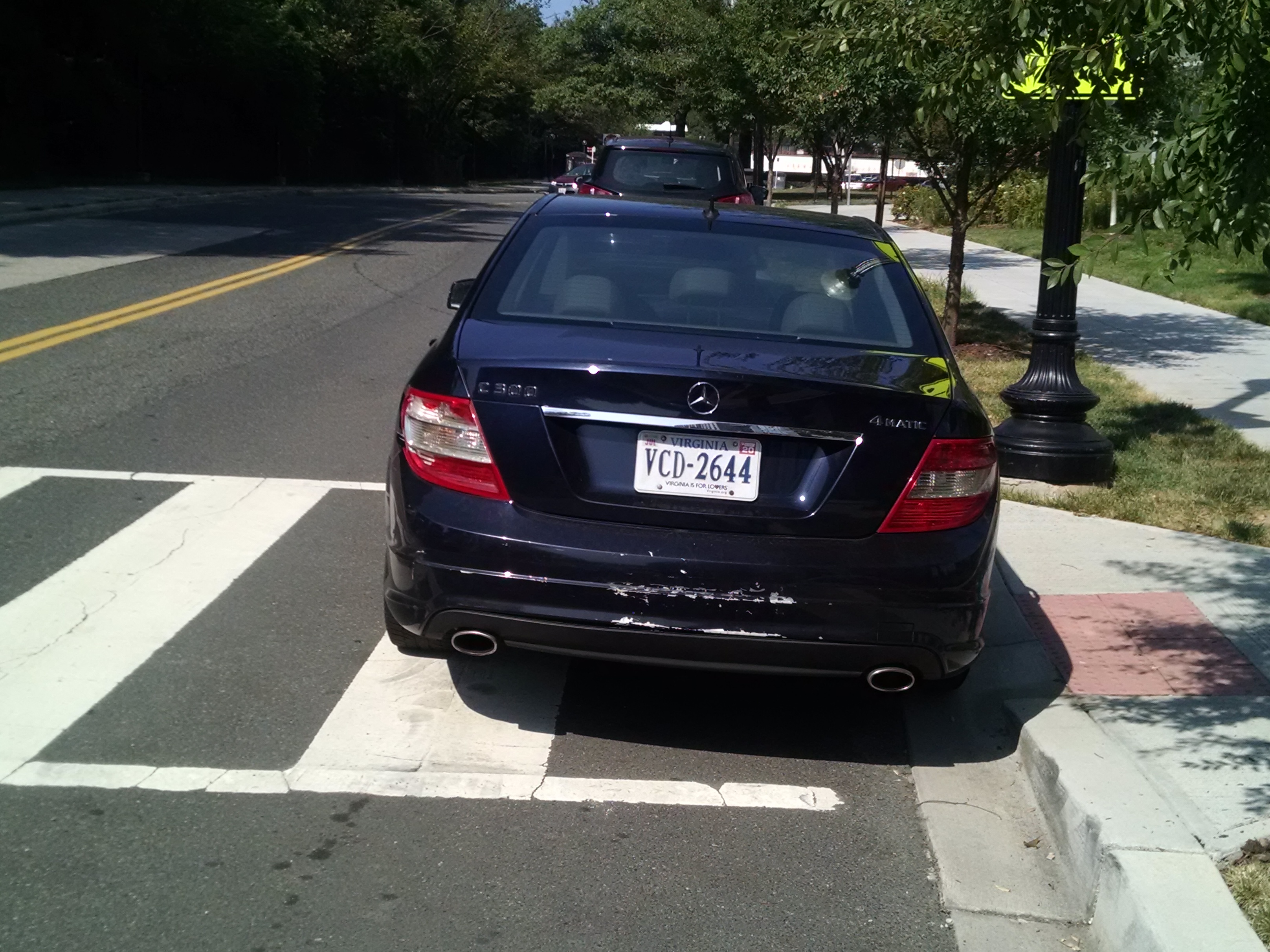
Car parked in crosswalk 400 block of Galloway Street
So we took pictures of cars parked in the crosswalk and asked that a curb cut be installed so that drivers would not park in the crosswalk. That took some time. Even then, some drivers still parked in or partially in the crosswalk (very strange behavior).
In any case, the result ended up being that there was then a crosswalk between two parked cars because there was just enough space for one car behind the crosswalk. So sometimes drivers would still park partially in the crosswalk.
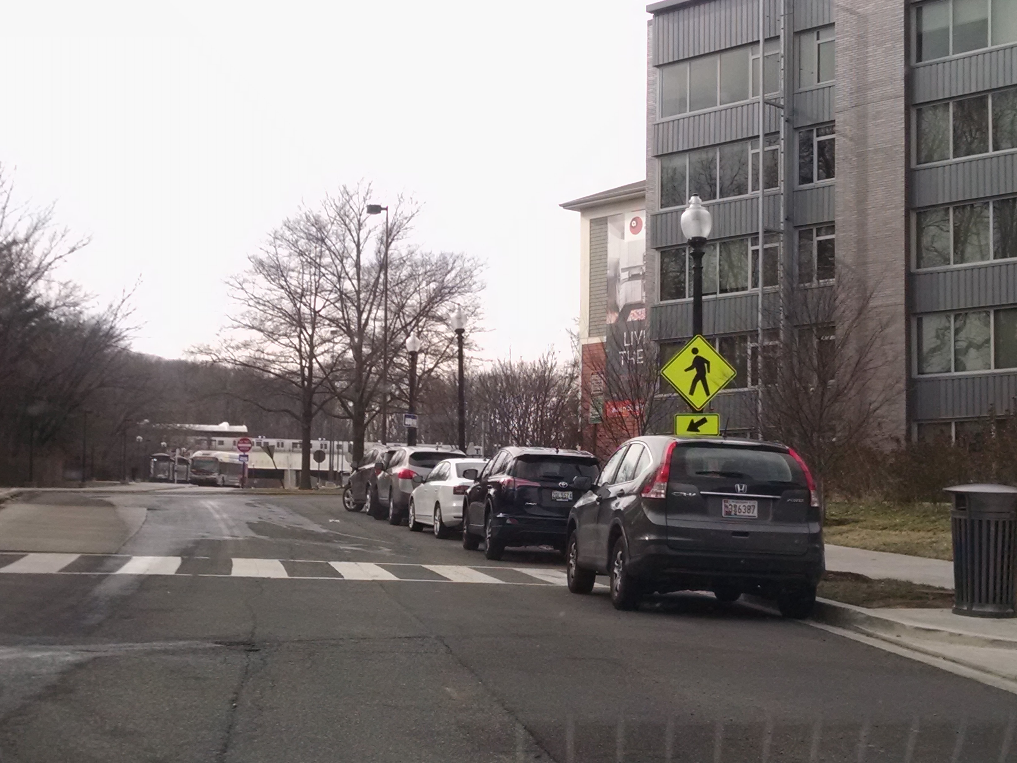
The bigger issue though was that drivers could not see a pedestrian waiting to cross in the crosswalk between two parked cars and a pedestrian would have to walk out into the street to see around the car parked behind the crosswalk. None of this made any sense. We requested “no parking” signage, which DDOT put in front of the crosswalk after many months of requests, but it was placed right in front of a tree so no one could see it unless people knew to look for it.
DDOT installed high visibility pedestrian crossing signs pointing to the crosswalk so that motorists would know the crosswalk was there. For a while, DDOT told us there was only one signmaker or something so that is why it took a while to get the signs done apparently. DDOT refused to install signage indicating that no parking was allowed behind the crosswalk though because according to them the existing signage was adequate. According to them, the space behind the crosswalk was not a legal parking space because it was so close to the crosswalk and the driveway to the Modern. I suppose people were supposed to know that, but every day people would park behind the crosswalk. DDOT said it was a parking enforcement issue. And to be fair, some days DPW would ticket a car parked behind the crosswalk. I told DDOT it did not make sense to keep issuing tickets when it was clear that people thought they were allowed to legally park behind the crosswalk.
In December 2019, following multiple email exchanges among myself, the ANC, DDOT, and CM McDuffie’s office, DDOT installed a micromobility corral in front of the crosswalk to provide a buffer. Interestingly enough, that corral is actually not as big as it should be because there was a car parked behind the “no parking” sign when DDOT went to install the corral.
View of micromobility corral in 400 block of Galloway Street NE
Still DDOT did nothing about cars parked directly behind the crosswalk. So I asked the ANC to draft a resolution requesting signage and flexiposts so that cars could not be parked behind the crosswalk. DDOT dragged its feet for many more months and told me they could not put flexiposts behind the crosswalk because it was too close to the driveway or something. So I took pictures of flexiposts installed near intersections and also sent them pictures every day of cars parked behind the crosswalk blocking the sightline of pedestrians and drivers. Finally, on March 25, 2021, DDOT informed me that installation of flexiposts was approved.
I recount all of this just because there has been a renewed focus on Vision Zero, given the completely reckless driving taking place during the pandemic. To me, it seems that DDOT would want to take care of low-hanging fruit like this situation fairly quickly while the big fights about the big projects go on. There is also this sense of urgency from the mayor’s office in getting people to return to school and office buildings, meaning soon enough there will be more pedestrians traveling along this street to get to work and school. We noted to DDOT that this crosswalk is right next to a daycare center that would be opening at some point. But it took them almost four years to adequately resolve the issue of a crosswalk that should have been reinstalled after construction of a new building. The transportation plan for this new building should have included provision for replacement of the crosswalk. Residents should not have to take pictures every day and take time out of their day to send repeated communications to DDOT, the mayor’s office, or the councilmember’s office for something that should already be in a construction plan and monitored by DDOT. There is a sort of dismissiveness from the agency that becomes really grating after a while that sometimes results in residents saying “forget it,” and that is not a good result for anyone.
I will say the one bright spot in this saga was the support of DDOT’s Ward 5 liaison Kelly Jeong-Olson, who is always awesome, and Ty’on Jones before her. They deserve kudos for actually listening to residents.
We can now finally stop talking about this crosswalk and move on to other things, like that missing sidewalk on the other side of the street.
Metro is soliciting input on its proposed fiscal year 2022 budget, available at wmata.com/budget. Complete Metro’s budget survey by March 16, 2021. The survey walks you through the proposed rail changes, which are easier to digest. Metro proposes keeping rail service at current levels for the remainder of 2021 and proposes an alternative plan beginning January 1, 2022, if additional funding is not secured. The alternative rail plan includes options for service frequency, operating hours (with system closing at 9:00 pm instead of 11:00 pm), turning back trains on the red and yellow lines, and closing some metro stations (Archives, Arlington Cemetery, Cheverly, Clarendon, Cleveland Park, College Park, East Falls Church, Eisenhower Ave, Federal Center SW, Federal Triangle, Greensboro, Grosvenor-Strathmore, Judiciary Sq, McLean, Morgan Boulevard, Mt Vernon Sq, Smithsonian, Van Dorn St, Virginia Square, Innovation Center*, Loudoun Gateway*, and Reston Town Center* – *Pending opening of Silver Line Phase II).
If you are interested in commenting on bus changes, look at the links for proposed bus changes on Metro’s budget website before completing the survey.
ANC 4B recently passed a resolution addressing Metro’s proposed budget. One of the ANC’s recommendations is that Metro “reopen the public comment period for the FY2022 budget before the final six months ‘fiscal cliff’ budget period that results in substantial service cuts in January 2022, especially if there is a possibility of additional federal or jurisdictional funding.” It is worth looking at some of the other recommendations in that resolution as well.
Metro is facing a significant budget shortfall due to a decrease in ridership caused by the Covid-19 pandemic. A second relief package from Congress in December 2020 allowed Metro to avoid layoffs, continue providing essential travel service and prepare for transit ridership to return. However, even with the additional funding there is not enough money to fill the entire budget gap for the fiscal year that begins July 1, 2021.
Metro is working with our Congressional delegation to secure additional funding to continue providing service as the region comes back to work. But service cuts remain a looming threat, and Metro must plan accordingly.
Metro’s budget for Fiscal Year 2022 (July 1, 2021 – June 30, 2022) is under consideration now, and Metro is requesting your feedback. Metro’s Board of Directors and management will consider your feedback when making difficult decisions this spring.
Tell us what matters to you
Public feedback is vital in helping Metro’s Board of Directors and management make decisions about pandemic recovery. Let us know what you think by 5 p.m. Tuesday, March 16, 2021.
Because of the ongoing pandemic, Metro will be hosting all Public Hearings virtually. To provide oral testimony at a hearing, participants must call toll-free 512-580-8850 and enter the four-digit meeting code for the Public Hearing you’d like to attend.
Below is a list of dates, times and meeting codes for each of the virtual Public Hearings: Date/Time: Monday, March 8, 2021, 11 a.m. Host: Board Member Paul Smedberg Meeting Code: 9476
Date/Time: Monday, March 8, 2021, 6 p.m. Hearing will focus on proposed changes in DC, but is open to everyone. Host: Board Member Stephanie Gidigbi-Jenkins Meeting Code: 3811
Date/Time: Tuesday, March 9, 2021, 6 p.m. Hearing will focus on proposed changes in Maryland, but is open to everyone. Host: Board Member Michael Goldman Meeting Code: 9131
Date/Time: Wednesday, March 10, 2021, 6 p.m. Hearing will focus on proposed changes in Virginia, but is open to everyone. Hosts: Board Members Paul Smedberg and Walter Alcorn Meeting Code: 9141
Watch or listen live Watch or listen to the Public Hearings live on this page, on YouTube.com/MetroForward or by calling toll-free 512-580-8850 and entering in the four-digit meeting code.
Public feedback will be provided to Metro’s Board of Directors in April 2021 as part of the final decision-making process. Any Board-approved changes will begin after Board approval in April 2021.
The District Department of Transportation (DDOT) is updating its moveDC long-range transportation plan. You might have taken a survey for the 2021 update at the end of 2020 as highlighted in this post. DDOT is out with another survey for the 2021 update (also referred to as the second phase). This one is super short. Take advantage of the opportunity to leave comments by clicking on the comment icon in the survey. Complete the survey here by March 31, 2021.
The project website for the moveDC 2021 update is wemovedc.org. The first phase of the moveDC plan was rolled out in 2014. You can view implementation progress of the 2014 plan here. If you missed the February townhalls, you can view the presentations at wemovedc.org.
(Washington, DC) – The District Department of Transportation (DDOT) is updating its long-range, multimodal transportation plan, moveDC, to determine the agency’s priorities over the next two decades. DDOT will host two virtual public meetings to review how the goals and policies identified in the first round of the survey released in October 2020 will be potentially implemented.
The same information will be presented at both meetings.
WHAT: Public Meeting – update on moveDC 2021 WHEN: February 9, 2021 at 6:30 p.m. or February 11, 2021 at 1:30 p.m. WHERE:rebrand.ly/moveDC-Feb2021
For more information about moveDC, please contact DDOT Project Manager Lezlie Rupert at move.dc@dc.gov or 202-599-7371 or visit the study website at wemoveDC.org.
Can’t Make a Meeting?
Materials from this meeting will be made available on www.wemoveDC.org within 24 hours of meeting conclusion. Those who would like to leave a comment about the study can do so by leaving a comment on the project website.
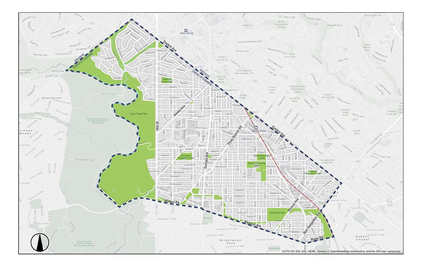
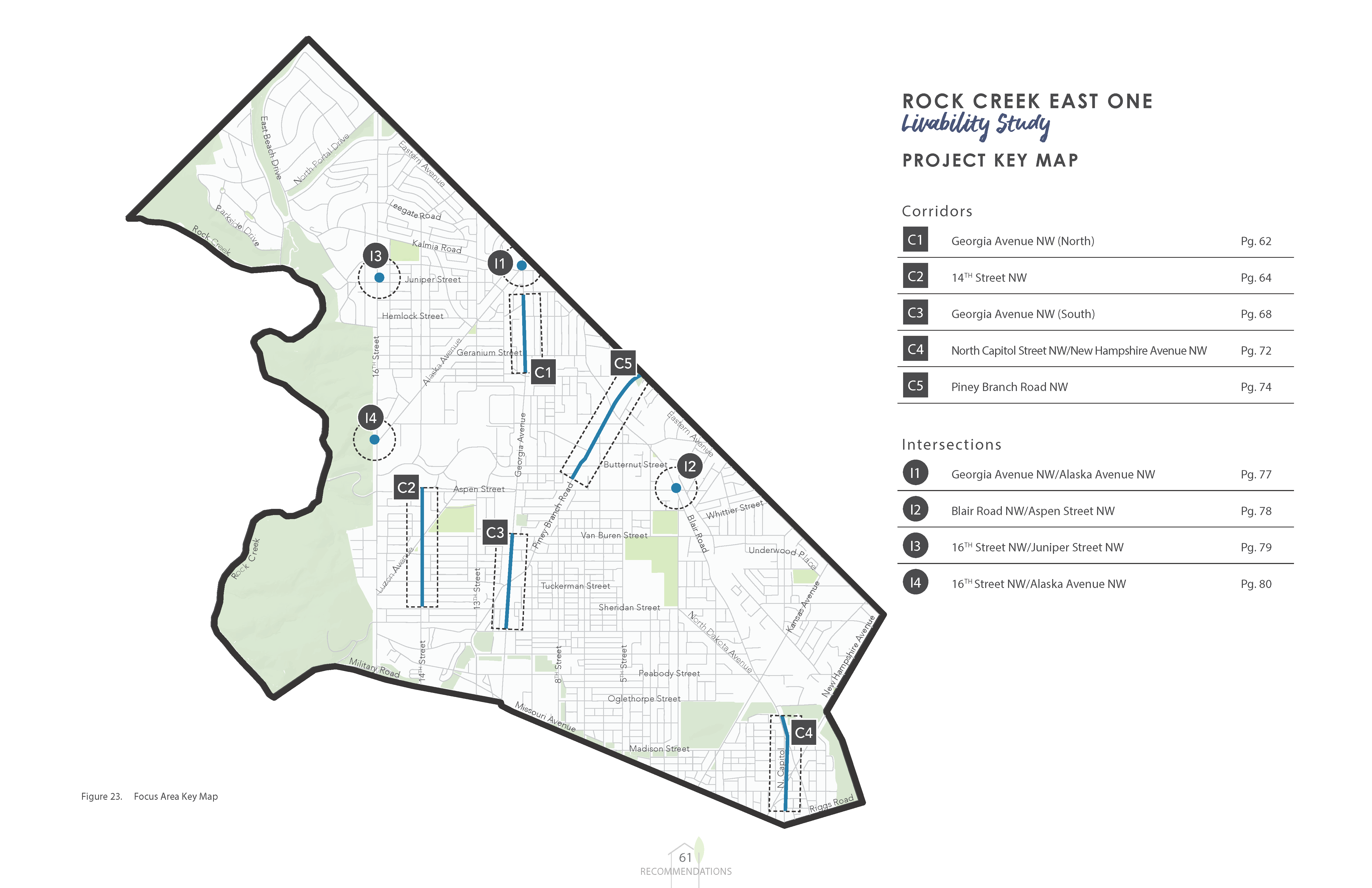
Riggs Park is just outside the study area, but Lamond is included. The study area is defined by Rock Creek and the Maryland border to the West, Eastern Avenue to the North, New Hampshire Avenue NE and the Red Line Metrorail tracks to the East, and Military Road NW, Missouri Avenue NW, and Riggs Road NE to the South
The District Department of Transportation (DDOT) announced last week that the final report for the Rock Creek East I Livability Study is now available on the project’s website. The study area includes Lamond, but not Riggs Park as Riggs Park is in a different planning area. The email from the project planner states, “DDOT welcomes any thoughts and suggestions in prioritizing project recommendations. DDOT will identify opportunities to implement short, medium, and long-term recommendations from the study.”
I have not taken a deep dive into the report but from a brief skim, it identifies several “focus area opportunities.”
Map of focus areas
Focus area corridors:
Georgia Avenuew NW (North);
14th Street NW;
Georgia Avenue NW (South);
North Capitol Street NW/New Hampshire Avenue NW;
Piney Branch Road NW
Focus area intersections:
Georgia Avenuew NW/Alaska Avenue NW
Blair Road NW/Aspen Street NW
16th Street NW/Juniper Street NW
16th Street NW/Alaska Avenue NW
I attended a a couple of the public meetings for this study but did not invest as much time or attention as I might have were Riggs Park included in the study area. That said, I did speak with DDOT representatives during the public meetings to point out areas of concern that are a couple of block outside of the study area (such as Riggs Road and South Dakota Avenue NE). Those representatives assured me that these concerns could be addressed outside of this particular study.
In any case, if residents have suggestions about short/long term fixes or priorities for any part of the study area, I am sure ANC commissioners and the Ward 4 council office would be interested in listening.
The Commission is now seeking applicants for Committee membership. You must be a resident or businessowner within the Commission’s boundaries to be a member. Check if you reside within the Commission’s boundaries here: https://anc4b.com/about-the-anc/.
If you are interested in serving as a member of the Committee, please email a statement of interest, including any relevant experience, by February 15th. The Commission will not be monitoring responses to the listservs. Please send any statements of interest directly to the Co-Chairs of the Committee, Commissioner Evan Yeats (4B01), at 4B01@anc.dc.gov and Commissioner Alison Brooks (4B08), at 4B08@anc.dc.gov.