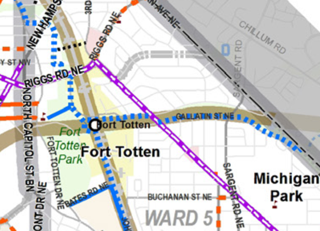
At ANC 4B’s meeting on February 24, 2020, DDOT shared updates about a couple of projects that have been on the backburner.
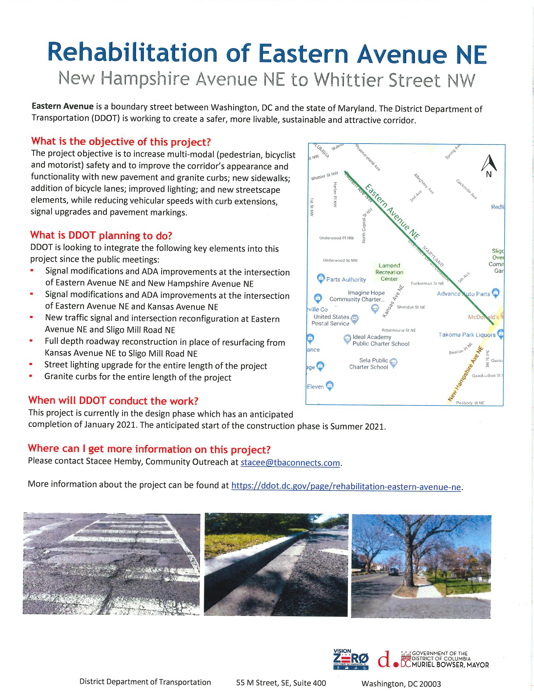
Rehabilitation of Eastern Avenue NE
DDOT Eastern Avenue NE Rehabilitation Project Fact Sheet
The long-awaited rehabilitation of Eastern Avenue NE between New Hampshire Avenue NE and Whittier Street NW has been delayed. DDOT tweaked the design to add a few items to the scope of the project. Construction is now anticipated to start in summer 2021. The project website is https://ddot.dc.gov/page/rehabilitation-eastern-avenue-ne. View DDOT’s handout here.
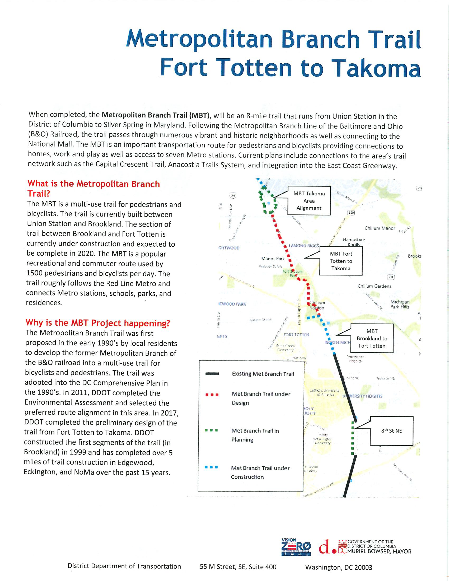
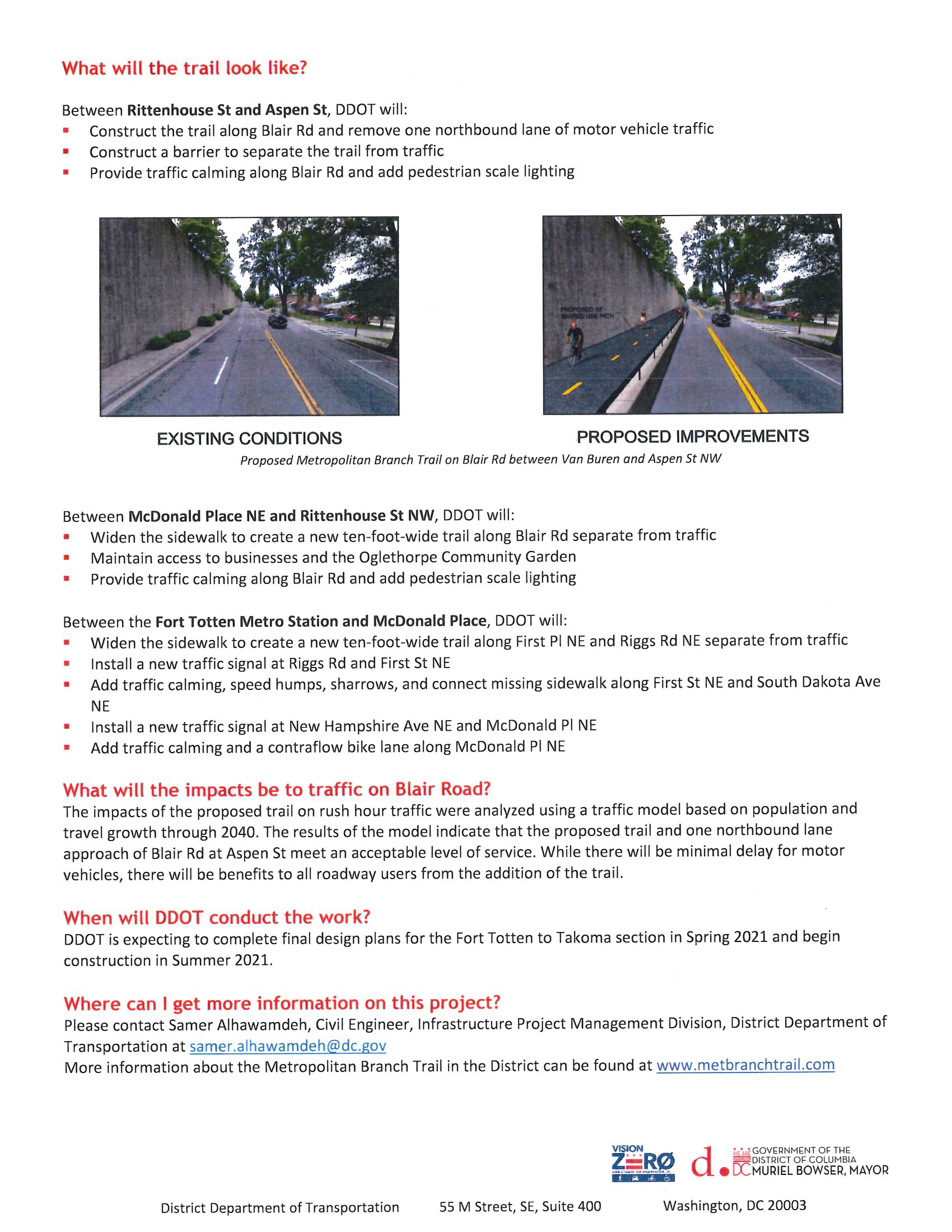
Metropolitan Branch Trail Fort Totten to Takoma
DDOT is working on the design for the extension of the Metropolitan Branch Trail from Fort Totten to Takoma. According to DDOT’s handout, DDOT expects to complete the design in spring 2021 and for construction to start in summer 2021.
DDOT will be back to visit ANC 4B to give fuller updates on both of these projects later this year.
Last week, the Washington Post reported on pretty gross behavior by the Metro Transit Police Department (MTPD). According to the report, an MTPD supervisor based at Fort Totten metro station came up with a really terrible idea in which MTPD officers would get points leading to prizes for different enforcement actions, such as an arrest or citation.
There have long been complaints about the actions of MTPD officers. According to WAMU, DC At-Large Councilmember Robert White and Ward 6 Councilmember Charles Allen are introducing a resolution to request establishment of an MTPD civilian complaint board, among other measures.
There is a lot to say about this that I am finding difficult to put in a post. The one thing I will say is that I often hear people clamoring for more and more police in this community and I think we need to be a little more thoughtful and very specific and intentional in what we ask of public safety and elected officials.
MTPD Chief Ronald Pavlik, Jr. has been invited to the next ANC 5A meeting.
Catching up on posts, starting with a few updates from the DDOT Ward 5 Open House held on February 8, 2020.
Metropolitan Branch Trail (MBT) Fort Totten Extension
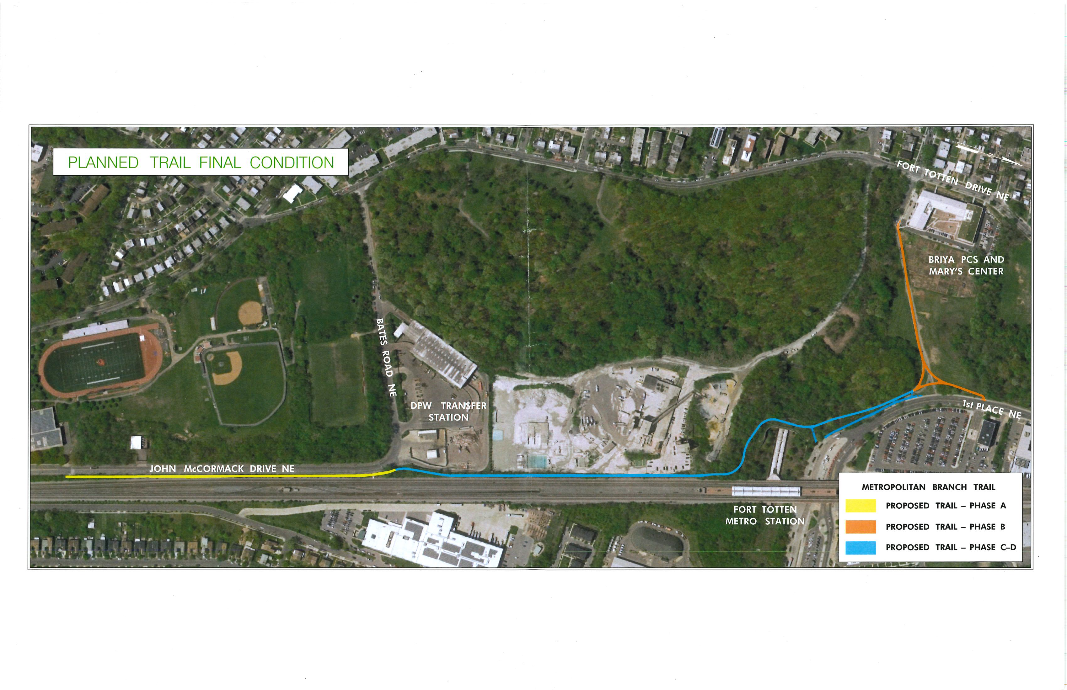
MBT Extension Brookland to Fort Totten Construction Phases. Source: District Department of Transportation
DDOT’s Metropolitan Branch Trail Project Manager Nannette Bowles shared a few updates about the MBT extension from Brookland to Fort Totten metro station (see handout here). DDOT has finally gotten the necessary easements and rights-of-way from various property owners (Metro, National Park Service, Aggregate Industries) in order to proceed with work on the middle portion (Phases C-D) of the extension, which is also the most complicated part.
As spring approaches, there will be more activity along 1st Place NE by Fort Totten metro station. Replacement of the existing trail alongside the Mamie D. Lee garden and Mary’s Center/Briya/Bridges is nearly done.
After a long pause in posting updates after March 31 of last year, DDOT has started updating the two-week look ahead reports (the weekly progress reports are still a work in progress). They have also revised the timeline again so projected completion is now expected in winter 2020 rather than September 2020. It is entirely possible that this date will change again, but at least it sounds like progress is being made.
Sidewalk on South Side of Galloway Street NE
DDOT’s Ward 5 liaison Kelly Jeong-Olson shared that DDOT and NPS are working to finalize an MOU to construct a trail on the south side of Galloway Street NE between South Dakota Avenue and 4th Street (where there is not a sidewalk). NPS is responsible for design, which DDOT will need to approve. DDOT hopes to have a design finalized by the middle of this year. Once the design is done, DDOT will present it to the community for feedback, likely at an ANC meeting.
This project has been delayed because the original trail NPS designed was not done to proper specification, with NPS designing a 6-foot wide trail rather than a 10-foot wide trail. There will need to be a retaining wall. The design team was also working out how to work around all of the deep tree roots. Stay tuned for an update from your ANC.
Also, folks probably noticed the sidwalk leading from South Dakota Avenue to the bus stop on the south side of Galloway Street was repaved. In addition, the broken sidewalk on Galloway leading to the metro station was finally repaired last week, thanks to attention from two residents, Deborah Grimstead and Robert Oliver.
Crosswalk 400 block of Galloway Street NE
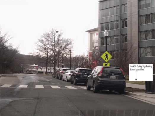
View of crosswalk 400 block of Galloway Street NE pre-corral installation and post-corral installation
In December 2019, DDOT installed an off-sidewalk parking corral in a portion of the no parking zone near the crosswalk in the 400 block of Galloway Street NE. People still park cars directly behind the crosswalk though so visibility of pedestrians attempting to use the crosswalk is still a problem. At the open house, DDOT said they would investigate placing a second corral behind the crosswalk so that cars are not parked there.
This has been an ongoing issue since fall 2017 when The Modern at Art Place opened. The crosswalk was removed during construction of The Modern. Once the building was completed in 2017, no one thought to put the crosswalk back in and there were conflicting reports about whether DDOT expected the crosswalk to be replaced. It took months for the crosswalk to be replaced and then cars were being parked in the crosswalk and directly surrounding the crosswalk because there was not a curb cut. It took another couple of months for a curb cut to be installed. DDOT piecemealed improvements and repeatedly declined to put in additional signage to indicate that cars should not be parked directly behind the crosswalk.
This is one example of why there needs to be a better method to address the pedestrian safety impacts of development (see also the Ingraham Street NE hawksignalsaga). When development projects are completed, there needs to be a more effective way to ensure that the developer has addressed issues in its transportation demand management plan instead of making residents jump through unnecessary hoops to have basic things addressed that should have been addressed during the development and construction process.
The other issue that will need to be addressed here is that a daycare center is scheduled to open in the 400 block of Galloway later this year. Children will undoubtedly be dropped off in cars so there will need to be some accommodation to handle dropoff and pickup around this area that also gets a lot of bus and vehicle traffic.
Path between Gallatin and Galloway Street NE
The saga that is the informal trail between Gallatin Street and Galloway Street near Fort Totten metro station is not something I spoke with anyone about at the open house, but I am putting information about the path here that was shared in a comment by resident (and blog contributor) Robert Oliver on my post with 2020 development updates. Construction of a paved, lit path is scheduled for spring of this year.
Assaults have occurred from time to time on the existing informal path. For decades, residents have requested Congresswoman Eleanor Holmes Norton to get NPS to do something about this informal trail. When the paved path is finally installed, people should still be aware of their surroundings. After all, there is a fully paved trail just west of Fort Totten metro station and people still complain about assaults happening there (not to mention the muggings that happen on sidewalks across the city in broad daylight).
Metro is soliciting feedback on its proposed budget until March 2, 2020. You can fill out a survey, submit written comments, and attend an open house and public hearing. There will be an open house at Metro headquarters in DC (600 5th Street NW) on February 26, 2020, starting at 4:00 pm.
There are a number of proposed changes, including a peak fare increase, a flat fare weekend rate proposal, adjustment to service routes and hours for metrobus (including for the 80, E2, and E4 routes in this area), and adjustment to service hours and frequency for metrorail. If you are a metrobus or metrorail user, it is worth visiting Metro’s website to view the proposed changes.
The District Department of Transportation (DDOT) will host an Open House for residents in Ward 5 to learn about current and future safety improvement projects that are advancing Mayor Bowser’s Vision Zero and infrastructure goals.
At the event, DDOT project managers and staff will be available to discuss safety and infrastructure projects in Ward 5, including the Florida Ave NE project, Florida/New York Ave intersection (also known as “Dave Thomas Circle”) project and the Metropolitan Branch Trail (Brookland – Fort Totten) project among other improvements in the Ward.
This Open House is an opportunity for residents to engage directly with DDOT staff to facilitate one-on-one conversations and receive answers for specific questions. There will not be a formal presentation, so residents can come and go when they are able without missing any of the content. Residents should click here.to register for this event.
WHAT: DDOT Ward 5 Open House WHEN: Saturday, February 8, 2020 12:00 p.m. – 2:00 p.m. WHERE: Trinidad Recreation Center 1310 Childress St NE Washington, DC 20002
DDOT Ward 4 Open House December 7, 2019 12:00 pm-2:00 pm Roosevelt High School (Gym) 4301 13th Street NW
The District Department of Transportation (DDOT) will host an Open House for residents in Ward 4 to learn about current and future safety improvement projects that are advancing Mayor Bowser’s Vision Zero and infrastructure goals.
Registration is open for the 2020 visitor parking pass program. If you live on a block zoned for residential permit parking, visit https://vpp.ddot.dc.gov/vpp to obtain your pass.
NBC Washington has a nice two-minute video featuring contributor David Kosub on the new HAWK signal that was finally installed at South Dakota Avenue and Ingraham Street NE on September 26. The new signal is really helpful in helping pedestrians cross this busy intersection, but a few residents have reported that drivers sometimes do not stop when the signal is red. Also, the signal has malfunctioned a couple of times already, so if you see that it is flashing yellow constantly, please submit a 311 request so that it can be fixed. Please continue to contact your Ward 5 MOCR Malik Miller and ANC Commissioner Gordon Fletcher (5A08) with concerns about how this signal is operating.
(Washington, DC) – The District Department of Transportation (DDOT) is scheduling lane closures on Riggs Road eastbound from North Capitol Street to 1st Street NE starting on Saturday, October 12, 2019, weather permitting. At least one lane will be open to traffic in each direction.
The closures and restrictions are needed for roadway repairs. The contractor is authorized to work Saturday from 7:00 a.m. to 7:00 p.m. and Monday through Friday from 9:30 a.m. to 3:30 p.m. Construction is scheduled to be completed by October 15, 2019, weather permitting.
Parking restriction signs will be posted at least 72 hours in advance at locations where parking will be prohibited. These signs will notify the duration and dates of the parking restriction and provide contact information of the engineer in charge.
Traffic controls will be in place to warn drivers approaching the areas. Motorists should anticipate moderate delays due to the lane closures. Drivers are advised to stay alert while traveling through these locations and to be observant of the work zone.
The HAWK signal at South Dakota Avenue and Ingraham Street NE is now operational! This is a wonderful step forward to strengthening pedestrian safety and encouraging walkability in Riggs Park.
I want to personally thank all the residents who devoted many person hours to ensuring we got to this point. You wrote letters of support. You spoke with the ANC. You reported many issues with 311. You worked behind the scenes with DDOT. Your dedication will not go unnoticed.
DDOT was also a valued partner in this endeavor, and I want to recognize them too. They worked with us throughout the spring and summer, providing updates on their progress and hearing our multiple concerns.
If you encounter any issues with the signal, crosswalk, and/or drivers failing to stop, please contact 311 right away.
Gearin’ Up Bike Repair Pop Up Lamond-Riggs Library 5401 South Dakota Avenue NE July 22, 2019 5:00 pm
Need to dust off that bike sitting in the garage? Gotta fix that flat tire? Visit Gearin’ Up Bicycles at a neighborhood library near you to receive free basic bike repair and maintenance. Limit one adult bicycle or two children’s bicycles per customer. For a complete list of Gearin’ Up Bike Repair Pop Up dates and locations at DC Public Libraries click here.
Fridays at Fort Totten Concert Series featuring music by Allthebestkids and Carnivore BBQ food truck. 6:00 pm, corner of South Dakota Avenue & Galloway Street NE. Bring a lawn chair for seating
June 29, 2019
DDOT Rock Creek East I Livability Pop-up: Share your views on how to make the transportation network safer and more accessible. Study area is defined by Rock Creek and the Maryland border to the West, Eastern Avenue to the North, New Hampshire Avenue NE and the Red Line Metrorail tracks to the East, and Military Road NW, Missouri Avenue NW, and Riggs Road NE to the South. 10:00 am-12:00 pm, Safeway, 6500 Piney Branch Road NW
Explore! Jumpin’ July Community Festival featuring petting zoo, music show, science show, coloring, storytelling, face painting, and more. 10:00 am-1:30 pm, The Modern at Art Place, 400 Galloway Street NE
Bus Bay Reassignment: Routes E2 and E4 at Fort Totten Station, June 23
Advisory Effective: 6/22/19 – 7/31/19 Effective: Sunday, June 23, 2019
Routes Affected: E2, E4
In response to customer requests, routes E2 and E4 will be assigned to new bus bays at Fort Totten Station beginning, Sunday, June 23.
E2 Ivy City-Fort Totten southbound toward Ivy City E4 Military Road-Crosstown eastbound toward Riggs Park • Current Bus Bay Assignment: Bus Bay G – Stop ID 1003439 • New Bus Bay Assignment: Bus Bay D – Stop ID 1003237
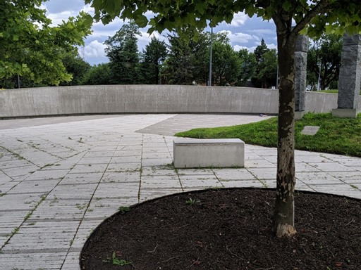
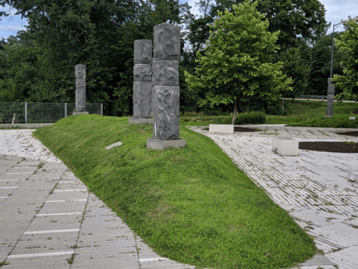
The following lines strive to remember where we were, how we felt, and what has happened since the Fort Totten metro train accident ten years ago. Though not meant as a singular story, this is more so a collective communal story woven together with memories shared from neighbors, news coverage, quotes from surviving family members, and a walk through Legacy Memorial Park.
June 22, 2009 Rush hour Sitting on a red line train Don’t remember how long it took me to get home Don’t remember the alternate route I took I do remember the delay and wondering why is this happening I just wanted to come home from work
When above ground and with access to the radio I was like, “Oh my” That’s when I heard the commotion about the crash And also Feeling selfish for those earlier thoughts
Curiosity leading me to the FIRE-EMS staging area Realizing how bad the accident was Just imagine being on the scene and imagine what you may have witnessed
Doolittle, DuBose, and Fernandez Hawkins, King, and McMillan Wherley, Wherley, and Williams Nine lives lost Many others injured
Every day, we can commemorate this tragedy Through a plaque on a metro station pillar We recognize “those whole lives that were forever changed” And also understand what the first responders experienced Coming to “our aid in our time of greatest need”
Through a nearby memorial park While ringing with the sound of children playing Mere steps from where a community grows together We are also encouraged to meditate, remember, reflect, and hope
Words are found etched in stone “The space inhabits the hearts of nine uncommon Souls. They were put here to leave eternal love. In stillness…embrace love, peace, courage, and strength.”
After seeing the Riggs Park profile published by the Washington D.C. Economic Partnership, the Fort Totten Metro Station data intrigued me. And, yes, before you ask, there is nothing wrong with being intrigued by looking at administrative data held within public agencies! All the cool kids do it.
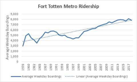
While searching the Public Records available on the Washington Metropolitan Area Transit Authority’s (WMATA’s) website, I did find a few nuggets of ridership data related to Fort Totten metro that I’d like to share (see the original source data here and my manipulations on this Excel sheet here). WMATA publishes historical ridership figures for each station going back to 1977, with Fort Totten coming online a year later (read these articles here and here to see how residents felt about it back then). Figure 1 displays the average number of weekday boardings per year at the Fort Totten station from 1978 to 2018 (data for 1983 were not available). Note, I assume “boardings” in Metro language refers to those who passed through a faregate, not simply transferred to another train (e.g., red line to green line). Boardings grew from 2,969 on an average weekday in 1978 to 7,842 four decades later. Note, these data represent actual average weekday boarding counts and not normalized to population change.
Figure 1 shows the average weekday boardings at the Fort Totten metro station between 1978 and 2018.
For kicks, let’s take a look at how Fort Totten compared to other stations across the system for average weekday boardings in 2018. As the table below shows, we clock in at number 25—not too shabby, especially when considering some of those other stations our weekday boarding numbers beat!
Station
2018***
1
Union Station
28,315
2
Metro Center
24,532
3
Gallery Pl-Chinatown
22,613
4
Farragut North
22,184
5
Farragut West
20,348
6
L’Enfant Plaza
20,240
7
Foggy Bottom-GWU
18,299
8
Dupont Circle
16,542
9
McPherson Square
13,889
10
Pentagon
13,667
11
Rosslyn
13,020
12
Pentagon City
12,311
13
Silver Spring
11,682
14
Shady Grove
11,139
15
Navy Yard-Ballpark
11,013
16
Crystal City
10,795
17
Columbia Heights
10,448
18
NoMa-Gallaudet U
9,346
19
Smithsonian
9,331
20
Ballston-MU
9,029
21
Bethesda
8,999
22
Vienna/Fairfax-GMU
8,970
23
Archives-Navy Memorial-Penn
Quarter
8,226
24
Friendship Heights
7,900
25
Fort Totten (woot woot)
7,842
26
Wiehle-Reston East
7,785
27
Federal Triangle
7,576
28
Judiciary Square
7,475
29
King St-Old Town
7,131
30
Capitol South
7,003
31
Huntington
6,896
32
New Carrollton
6,584
33
Court House
6,420
34
Anacostia
6,305
35
Federal Center SW
6,014
36
Ronald Reagan Washington National
Airport
5,964
37
Franconia-Springfield
5,940
38
Woodley Park-Zoo/Adams Morgan
5,913
39
Georgia Ave-Petworth
5,889
40
U St
5,637
41
Van Ness-UDC
5,476
42
Glenmont
5,475
43
Brookland-CUA
5,436
44
Rhode Island Ave-Brentwood
5,417
45
Greenbelt
5,350
46
Eastern Market
5,303
47
Tenleytown-AU
5,286
48
Branch Ave
5,263
49
Medical Center
5,181
50
Takoma
5,033
51
Grosvenor-Strathmore
4,995
52
Southern Avenue
4,744
53
Braddock Road
4,376
54
Clarendon
4,375
55
Shaw-Howard U
4,314
56
Suitland
4,290
57
Waterfront
4,271
58
Mt Vernon Sq 7th St-Convention
Center
4,238
59
Largo Town Center
4,181
60
East Falls Church
4,023
61
Prince George’s Plaza
4,012
62
Twinbrook
3,807
63
Dunn Loring-Merrifield
3,789
64
Rockville
3,756
65
Virginia Square-GMU
3,728
66
Cleveland Park
3,657
67
College Park-U of Md
3,650
68
White Flint
3,506
69
Potomac Ave
3,494
70
Tysons Corner
3,480
71
Wheaton
3,468
72
West Hyattsville
3,184
73
Addison Road-Seat Pleasant
2,652
74
Benning Road
2,604
75
Van Dorn Street
2,576
76
West Falls Church-VT/UVA
2,544
77
Stadium-Armory
2,423
78
Naylor Road
2,283
79
Congress Heights
2,223
80
Minnesota Ave
2,149
81
Forest Glen
2,045
82
Eisenhower Avenue
1,919
83
Capitol Heights
1,864
84
McLean
1,830
85
Morgan Boulevard
1,826
86
Landover
1,543
87
Arlington Cemetery
1,485
88
Greensboro
1,265
89
Deanwood
1,240
90
Spring Hill
1,203
91
Cheverly
980
I next wondered how much of the total Metro daily boardings Fort Totten represented. To answer this, I looked at the proportion of Fort Totten boardings on an average weekday compared to (1) the system as a whole or (2) only those stations in the District. Please keep in mind that not every metro station open today (n=91) was around at the beginning (n=24), so ridership data can change substantively with each new station opening (amongst other factors).
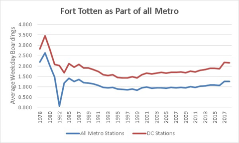
Figure 2 displays these results. As a percentage of all of the stations in the system (lower line), Fort Totten started around 2.2 percent of all Metro boardings in 1978, fell to below 1 percent between 1992 and 2010, and began climbing thereafter rising to 1.3 percent in 2018. When focusing on only stations in the District (higher line), the trends are the same, starting at 2.8 percent in 1978, dipping down in the 1990s and 2000s, and rebounding thereafter to 2.3 percent in 2018.
Figure 2 shows the percent of average weekday boardings at the Fort Totten metro station compared to boardings across all metro stations (lower line) and metro stations in the District (higher line) between 1978 and 2018
So, what do these limited data tell us? Well, we can see the growth over time in the number of riders beginning their trips at Fort Totten on an average weekday. And, that is likely commensurate with multiple factors, such as changes and growth in D.C.’s population over time and more residents preferring public transportation to personal vehicles. Further, as compared to the system as a whole, it is exciting to see our numbers creep up in recent years, even when considering how many stations are open now compared to in 1978. To me, this shows a healthy use of the Fort Totten metro station on a daily basis—providing additional evidence that the nearby vicinity is ripe for robust transit-oriented development as called for in the 2009 Small Area Plan. My hope is that, when recruiting shops, restaurants, and other potential business owners to the neighborhood, we can use the additional evidence that our community is worth the investment.
ANC Commissioner Evan Yeats (4B01) plans to offer a resolution in support of extending Metro service on the Yellow and Red Lines. Metro’s proposal was previously covered in this post. The draft resolution is here.
Metro’s Finance Committee approved the proposal on March 14, 2019, and the full board is scheduled to vote on March 28:
NEW: Metro board gives unanimous pre-approval to Metro's $3.5B FY2020 budget, which extends Yellow Line to Greenbelt, Red Line to Glenmont (eliminating Silv. Spring turnback) and maintains current hours #wmata
More trains could soon serve Fort Totten metro station, if approved by the Metro board.
In October 2018, Metro’s General Manager released the proposed
budget for fiscal year 2020, which includes service improvements.
The Washington Metropolitan Area Transit Authority (WMATA) board is expected to
approve a final budget within the next few weeks. WMATA’s Finance and Capital
Committee is scheduled to consider the budget proposal on March
14.
The proposed budget would benefit Fort Totten by adding
Yellow Line service during rush hour and increasing direct connections on the
Yellow and Red Lines.
Currently, Yellow Line trains end at Mt. Vernon Square during
rush hours and at Fort Totten at all other times. Under the proposed budget,
all Yellow Line trains instead would run to Greenbelt – to and through Fort
Totten.
From
2012 to 2017, Yellow Line trains ran to Greenbelt under Metro’s
“Rush Plus” program. The FY 2020 budget proposal would restore that service at
all times.
For Fort Totten, the proposed budget would add new service
during rush hour to downtown DC, Arlington, and Alexandria (toward Huntington)
and to Prince George’s County (toward Greenbelt). Outside of rush hour, there
would be additional trains toward Greenbelt.
The proposal would also add more direct connections on the
Red Line. Currently, some Red Line trains turn back at Silver Spring. Under the
proposed budget, all Red Line trains instead would run to Glenmont, providing
more trains from Fort Totten to Forest Glen, Wheaton, and Glenmont.
WMATA
estimates these changes would benefit 12.4 million Yellow Line
and 3.4 million Red Line trips overall next year.
For now, this is only a proposal. The WMATA board has to give
final approval, and board members have criticized some aspects of the proposed
budget. However, the Yellow and Red Line changes seem to have broad support
among the board, according
to the latest reports.
If
approved, these service improvements could be significant for our neighborhood,
and not only in terms of more convenient transit service. In addition to adding
more service generally, it would also offer a one-seat ride from Fort Totten to
the future
Amazon “HQ2” in Arlington and Alexandria. Amazon’s expected 25,000
jobs in Northern Virginia will make it the largest private employer in the DC
area, and those employees will have to live somewhere. With direct Yellow Line
service from Fort Totten to “National Landing,” maybe some of them will choose
to call Riggs Park home – or at least check out Meow
Wolf.
Thanks to the 58 neighbors and bicyclists who responded to my survey between February 5 and 19, we now have more information about why and how to make the Fort Totten Metro station and the future Metropolitan Branch Trail more accessible to folks on bikes.
From the south: Galloway Street
Galloway Street is one of the most important access routes for bicyclists to Fort Totten Metro station and the future MBT trailhead, but also the route most in need of improvements, according to the survey results.
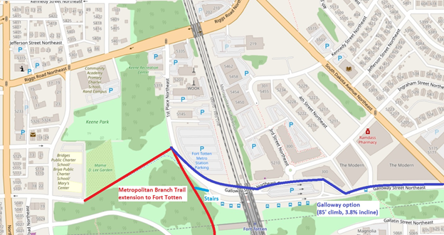
Galloway Street option
Galloway Street was the:
Most preferred route
if bike facilities were installed
(51.8%, more than double the second-most preferred option);
Least preferred
route under current conditions (26.8%); and had the
Lowest percentage
of respondents who would be comfortable biking the route without new facilities
(15.1%).
Several respondents identified the heavy vehicular traffic,
the climb, or the combination of both as challenges with biking on Galloway:
“I live at the Modern so I bike the hill up Galloway
frequently. It is packed with cars especially during the morning rush hour so
getting up the hill and under the tracks is very tricky on a bike. Usually I
either have to wait in line with the cars, or resort to the sidewalk. It’s not
fun.”
“I bike from my home on Hamilton St NE to Ft Totten
metro station. That hill is really tough, and is often a deterrent for me to
bike.”
“I bike it now and it sucks. I’ll still keep biking
it, but it feels very unsafe at rush hour with buses coming up Galloway,
delivery trucks idling outside the Modern, and commuter cars in a rush to drop
people off.”
My recommendation: Separate
bike facilities should be installed on Galloway. While only 15.1% of
respondents would be comfortable biking the route today, 71.7% would be
comfortable if bike lanes were installed.
While the survey did not ask about an off-street trail along Galloway, it would likely serve the same need as an on-street bike lane, and probably even better. The District Department of Transportation’s (DDOT) 2014 moveDC plan includes a future trail along Galloway St. from the Fort Totten trailhead to South Dakota Avenue. Reportedly, DDOT is looking at options to make that happen. A trail alongside Galloway would not only significantly ease access to the Metro and MBT, it would also link to the future trail between Galloway and Gallatin Streets and the planned MBT segment continuing east to the planned Prince George’s County Connector.
From the north: Kennedy Street (or…)
Access routes north of Galloway Street are also important, according to the survey results, with a slight preference for Kennedy Street over Ingraham Street.
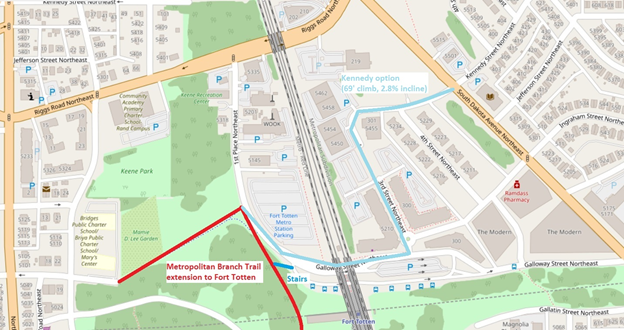
Kennedy Street option
Kennedy Street was the:
Most preferred route under current conditions (39.3%); had the
Highest percentage of respondents who would be comfortable biking the route without new facilities (34%); and would be the
Second-most preferred route if bike facilities were installed (25%), after Galloway Street
Ingraham Street was slightly behind Kennedy Street on all counts, with responses rating it in between Galloway and Kennedy.
Some respondents commented that the Kennedy route is too roundabout or too far out of their way, especially those coming from the south (Galloway to Kennedy is an additional quarter-mile up South Dakota Avenue). However, a few respondents indicated that they use Kennedy currently and prefer that route:
“I’ve ridden Kennedy and 3rd to reach Fort Totten from
Lamond-Riggs, and much prefer it to Galloway, even as is.”
“This is the way I usually now access the Metro
station on my bike. The incline is more spread out with a break between Kennedy
and Galloway. The same issue applies, though, with traffic back ups at
underpass and traffic circle.”
“This is the way that I currently ride from my house
(near Riggs and Eastern) to get across to NW. The ramp would be important, also
the connection to the trail from the dead in at Kennedy St would need to be
improved, it is always a big puddle and is getting worse. Also some lights on
the trail would be a big safety improvement.”
My recommendation: Bicyclists should consider both Kennedy and Ingraham streets as potential options to access the Metro and MBT. Minor improvements could improve access, most importantly installing a curb ramp where 3rd Street ends and the asphalt trail begins. Signage could also be helpful. At the asphalt trail, drainage and security (lighting and visibility) should be addressed. Street adjustments to better accommodate bicyclists should be considered (such as a bike lane on Kennedy, traffic calming, and reduced speed limits).
Farther
north
While this survey focused on the area between Kennedy and Galloway, access from farther north will also be an issue. Riggs Road, South Dakota Avenue, and the WMATA/CSX railroad tracks form considerable barriers for bicyclists.
2014 moveDC plan. Blue dotted lines indicate a planned off-street trail, purple dashed lines indicate a planned cycletrack (or protected bike lane), orange dotted lines indicate a planned on-street bike lane, black dotted lines indicated a planned new street
DDOT’s 2014 moveDC plan includes protected bike lanes along Riggs Road and South Dakota Avenue, and in fact, one respondent indicated their preferred route with new bike facilities would be Riggs Road. But I don’t know if any progress has been made on those proposals. Additionally, the moveDC plan includes a new railroad crossing near Longfellow Street NE, which would connect to a future segment of the MBT. Those are improvements that would benefit our neighbors farther north in Lamond-Riggs and Manor Park, but their path forward is unclear.
In case you were not able to make the Lamond-Riggs Citizens Association meeting on February 4, DDOT announced they will install a HAWK signal, a controlled pedestrian signal, at the intersection of Ingraham St NE and South Dakota Ave NE. This is a great step forward in strengthening pedestrian safety here in our community.
DDOT has a handy video explaining how HAWK pedestrian signals work on its website. When a HAWK signal is activated by a push button, yellow lights will flash to warn motorists to slow down for an impending red light. When the light turns red, motorists will be required to stop, just as with traditional traffic signals, to permit pedestrians to cross the street.
Work is expected to be completed around late summer/early fall 2019. We will provide regular updates on DDOT progress as they are received over the coming months.
DDOT committed to take the following actions:
South Dakota Avenue NE and Ingraham Street NE Intersection
Install a HAWK signal in accordance with the MUTCD and DDOT guidelines.
South Dakota Avenue NE and Jefferson Street NE Intersection
Install in-street pedestrian crossing signs (R1-6a) at both sides of crosswalk located at the southbound approach of South Dakota Avenue NE.
Install advanced pedestrian crossing sign (W11-2) along both directions of South Dakota Avenue NE.
Remove the pedestrian warning sign on the northwest of Jefferson Street.
Mid-block (between Ingraham Street and Jefferson Street)
Update redundant parking regulation signs on the eastern side of South Dakota Avenue NE.
Please pat yourself on the back for this outcome. Without your letters of support, many reports to 311 and 911, outreach to elected officials, submitting traffic studies, direct engagement with city agencies, and so much more, we may not be in the position we are today.
Take my survey to tell me what you think, or read on for more
information.
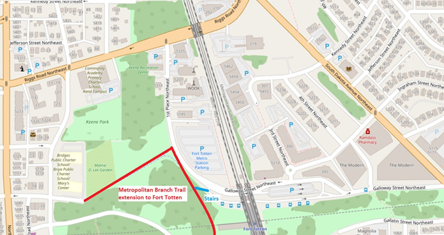
The Metropolitan Branch Trail (MBT) is a multi-use trail that will run from Silver Spring to Union Station when completed. Today, the trail segment connecting Fort Totten to the south is under construction and expected to open in 2020. When it opens, Lamond-Riggs and adjacent neighborhoods will have access to a great facility for walking, jogging, and biking. To access the MBT, the Fort Totten trailhead will be located on 1st Place NE, just west of the Fort Totten Metro station. The trailhead will connect to the sidewalk network, as well as the trail spur that connects west to Gallatin Street NE (which will be repaved as part of this project).
Overview map of the area, including approximate location of the new trail
But for those of us who live in Lamond-Riggs, the question
is: How are you going to bike there?
Bicycling is one of the primary purposes of the MBT, whether for recreation or commuting. However, Lamond-Riggs currently has no bike facilities, other than a single bike lane on Kansas Avenue, a mile away from Fort Totten. (Michigan Park and North Michigan Park also have no bike facilities.)
Biking on sidewalks is legal in this area, but not
recommended. (Bicyclists on sidewalks have to yield to pedestrians, and are at
greater risk of being struck by drivers at road crossings.)
Since there are no bike facilities and we don’t want to bike on the sidewalk, then that leaves biking in the street. Four streets provide access to the Fort Totten trailhead from Lamond-Riggs: Riggs Road, Galloway Street, Ingraham Street, or Kennedy Street (via 3rd Street). Riggs Road is a difficult option for cyclists because of high traffic speeds and volumes, so let’s look at the others. Galloway, Ingraham, and Kennedy streets all share another challenge for bicycling: a big hill. The climb on Galloway Street from South Dakota Avenue to the Fort Totten trailhead is comparable to Meridian Hill! I’ve watched many bicyclists humping up that hill, and none looked like they were having fun.
Up a big hill
Route
Distance
Climb
Incline
Galloway Street NE from South Dakota Avenue to the Fort Totten trailhead
2,255′
85′
3.8%
16th Street NW from U St. to Euclid St. (Meridian Hill)
2,284′
85′
3.7%
(Data from Google Maps)
Of course, that hill is exactly why Fort Totten is where it
is: to have a commanding view of Confederate advances. While that topography
served the Union Army well, it’s not so great for a leisurely ride.
Combine topography with traffic and this will be a frustrating spot. Drivers don’t want to be behind an exhausted bicyclist going uphill . . . and that bicyclist doesn’t want to be in front of drivers. Notably, Galloway Street is the route for several Metrobuses, as well as parking and kiss-and-ride for the Fort Totten Metro station.
The MBT is meant to be enjoyed by people of all ages and
ability levels. But under the current conditions, reaching the MBT by bike from
Lamond-Riggs may be an unpleasant experience for many people.
However, there may be opportunities to make some improvements so our neighborhood can have better access. There have been various plans for bike facilities on or next to Galloway Street. The District Department of Transportation’s (DDOT) 2014 moveDC plan includes a future trail along Galloway St. from the Fort Totten trailhead to South Dakota Avenue. That trail segment would continue along Gallatin St. to the District line, to a connection with the Northwest Branch Trail in Maryland. If built, that segment would connect our neighborhoods to many more miles of trails. However, at this time there seems to be no concrete plan for building it.
2014 moveDC plan. Blue dotted lines indicate a planned trail
More modestly, last year DDOT listed a climbing lane as a “possible 2018 installation” on the lower portion of Galloway Street, from South Dakota Avenue to 4th St. NE (the alley through the Modern). A climbing lane is an on-street bike lane in the uphill direction only. While that would be a start, bicyclists would still have to mix with vehicular traffic the rest of the way uphill, and all the way downhill from the trailhead. More to the point, 2018 is now over and it didn’t happen yet. (However, the recent February Lamond-Riggs Citizens Association, a DDOT representative said that the planned sidewalk would be installed on the south side of Galloway Street in this location some time in 2019. Maybe the sidewalk and the bike facility are related?)
Looking north, the Cafritz Foundation’s Art Place development sits between Ingraham and Kennedy streets. Maybe new bike facilities could be built as part of any transportation changes arising from that development. In fact, the developers have stated that they would like to realign Kennedy Street in a future development phase. Realignment would involve new paving and curbs: if appropriate, maybe new bike facilities could be included.
These are some of the issues and ideas as I see them. How about you? Take my survey to tell me what you think, and let’s work together to find solutions for our neighborhood. If folks respond to the survey, I’ll share the responses out with the community.