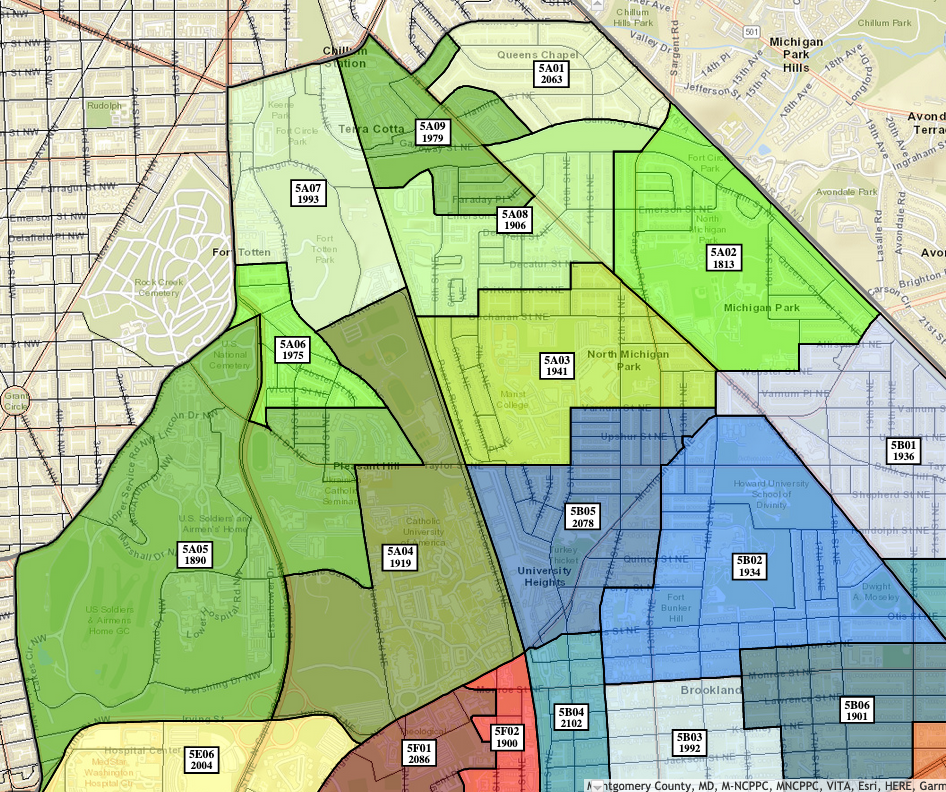
ANC 5A held its monthly public meeting on March 23, 2022. Commissioners present: Damion McDuffie (5A01); Charles Lockett (5A02); Diego Rojas (5A04); Ronnie Edwards (5A05) – Chair; Derrick Holloway (5A06); Sandi Washington (5A07) – Treasurer; Gordon Fletcher (5A08) – Vice Chair.
ANC Business
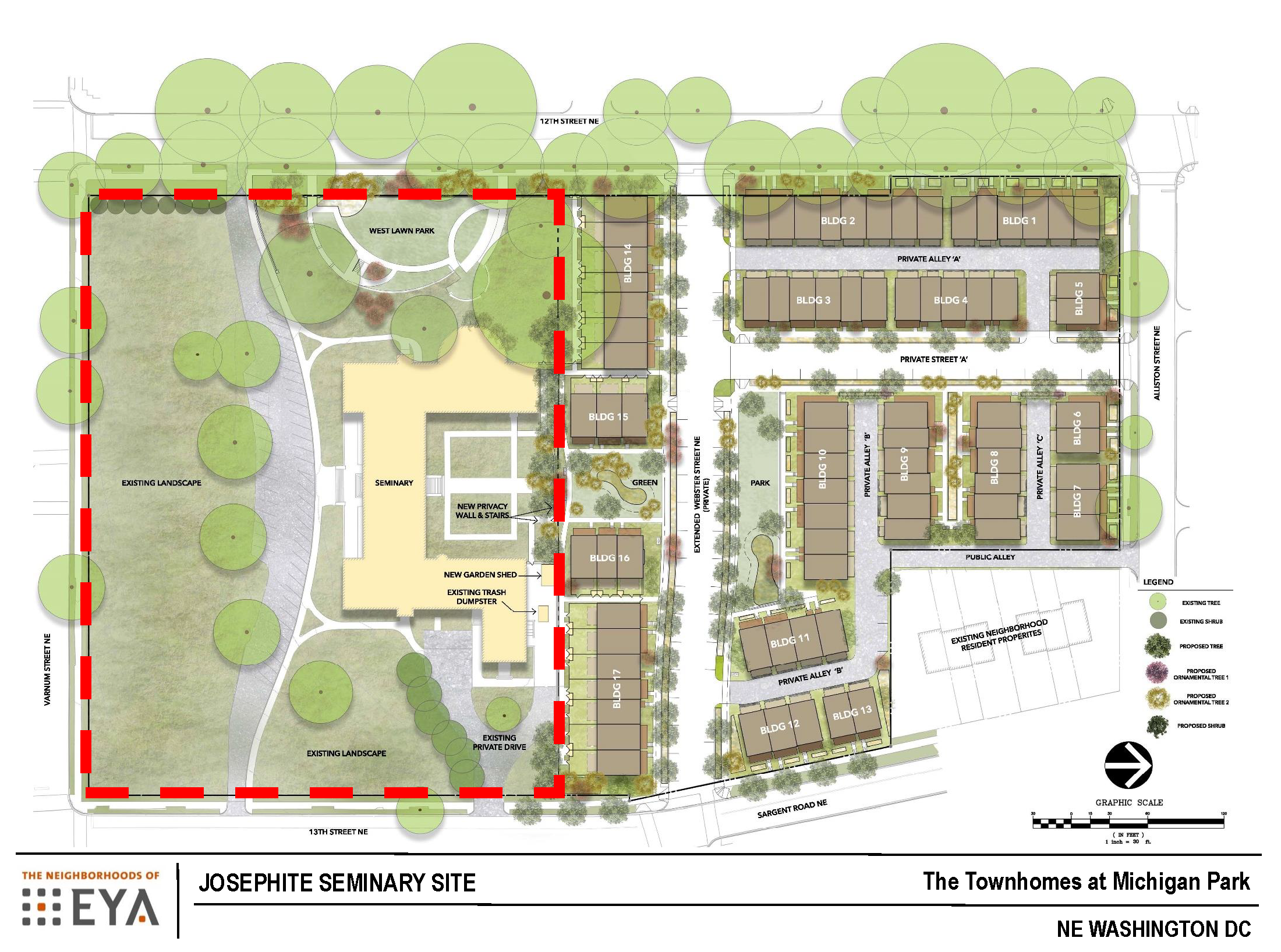
The matter of 1 Hawaii Avenue NE was removed from the agenda.
I could not quite follow what Commissioner Sandi Washington (5A07), treasurer for the ANC, said about the contract for the ANC’s website. Sounded like they need to extend it, not sure though. In any case, it would be nice if the site were updated (it still says that 5A04 is vacant for example, and some of the links are broken or redirect to incorrect pages).
The ANC is establishing a process for recognizing the contributions of residents (or something like that).
Trinity Grill & Social Marketplace ABRA Application (5A05) (Owner Terrell Bagley, Representative Jeff Jackson)
Trinity Grill & Social Marketplace is a new neighborhood grocery and restaurant that will be opening at 200 Michigan Avenue NE. The owner, Terrell Bagley, is local, familiar with the neighborhood, having grown up around 12th Street NE. Mr. Bagley stated that he is focusing on using local vendors, so the grocery will have local produce and goods from local bakers. The restaurant portion will serve breakfast, lunch, and dinner and will have space for people to work and gather.
The owner is seeking a full retailer Class B license to sell and serve beer, wine, and spirits (this is a change from the original application). He said there will not be a full bar per se, but the idea is to have hand-crafted cocktails. They compared the not bar to the same concept as the one in the Giant on 7th and O Street NW.
One resident asked about the possibility of people hanging around outside the space. The owner and representative responded that the grocery will not sell singles. The owner also stated that he is crafting a security plan.
The commissioners did not have the updated application available to them during the meeting, so a few basic questions could not be answered.
An ABRA hearing is scheduled for April 25, 2022. Petitions are due April 4, 2022. The ANC voted unanimously to support the ABRA application on the condition that they receive a copy of the updated application from the owner, that the owner provides a security plan, and that the application outlines operating hours. (Note: I pulled the ABRA hearing notice. According to that notice, operating hours would be Sunday through Thursday 6am – 11pm, Friday and Saturday 6am – 12am. Hours for alcohol sales would be Sunday through Thursday 10am – 11pm, Friday and Saturday 10am – 12am).
Catholic University Field Lighting Upgrade (5A04) (Cheyenne Range, Catholic University)
Catholic is upgrading the lighting on its baseball and softball field. No action from the ANC is required. Catholic just needs to demonstrate that the university shared the plan with the community and received community input. The lighting will be on for field use at dawn and during late night hours. The LED fixtures will be directed at the field, so university officials believe there should be no impact/spillover to neighborhood homes.
There will be a community field day on April 24, 2022.
A couple of people raised concerns about university event attendees parking in the neighborhood as well as speeding on local roads leading to the parking lots. University officials said they will work on a plan. That might include maybe stationing an official near the entrances and exits to discourage people from speeding and to direct people to the appropriate parking lots. They will see about making sure they communicate clearly where people should be parking, but they are limited in what they can do if people attending events on campus do park in the neighborhood. (Note: There was a lot of discussion about which gates are open when so if you live in that area and care about this, I recommend you reach out to Commissioner Sandi Washington (5A07) and Commissioner Diego Rojas (5A04). The fields are in the single member district (SMD) of Commissioner Rojas, but a couple of the surrounding roads are in Commissioner Washington’s SMD).
The ANC voted unanimously to send a letter of support for the lighting project.
UDC Bertie Backus Food Hub Upgrade (5A01) (Dr. Kamran Zendehdel, Acting Director, UDC Center for Sustainable Development; Michael Whyte, Bertie Backus Food Hub Manager)
UDC is upgrading the Bertie Backus Urban Food Hub (at South Dakota Avenue and Galloway Street NE). Upgrades include installion of a new heating/cooling system, permanent water system, electricity, and a stormwater management system. They anticipate finishing the renovations by May.
Dr. Kamran Zendehdel also stated that the food hub will host a full cycle farmers market this season. They are currently hiring. The market will run from the second week of May until December 1.
In addition, the commercial kitchen will be open by the end of spring.
Earth Day is April 22. Events will be held at the food hub.
Someone asked why they are not using solar power for electricity. Dr. Zendehdel said they would like to have a solar energy system because that is consistent with their sustainable principles. He said they are working with Pepco.
Commissioner Charles Lockett (5A02) asked about opportunities for youth to learn about the food hub and sustainable gardening principles. Dr. Zendehdel said that DC Public Schools does provide field visits for students.
For questions about the food hub, contact Michael Whyte at michael.whyte1@udc.edu
Mayor’s FY 2023 Budget (Drew Hubbard, Interim Director, DC Department of Housing & Community Development)
Details of the mayor’s proposed budget are available at https://mayor.dc.gov/page/fy2023-fair-shot-budget. For information on spending related to affordable housing, view the one pager. There is $500 million proposed for the housing production trust fund, $10 million towards increasing Black home ownership in DC, a proposal to lower the cap on property tax increase for seniors, and $1 million for legal assistance to help with getting clean title to family homes (heirs’ property).
For information on financial assistance for single family home repairs, visit https://dhcd.dc.gov/SFRRP.
DC Department of Parks & Recreation (Christopher Dyer, DPR Community Engagment Manager)
View DPR’s presentation here. Registration for DPR summer camps opens April 4, 2022.
Initiative 82 (Ryan O’Leary)
Signatures have been collected to place an initiative on the June 21st ballot that, if approved, would gradually raise the tipped minimum wage until it matches the standard minimum wage by 2027 (eliminating the tip credit that employers may take to satisfy the minimum wage) (Initiative 82). Every registered DC voter (including independents) will have the opportunity to vote on this initiative if it is on the ballot. The DC Board of Elections is currently examining whether enough signatures were collected from 5 percent of registered voters in 5 of the 8 wards.
Ward 5 Mayor’s Office Report (Ward 5 MOCR Nokomis Hunter)
April 2, 2022, will be the last day for residential and bulk dropoff at Fort Totten Transfer Station for six months while the location undergoes renovation for stormwater managment. Services will be relocated to the trash transfer station at 3200 Benning Road NE during renovation of the Fort Totten location.
On March 30, 2022, North Michigan Park Civic Association president Carmen Williams will have a walk with DPW, DCRA, DDOT, and DBH.
Ward 5 Councilmember Kenyan McDuffie Report (Laisha Dougherty, Chief of Staff)
Budget hearings are ongoing. Residents are encouraged to testify. (Note: See schedule at https://dccouncil.us/2021-2022-performance-oversight-fy-2023-budget-schedules).
Miscellaneous
A resident mentioned that she received a notice of filing for a zoning amendment for the McDonald’s on South Dakota Avenue.
(I also raised the pedestrian fatality that happened at South Dakota & Ingraham. The whole situation is disturbing.)