Neighbor Gavin shared that Metro has a survey out about walking and biking to Metro. Please take a few minutes to recommend improvements for the area around Fort Totten station in the comment box in the survey.
Roadway Project on South Dakota Avenue NE from Galloway Street NE to Ingraham Street NE Begins May 16
(WASHINGTON, DC) —
The District Department of Transportation (DDOT) is scheduled to begin roadway work that includes concrete work on South Dakota Avenue NE from Galloway Street NE to Ingraham Street NE starting on or about Friday, May 16, 2025, weather permitting. The roadway project is anticipated to be completed by Friday, June 20, 2025. Temporary lane closures are to be expected with one travel lane remaining open.
Work will take place from Monday through Friday, (daytime) from 9:30 a.m. to 3:30 p.m. The contractor may work Saturdays (daytime) with prior DDOT approval.
Adjacent curbside parking may be restricted during the repair work. If so, parking signs will be posted at least 72 hours in advance at locations where parking will be restricted. The emergency “NO PARKING” signs will provide details of the hours of construction operations, dates, duration of the work, and information on the engineer in charge.
Traffic control devices will be in place to warn pedestrians, cyclists, and drivers approaching the work zone(s). Drivers are advised to stay alert while traveling near the work locations, be prepared for possible detours and to be observant of the work zone.
Cyclists should be prepared to adjust their route accordingly. Metro bus will continue their routes. Flaggers will be available to manage traffic and arrow boards will be utilized, as necessary
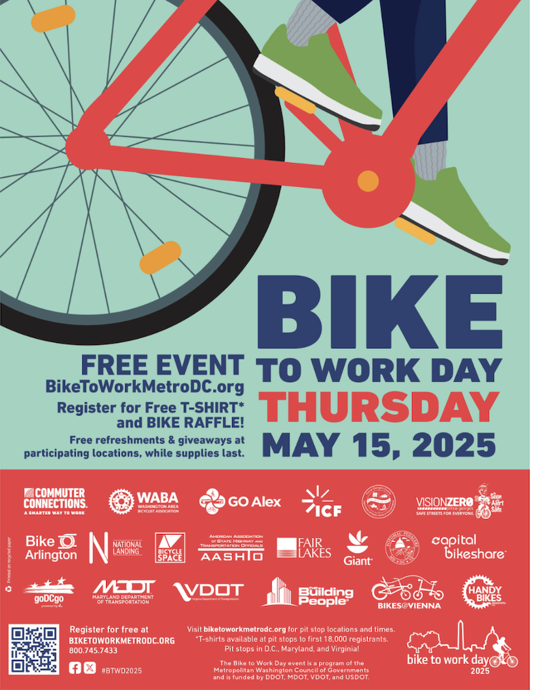
Bike to Work Day is Thursday, May 15, 2025. There will be a pit stop at Fort Totten Metro Station from 6-9am!
The first 18,000 who register and attend at a pit stop receive a FREE T-shirt. Free giveaways, food, and beverages at participating locations, while supplies last.
Join WABA for their next DC meetup in Brightwood. This will be an informal social event. Stop by any time but register to let WABA know you are coming.
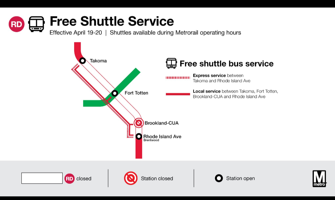
Metrorail weekend service for Saturday, April 19 through Sunday, April 20
Advisory Effective: 4/19/25 – 4/20/25
Hours: Sat 7 a.m. – 1 a.m.; Sun 7 a.m. – Midnight
Service-At-A-Glance
Red Line
Free shuttle buses replace trains between Rhode Island Ave and Takoma stations. Brookland-CUA and Fort Totten (Red Line platform) closed. Trains run every 6 minutes (daytime) and 10 minutes (evening) between Shady Grove and Rhode Island Ave and between Takoma and Glenmont.
Silver Line
Trains single track between Herndon and Innovation Center. Trains run every 12 minutes (daytime) and 15 minutes (evening). Trips may be earlier or later than regularly scheduled to avoid conflicts in work zones.
Blue Line
Normal Service. Trips may be earlier or later than regularly scheduled to avoid conflicts in work zones.
Orange Line
Normal Service. Trips may be earlier or later than regularly scheduled to avoid conflicts in work zones.
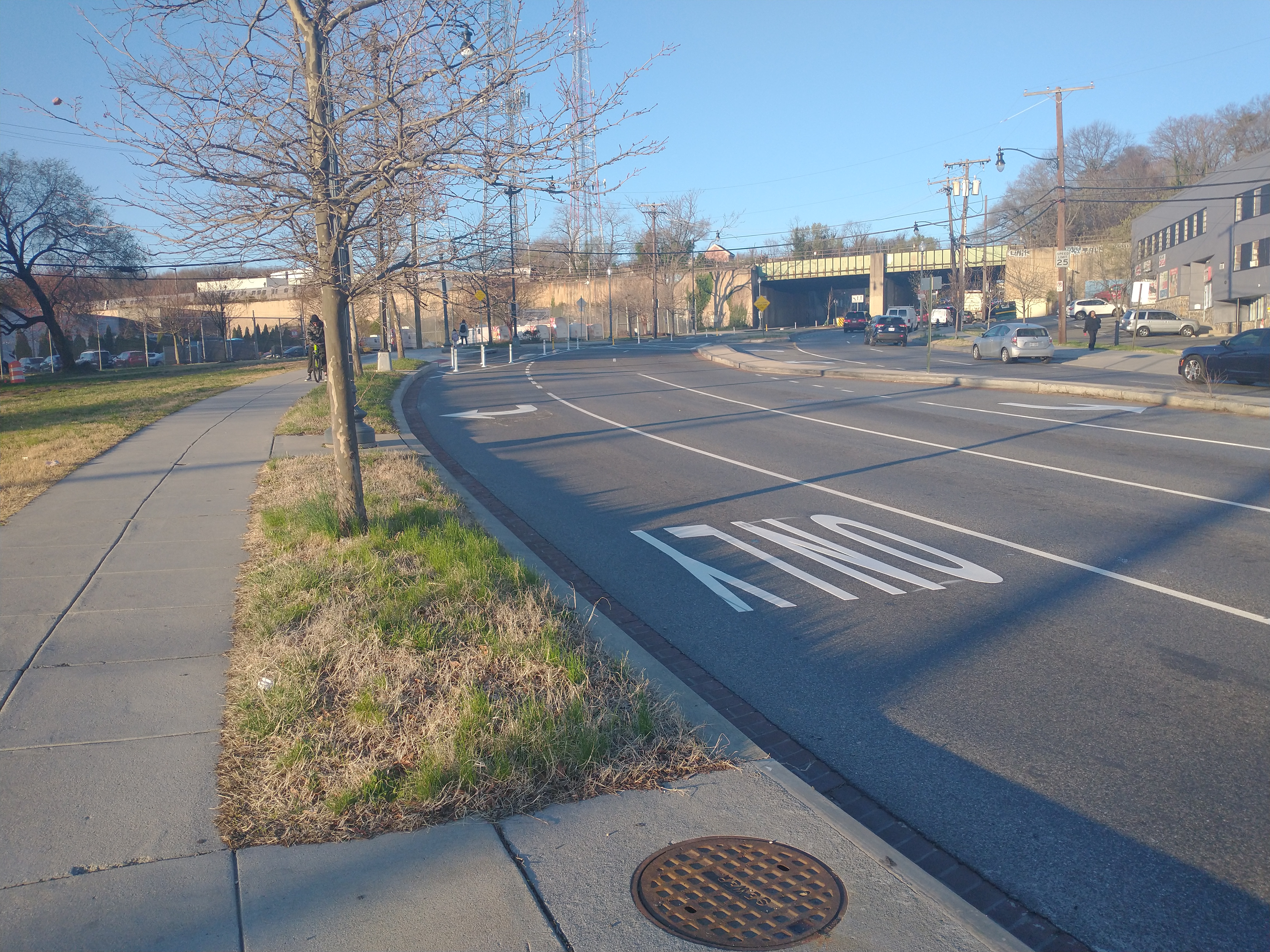
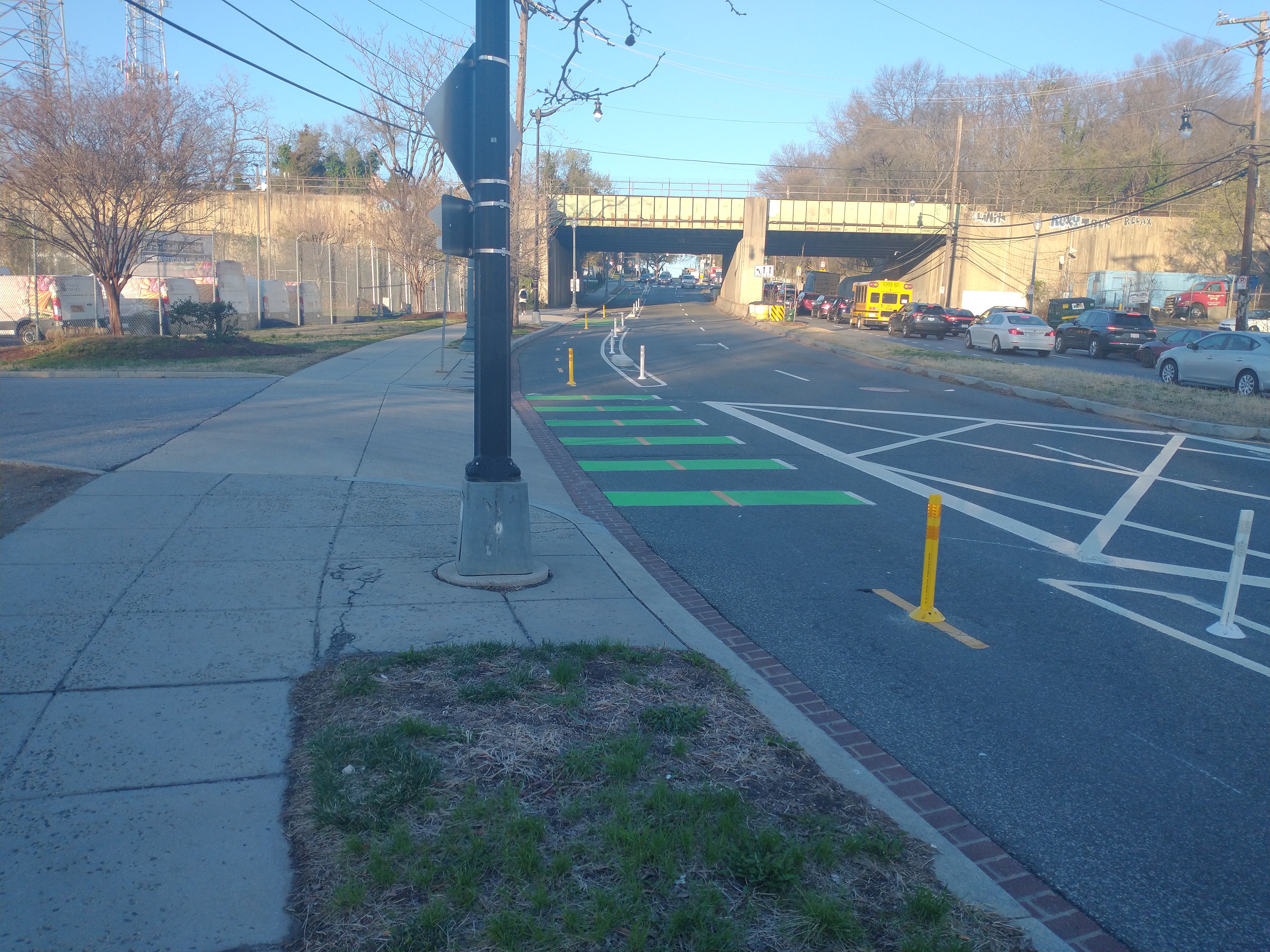
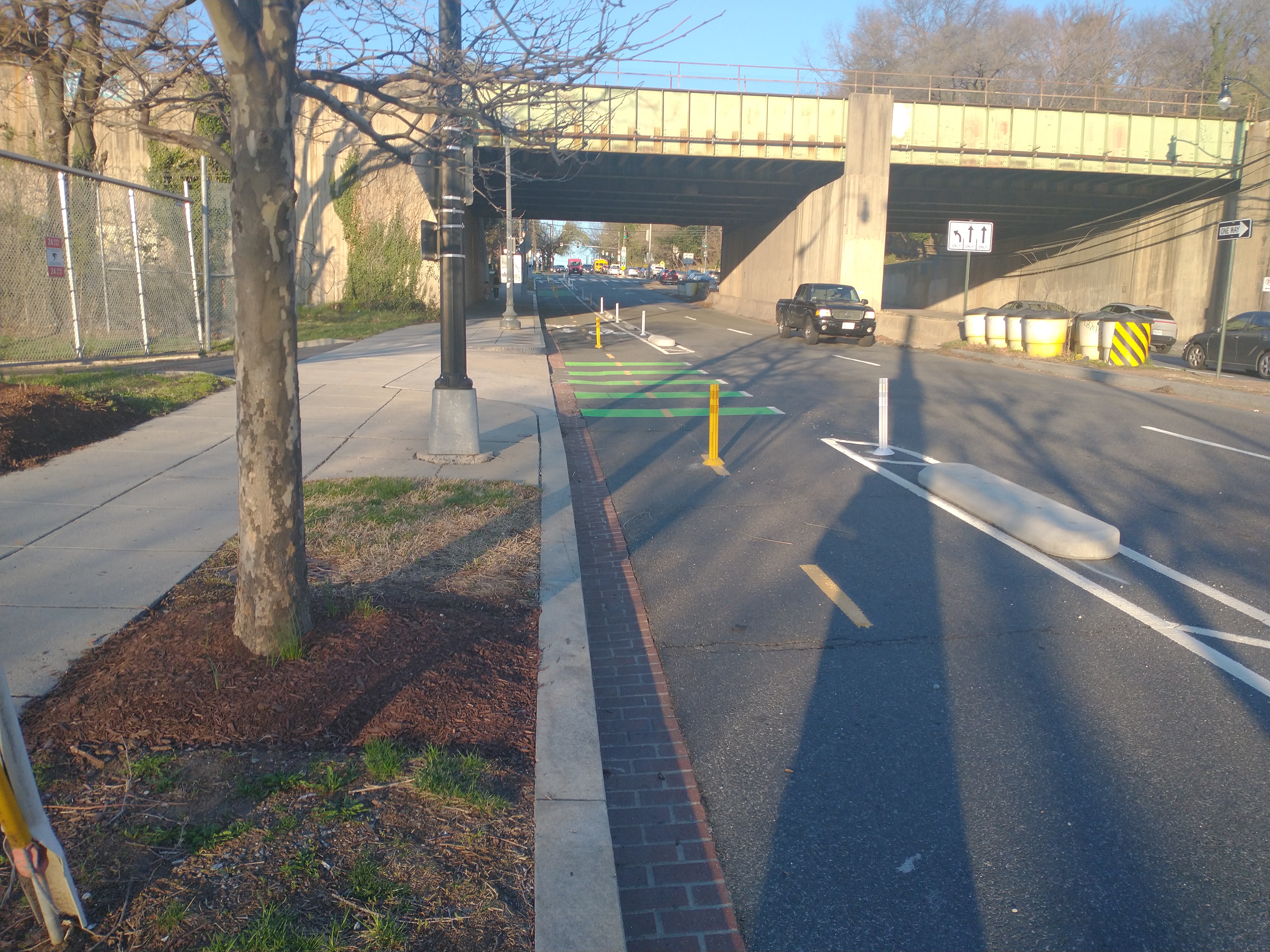
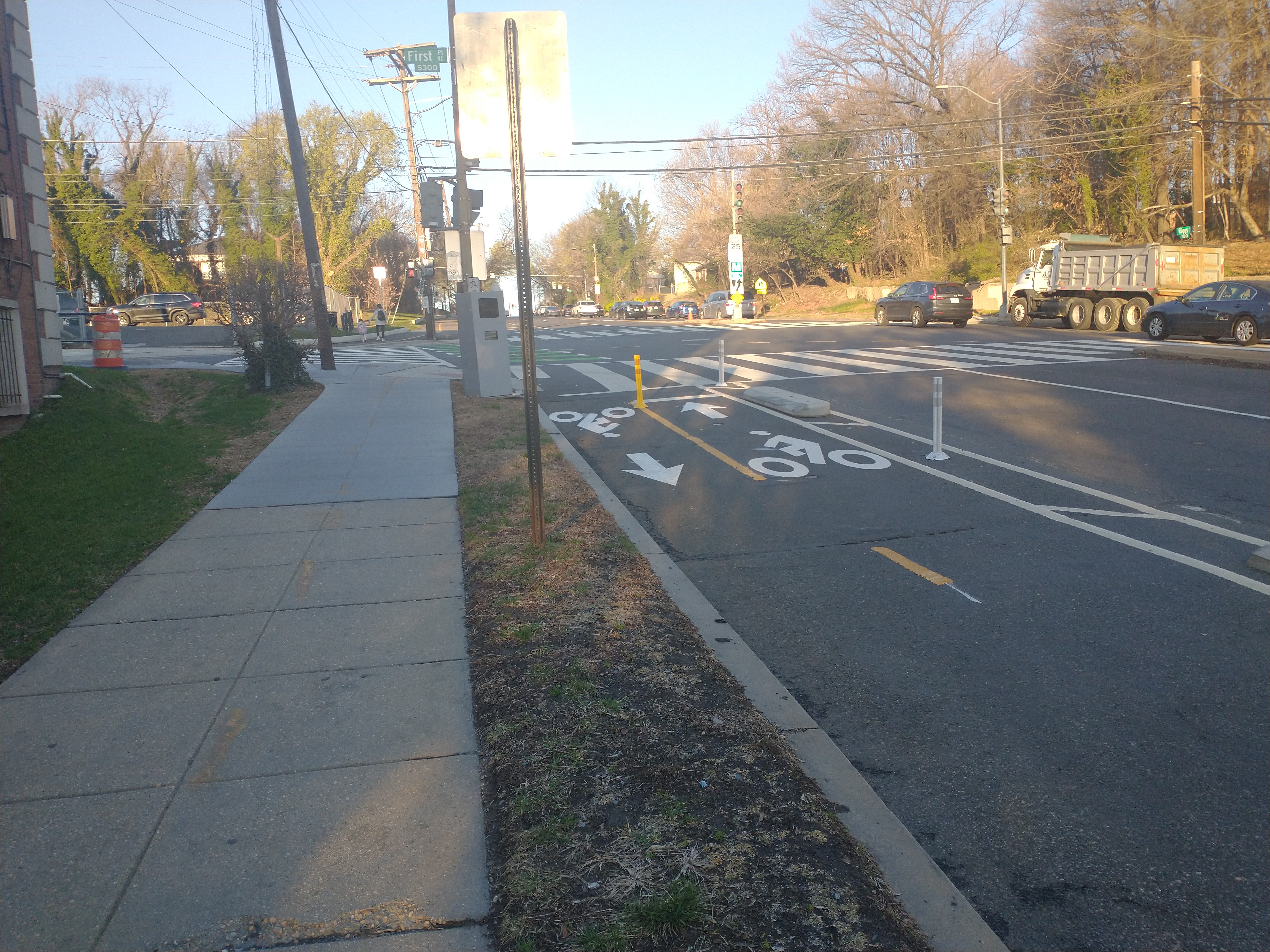
The District Department of Transportation (DDOT) recently installed a short two-way cycletrack on the south side of Riggs Road between 1st Place NE and South Dakota Avenue NE. DDOT initially proposed installing the cycletrack back in 2022. Plans stalled due to staffing issues before DDOT reissued a Notice of Intent in 2023. Plans always included retaining a portion of the dedicated right-turn lane from Riggs onto South Dakota.
I used the cycletrack earlier this week. The nice thing about it is that it does provide a way for people to connect to the Met Branch Trail from east of South Dakota Avenue without having to share the narrow sidewalk with pedestrians.
It seems like drivers are getting used to it. A couple of ancillary effects of the new cycletrack are that drivers can no longer use the dedicated right-turn lane from Riggs onto 1st Place NE to drive straight ahead to South Dakota as they used to do. They can no longer change lanes in the middle of the intersection like they used to do. And just from my initial observation, it seems like there is a little less speeding down the slight hill towards South Dakota. People realize they need to drive a bit more carefully through this area.
In a recent newsletter, Ward 4 Councilmember Janeese Lewis George noted that she is working ANC Commissioner Danielle Geong (4B09) on pedestrian safety near LaSalle-Backus Elementary School. Commissioner Geong and several residents testified about this issue at DDOT’s recent oversight hearing.
CM Lewis George writes:
Working to Improve Traffic Safety in Riggs Park
Last week, my team joined ANC 4B Commissioner Geong, DDOT’s Safe Routes team, and the LaSalle-Backus PTO for a traffic safety walk around LaSalle-Backus Elementary School. The area along Riggs Road where the school is located has been a source of concern for many community members, with frequent reports of speeding and drivers running red lights, endangering students and families, particularly during drop-off and pick-up time. DDOT’s Safe Routes team is looking into several solutions, including potential jersey barriers, street narrowing, and speed bumps, and committed to improving signage in the area. I’m also continuing to work with DDOT to advocate for a Safe Routes Action Plan for LaSalle-Backus to look into further traffic calming measures to ensure our students, teachers, and families are safe.
The District Department of Transportation (DDOT) has issued a Notice of Intent (NOI 25-03-TSA) to install a new crosswalk at 8th and Jefferson Street NE. Send comments in support to alexander.webb@dc.gov by April 24, 2025.
[Ed. Note: I scheduled a few posts about mundane things to run today. I do want to acknowledge the terrible loss of life following the accident at National Airport and extend sympathies to everyone impacted.]
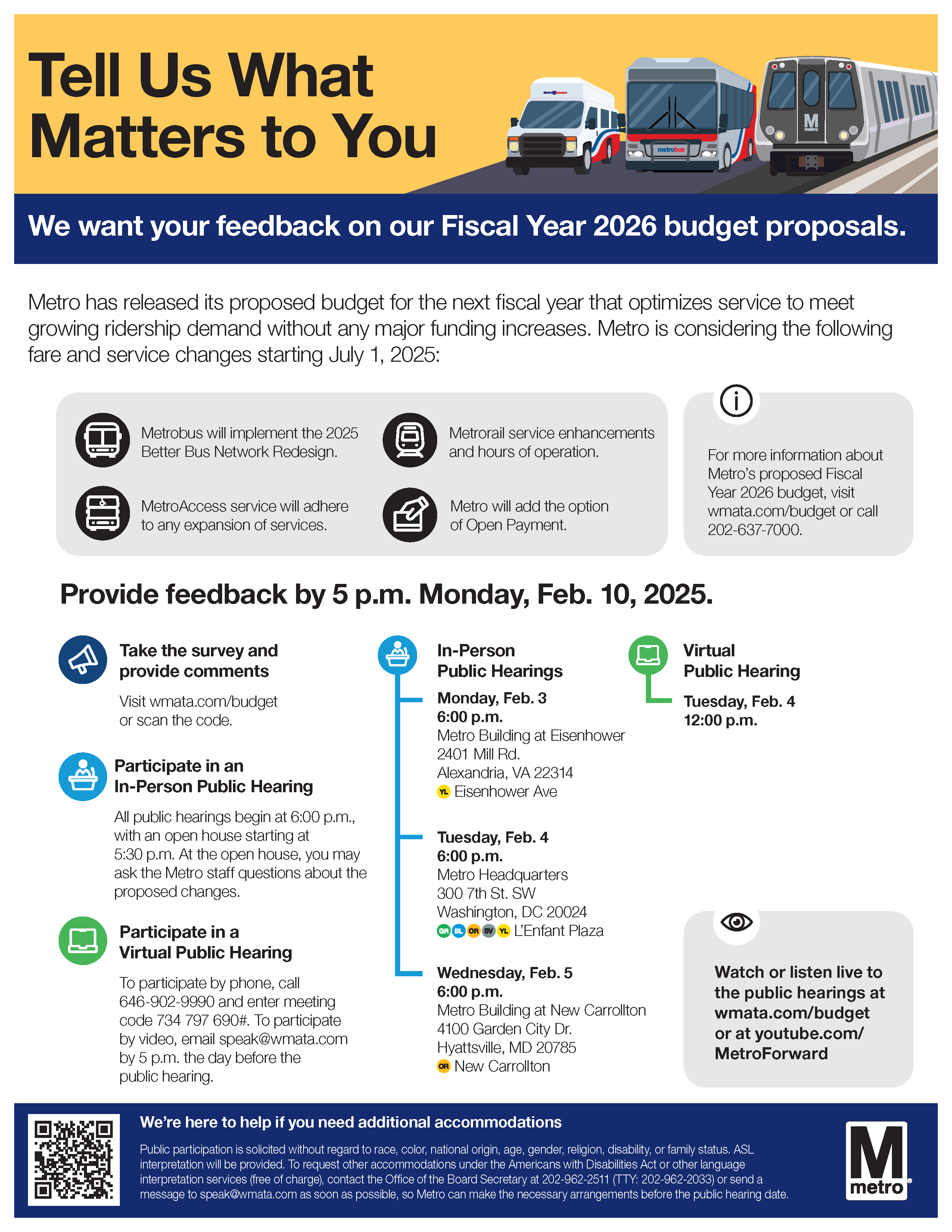
Metro is seeking input on its proposed Fiscal Year 2026 budget. For details and to submit comments/complete the public survey, visit wmata.com/budget. Provide feedback by 5:00 pm on February 10, 2025.
Metro is having hearings on the budget proposal during the first week of February. The Notice of Hearing contains instructions on how to sign up to testify.
Monday, February 3, 2025, 6 p.m.
Metro Building at Eisenhower, 2401 Mill Road, Alexandria, VA 22314
Metro staff will be available at 5:30 p.m. for an open house.
Tuesday, February 4, 2025, 6 p.m.
Metro L’Enfant Plaza Headquarters, 300 7th Street SW, Washington, DC 20024
Metro staff will be available at 5:30 p.m. for an open house.
Tuesday, February 4, 2025, 12 p.m.
Virtual only (via telephone or video); no open house
Wednesday, February 5, 2025, 6 p.m.
Metro Building at New Carrollton, 4100 Garden City Drive, Hyattsville, MD 20785
Metro staff will be available at 5:30 p.m. for an open house.
All hearings will be broadcast online at wmata.com/budget or youtube.com/metroforward.
Proposed Changes
Metro’s summary of proposed changes:
Extend half of Yellow Line trains to Greenbelt
Split Silver Line service between Downtown Largo and New Carrollton
Additional peak service on Red and Silver lines
Increase Weekend Hours of Operation
Implementing the Better Bus Network redesign
Introduce an open payment fare system, allowing taps from credit and debit cards
The big news is that Metro is proposing to run half of Yellow Line trains to Greenbelt, with the other half ending at their current terminus at Mt. Vernon Square. Please comment in support of this proposed change.
Metro is proposing to increase peak service on the red line during the busiest times:
Operate Red Line trains up to every 4 minutes, from every 5 minutes, during the busiest portions of weekday rush periods to provide additional capacity in both directions of travel. Red Line trains would continue to operate every 5 minutes during the remainder of peak service.
I personally think Metro needs to increase service more than proposed, given the constant drumbeat about workers returning to the office five days a week and the fact that trains are already crowded during rush hour right now.
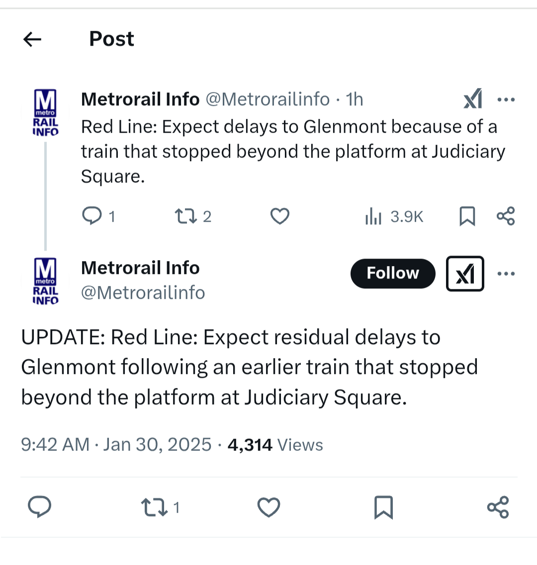
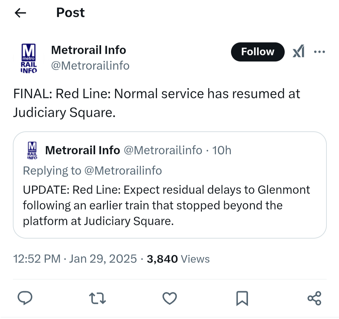
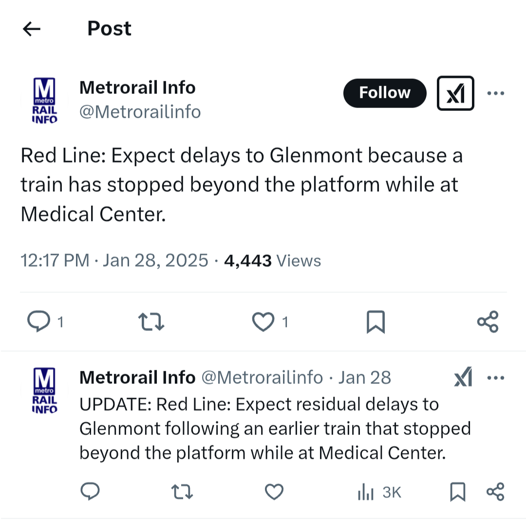
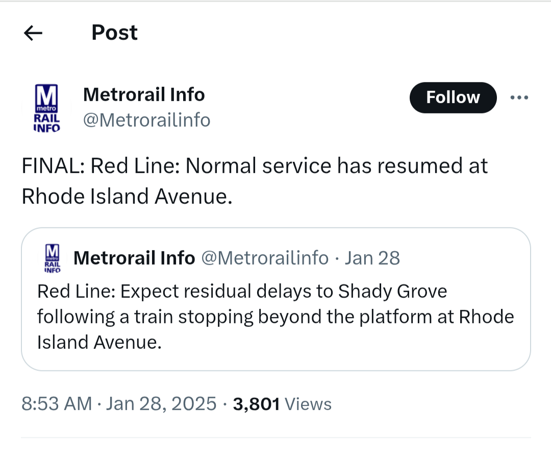
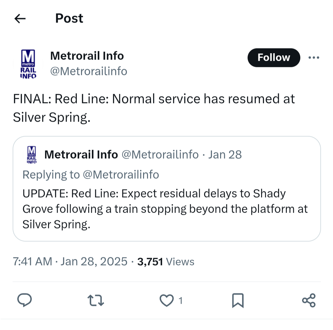
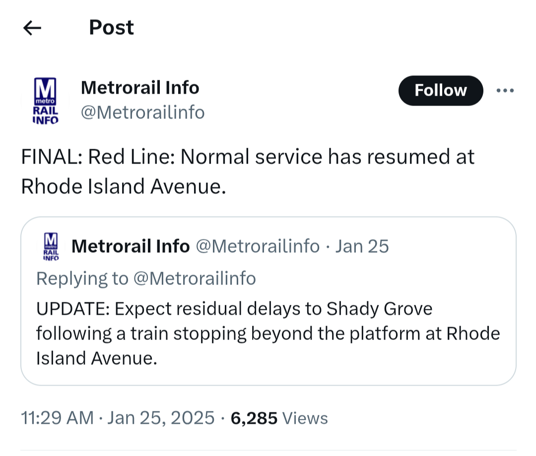
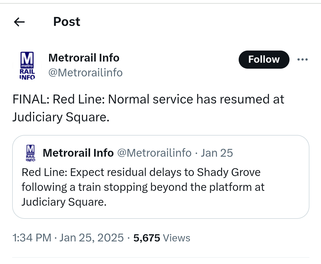
Also, Metro seems to have a problem with red line trains overshooting the platform lately. When trains stop beyond the platform, trains end up getting delayed up and down the line. This has happened seemingly three days in a row now, and I saw it happen by a long shot while waiting for a train at Judiciary Square a couple of weeks ago. Metro is running a lot of six-car trains during rush hour for reasons and when there are delays, the trains get dangerously crowded. Rush hour service on the red line has been pretty bad every day this week.
The proposed budget would also implement the “Better Bus Network,” which includes changes to bus routes and bus stops in our neighborhood. We previously discussed those changes on the blog. The budget proposal states that bus service changes have already been approved by Metro’s board. People can still comment if they would like.
Finally, Metro still needs a dedicated source of funding.
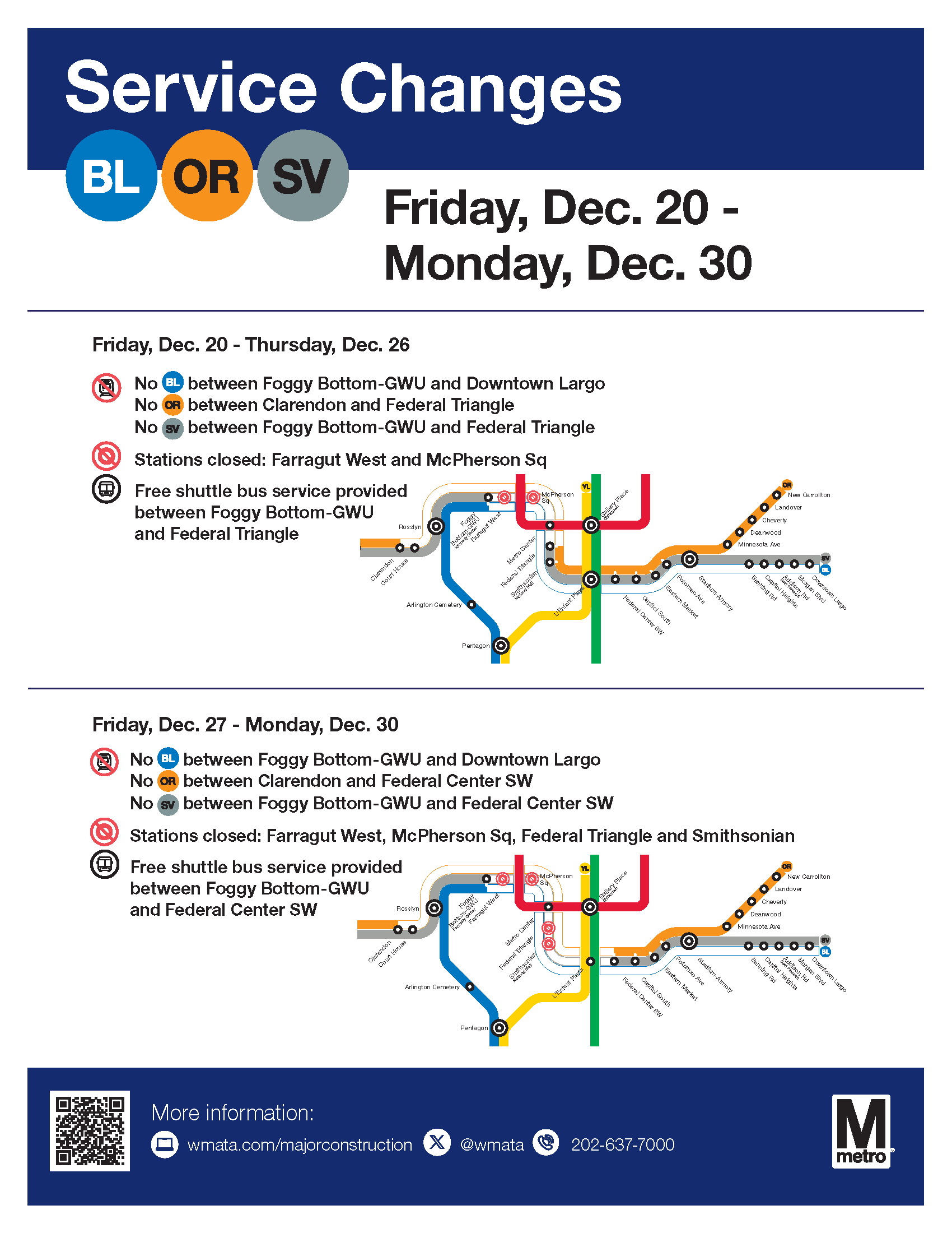
Starting December 20, 2024, Metro will close select downtown stations on the Blue, Orange, and Silver lines for an 11-day construction project.
Key Details:
· December 20-26: Farragut West, McPherson Square, and the lower level of Metro Center will be closed.
· December 27-30: The closures expand to include Federal Triangle, Smithsonian, and L’Enfant Plaza (lower level).
· Stations will reopen December 31.
During the closure, free shuttle buses will replace train service. The project includes replacing fasteners, welding joints, upgrading platform lighting, and more.
In the redesign, Metro continues to propose eliminating several neighborhood bus stops, as discussed in this post. But Metro now proposes to retain the stop at Chillum Place & Eastern Avenue NE that was originally slated for removal.
Bus Stop
Route
Plan
South Dakota Ave & 8th St NE
80
Remove
Galloway St & South Dakota Ave NE
80, E2, F6
Remove
Riggs Rd & Rock Creek Church NE
60, 64, E4, K2, K6
Remove
Riggs Rd & Blair Rd NE
60, 64, E4, K2, K6
Remove
Chillum Pl & Eastern Ave NE
E4
Retain
New Hampshire Ave & Longfellow St NE
K6
Remove
Nicholson St & Riggs Rd NE
E4
Remove
New Hampshire Ave & Oneida St NE
K6
Remove
New Hampshire Ave & Quackenbos St NE
K6
Remove
I am personally annoyed about the planned removal of the stop at South Dakota and Galloway. Riggs Park residents will have to either walk up the steep dirt hill to the stop at Galloway & 4th or walk to the stop at South Dakota & Farragut and stand at a stop on a narrow sidewalk without a bench or shelter. Alas.
(Yesterday, Councilmember Zachary Parker sent a letter to Metro leadership with some initial concerns about some of the proposed stop removals in Ward 5. The letter mentions the stops at Riggs/Rock Creek Church and Riggs/Blair).
New Naming Convention
Metro is moving forward with the new naming convention. Routes are named based on the following criteria:
The first character represents general area:
D or C (District of Columbia, with D generally corresponding to routes serving Downtown and C with Crosstown routes)
M (Montgomery)
P (Prince George’s)
A (Arlington and Alexandria)
F (Fairfax County, City of Fairfax, and Falls Church)
The second character represents a number that clusters routes along the same corridor or in the same neighborhood
The third character distinguishes it from other routes in that cluster; an X represents limited-stop service
Neighborhood Bus Route Crosswalk: Existing Route –> Approximate Proposed Route
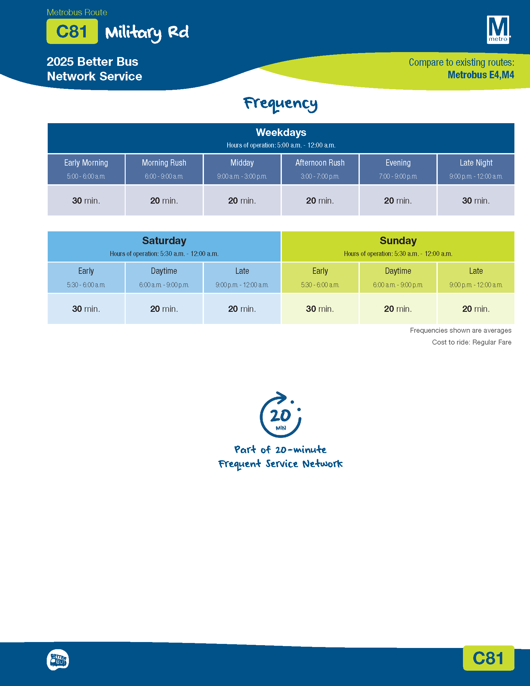
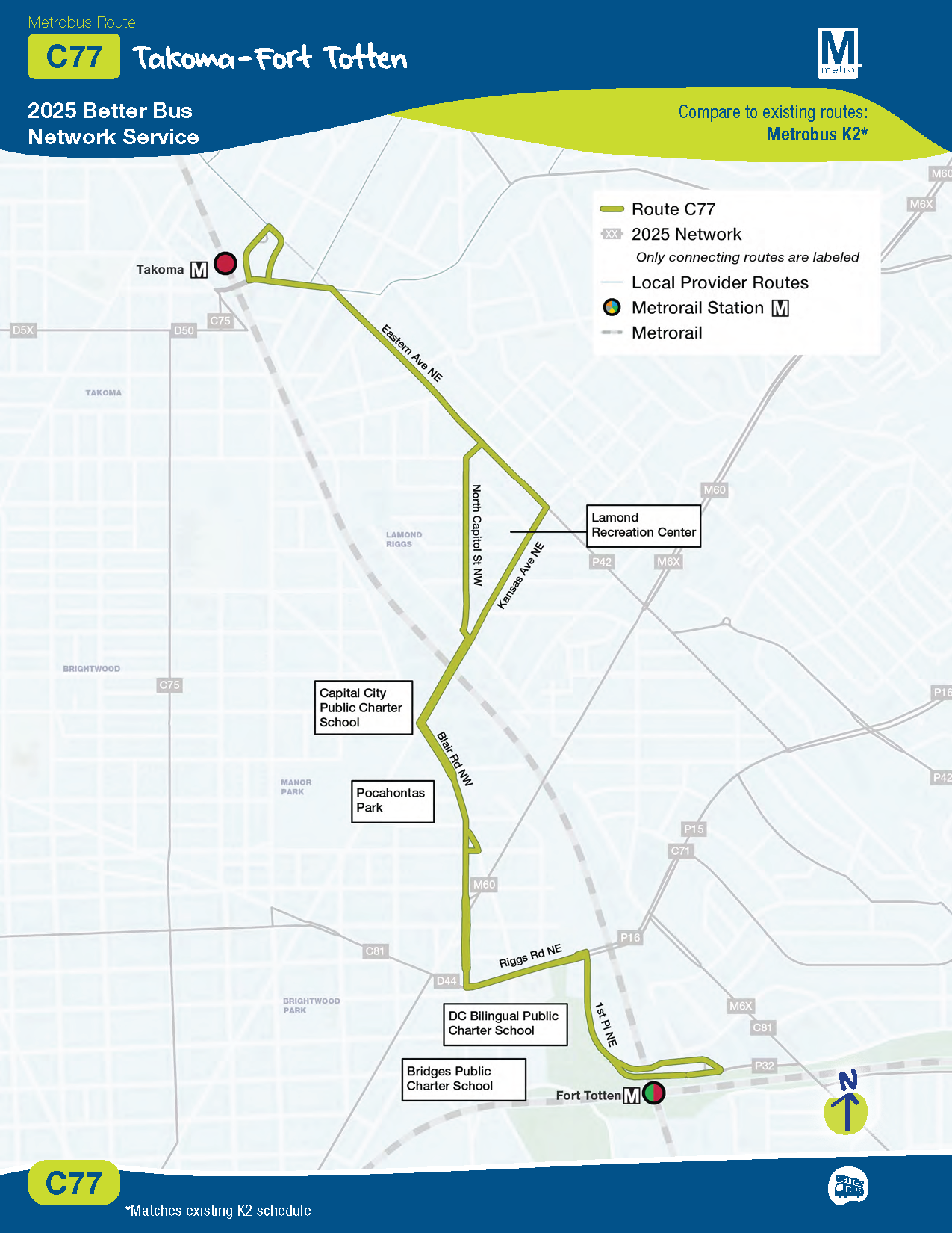
E2 –> C71 Fort Totten – Union Station via Ivy City E4 –> C81 Sibley Hospital – Fort Totten 80 –> D30 Fort Totten – Federal Triangle via North Capitol Street 64 –> D44 Fort Totten – Federal Triangle via 11 Street NW K2 –> C77 Takoma – Fort Totten K6, K9 –> M60 White Oak Medical Center – Fort Totten via New Hampshire Avenue K6, K9 –> M6X White Oak FDA – Fort Totten R1, R2 –> P15 Riggs Road – Adelphi via Riggs Road) R1, R2 –> P16 White Oak Medical Center – Fort Totten via Riggs Road F6 –> P32 Fort Totten – Greenbelt F6 –> P35 Fort Totten – New Carrollton K2 –> P42 Takoma – New Carrollton
Route Changes
Neighbor Gavin and I took a quick look at some of the final route changes for the neighborhood. A few differ from what Metro proposed earlier this year. Entirely possible missed some things or got something wrong. Metro made some tweaks to the Maryland lines that serve Fort Totten station, but I did not look super closely at them.
Metro prepared a handy response summary providing a bit of rationale for some of their decisions.
Service on Riggs Road/Chillum Place/Nicholson Street/Eastern Avenue NE(E2 –>C71)
Metro is moving forward with chopping the upper NE/NW route E4 crosstown loop to Riggs Park. Seems planners could not quite figure out what to do about service between Fort Totten station and Eastern Avenue NE, despite the several comments asking them to keep at least one crosstown loop to Riggs Park so that people can actually travel crosstown and get to locations like grocery stores, schools, library, and their homes without having to transfer buses.
Previously Metro proposed adding the eastern tail of the current loop to a route that would go out to Maryland. In the final plan, Metro goes in a completely different direction by putting the eastern tail onto route C71, a route most similar to existing route E2 that runs between Fort Totten and Union Station via Ivy City. Looks like the route will no longer travel down Gallatin Street NE. Instead, the route will service South Dakota, Riggs, Chillum Place, Eastern, and Nicholson.
Service 7 days/week. Frequency 20-30 weekdays; 30 minutes on weekends.
There will be just one upper NE/NW crosstown loop serving Fort Totten station. Route C81 will serve locations between Fort Totten station and Sibley Hospital. There will no longer be direct crosstown service to Friendship Heights station.
Service 7 days/week. Frequency of 20 minutes most of the time.
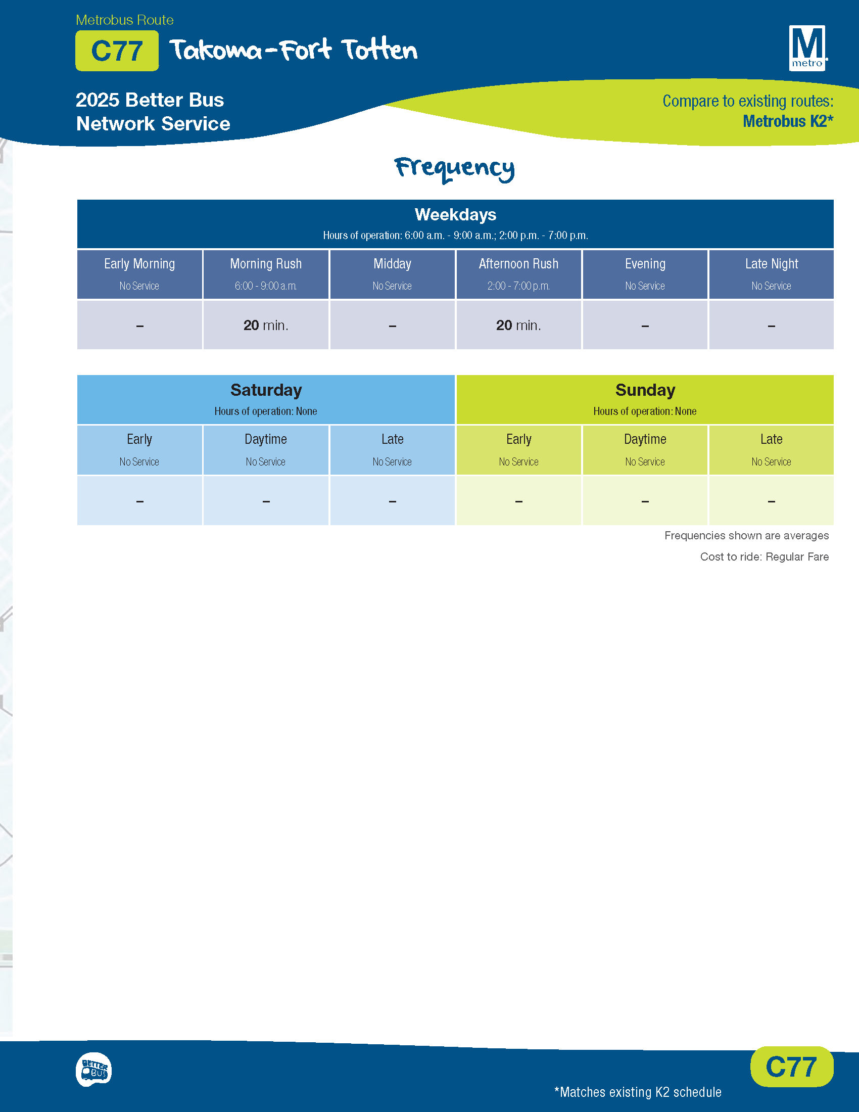
Metro previously proposed eliminating route K2 between Takoma and Fort Totten station. The final plan adopts new route C77, which will be similar to existing route K2.
Route C77 will run only on weekdays during rush hour. Frequency of 20 minutes.
Some Thoughts
This network redesign was a hefty task. I appreciate the level of outreach that Metro conducted and the various online tools developed to help make sense of all of the proposed changes and provide feedback. I also appreciated the comment/response summary documents. It is clear how much work went into collecting and analyzing all of the feedback and coming up with a final plan designed to meet several objectives. So while I would like to think of the bus as my personal chauffeur, I get that there have to be adjustments and tradeoffs.
Hopefully sooner rather than later, Metro will be able to enjoy a more sensible funding structure, and we can get a visionary network that the city and region deserve. On the Metrorail side, looking forward to the purple line in opening in a few years. Also, Metro is talking publicly about possibly restoring some yellow service to Fort Totten station.
In the meantime, Metro will be preparing to implement the bus network changes in summer 2025.
From Metro (updated, blue/yellow line trains will serve Pentagon station)
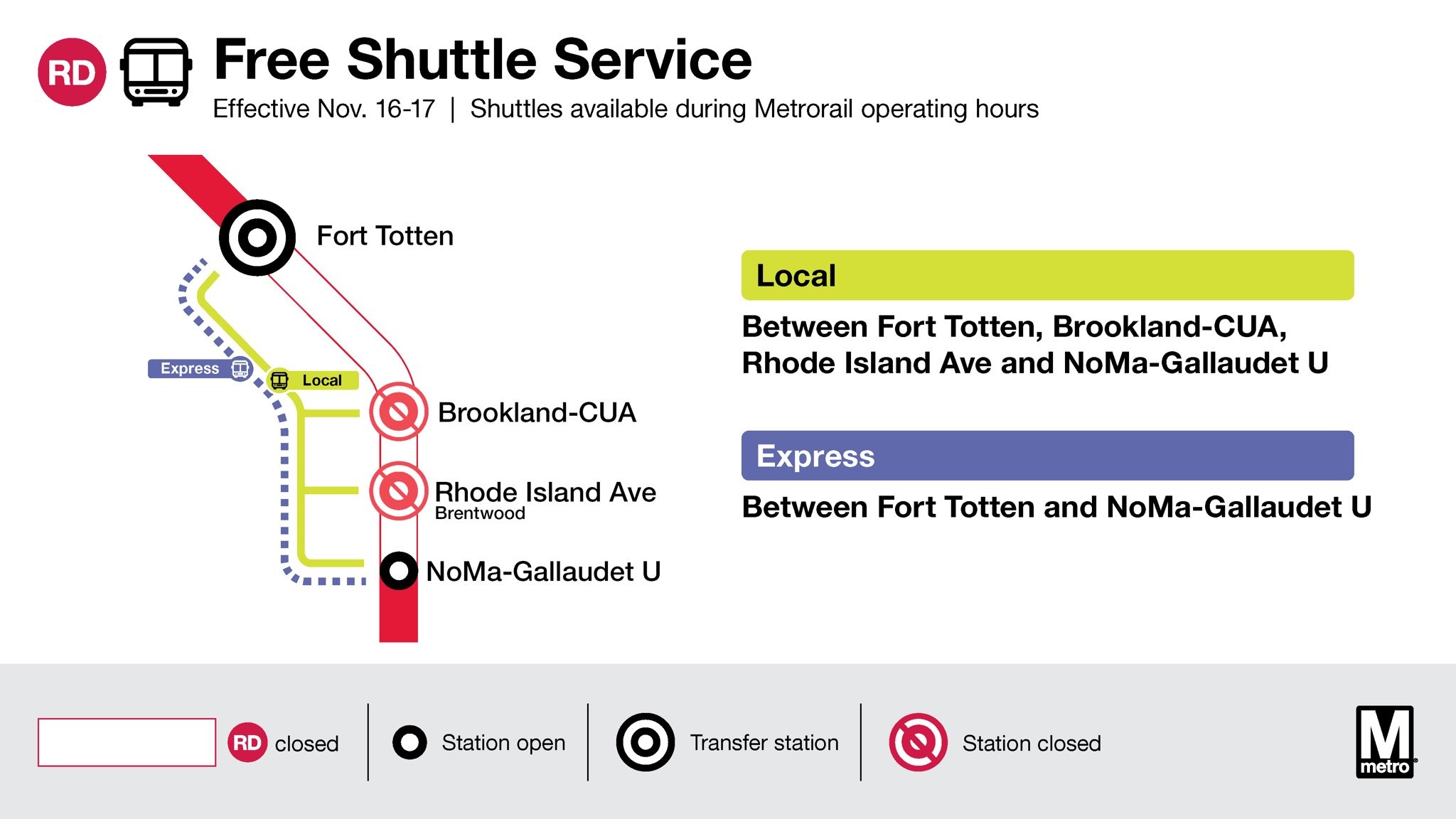
Metrorail weekend service for Saturday, November 16 through Sunday, November 17
Advisory Effective: 11/16/24 – 11/17/24
Hours: Sat 7 a.m. – 1 a.m.; Sun 7 a.m. – Midnight
Service-At-A-Glance
Red Line
Free shuttle buses replace trains between Fort Totten and NoMa-Gallaudet U. Trains run every 6 minutes (daytime) and 10 minutes (evening) between Glenmont and Fort Totten and every 8 minutes (daytime) and 10 minutes (evening) between NoMa-Gallaudet U and Shady Grove. Rhode Island Ave and Brookland-CUA stations closed.
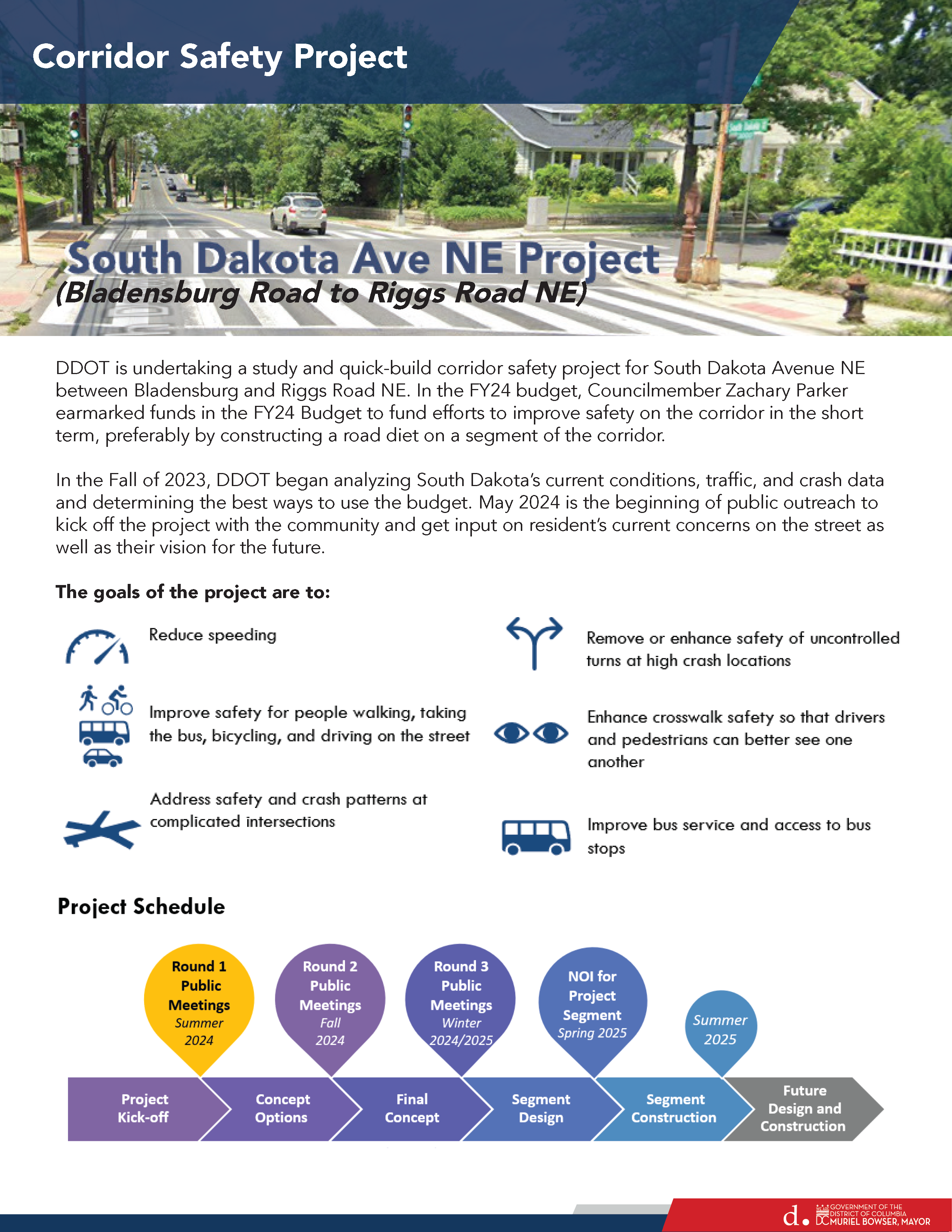
DDOT will study South Dakota Avenue NE from Bladensburg Road to Riggs Road NE for potential safety improvements. Currently DDOT has funding for design and construction of improvements on just the southern portion of the corridor, from Bladensburg to Taylor Street NE.
View details, concept plans, meeting slides, and timeline information on the project website.
Share your thoughts about Vision Zero and safe streets.
The DC Offices of Vision Zero and Highway Safety are working to develop a new plan to reshape street safety efforts. Staff are holding listening sessions to work closely with communities and stakeholders to identify problems and build solutions. These discussions will be part of the top-to-bottom update of the District’s Vision Zero Plan and DC Strategic Highway Safety Plan.
There will be in-person listening sessions across the city. View the full line-up.
The Ward 5 listening session will be on September 21, 10:30am-11:30am at Lamond-Riggs Library.
Complete the online survey here by September 23, 2024, at noon.
Thankfully, that means that the large number of charter buses idling on Galloway Street and along South Dakota Avenue, damaging neighborhood roads, and creating safety hazards in the neighborhood are now gone. Hopefully the next time Metro decides to shut down nearby stations, they will utilize their huge parking lot at Fort Totten station for shuttle buses instead of housing a bunch of buses in the neighborhood.
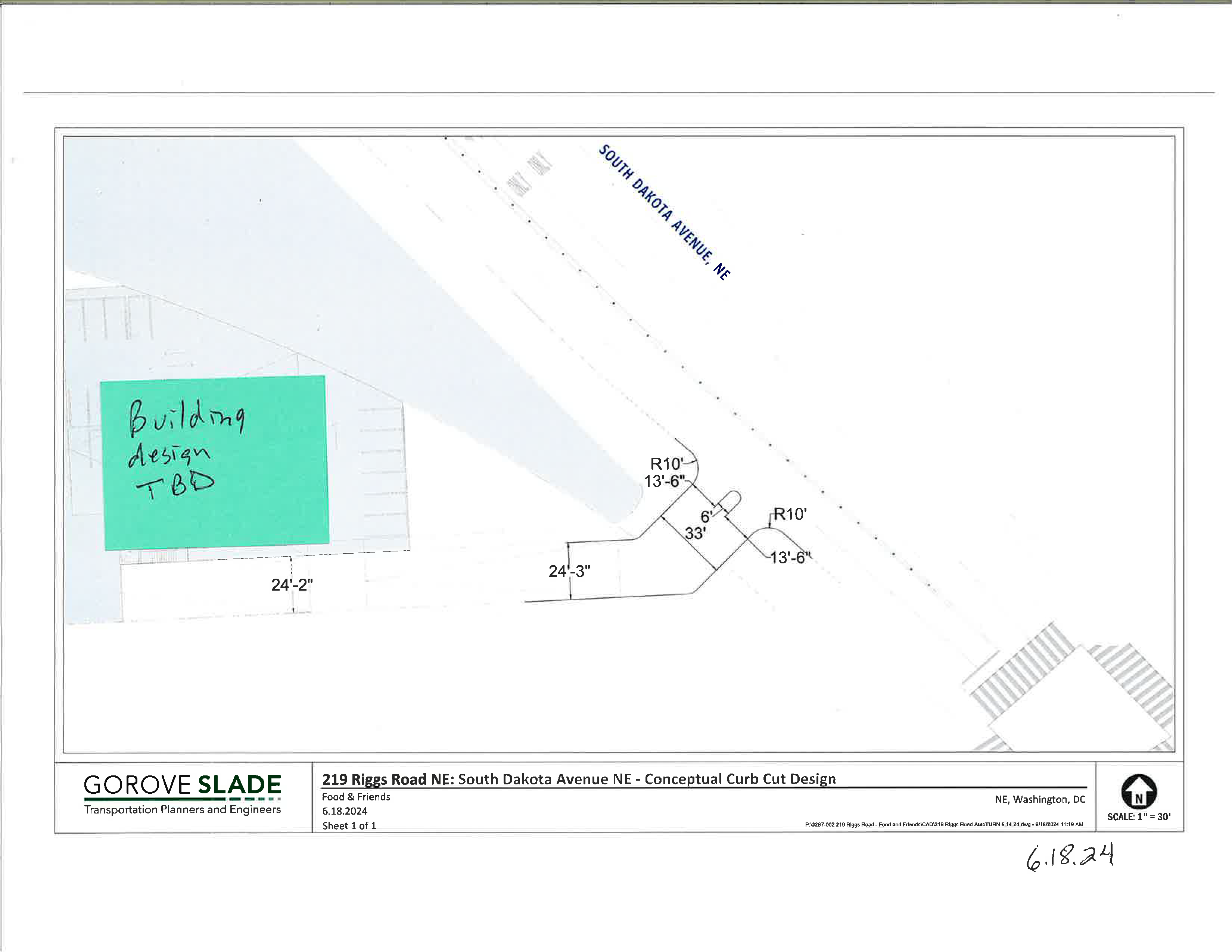
Food & Friends is requesting a curb cut on South Dakota Avenue just north of Kennedy Street NE. The so-called conceptual curb cut request will be the subject of a DC Public Space Committee meeting on August 22, 2024 (application #445416).
Food & Friends is looking to expand its building on the corner of South Dakota Avenue & Riggs Road NE in order to serve more clients. Because the land to the north of the property is District-owned land slated for park space, Food & Friends is looking to expand east towards South Dakota. Food & Friends reps have been to a few meetings, but there are still a lot of unanswered questions. They are calling this a conceptual curb cut project because they contend that their expansion is years away. So apparently the Public Space Committee is going to decide on whether the organization can get a curb cut on South Dakota Avenue in the absence of any information about their building expansion plan.
Conceptual curb cut diagram provided by Food & Friends.
Curb Cut Design
Residents do not have access to public space applications in the city’s online permitting system, which is known as TOPS. What we do know is that they are requesting a pretty sizeable curb cut (leading to a driveway) that looks to be about 33 feet wide on a block that currently has none. In an email to me, they said, “The design includes a 6-foot-wide pedestrian safety island, increased turn radii to alleviate off-tracking, and right-in/right-out movement.” We also know that curb cut access will likely require some amount of public space beyond just sidewalk access because of the way the property lines are drawn. But it is not clear to me based on the one diagram we have exactly how much public space they are requesting.
They say they are requesting this curb cut because they are thinking about building an expanded kitchen facility closer to South Dakota Avenue. So, they will want to reroute food delivery (via 18-wheeler trucks) to the South Dakota side in the future. My understanding is that DDOT is requesting that they close one of their two curb cuts on Riggs Road if they want a curb cut on South Dakota. My understanding is that staff and volunteers would continue to use Riggs to access the parking lot. But it’s a pretty large parking lot, so who knows if that space would be reconfigured as well as part of an expansion plan.
In an email to me, Food & Friends said:
Sixty-five staff, 80 kitchen volunteers, 10 Food & Friends delivery vans, 30 volunteer delivery cars and several vendor delivery trucks (including semi-sized) currently travel to our location daily to prepare and home-deliver 6,000 meals a day to the region’s most vulnerable neighbors. We encourage use of Metro and cycling (we had a cycling team in the 2000s!) and routinely shuttle our staff and volunteers to the Metro station to encourage less vehicles.
Ward 5 Councilmember Zachary Parker submitted a letter in support of the conceptual curb cut to the Public Space Committee.
My thoughts
I do not think anyone has done a really good job of explaining what is really happening here and we’re being asked to comment on something on which we lack full information, specifically impacts to public space. Obviously, Food & Friends plans to build on their property and may even want more public space than what is being publicly discussed. Residents do not have access to applications in TOPS and the ANC is not doing anything regarding this matter. I’m sure most support Food & Friends in their goal to serve more clients around the region.
(Fun fact about me: I served in Americorps in DC before continuing my education. One team member was placed at Food & Friends, and we would have team service days at Food & Friends at their old location in Southeast DC. I’m a big fan and supporter of Food & Friends).
We already know that curb cuts introduce vehicle/pedestrian conflicts. I think a really useful conversation would be how to maximize the amount of public space available to the community, how to minimize harm introduced by installing a new curb cut on the block, and how to safely and most efficiently accommodate the multiple uses that the property owners in the immediate area wish to put in that one little area.
I think it would be super useful for the property owners in the area to talk to one another, particularly the Cafritz Foundation (and their tenants) and Food & Friends. This conversation could also include Metro, National Park Service, and Impact DMV Church. I get the impression they don’t really communicate about their plans and how they are connected to an actual neighborhood, and I think that lack of communication at an institutional level makes it way more difficult than it needs to be to get things done.
Anyways, submit comments to the Public Space Committee at public.spacecommittee@dc.gov by August 20 and send a copy of your comments to CM Parker.
[Ed. Note: Republishing this post because today, August 15, is the last day to submit comments for the first phase of engagement on the South Dakota Avenue Corridor Safety Project. There is still time to provide feedback to DDOT to make sure we address speeding through street design, get needed improvements at key intersections in the neighborhood, and work towards developing a corridor that safely supports multiple means of moving around the neighborhood outside of just private vehicles.]
DDOT is looking at ways to address safety issues on South Dakota Avenue from Bladensburg Road NE to Riggs Road NE.
Let DDOT know what you think about what is needed along the corridor by completing this questionnaire and providing information on this public input map (where you can identify important changes you’d like to see at specific intersections like more visible crosswalks, better pedestrian accommodations, etc).
Councilmember Parker earmarked funds in the FY2024 budget for a road diet on the corridor. While much of the media attention has been erroneously focused on bike lanes, the alternatives for a road diet include potential parking lanes where there are none currently, as well. It is worth taking a look at the presentation slides to see all of the alternatives, including how DDOT could potentially address traffic diversion to side streets or address congestion through, for example, signal timing.
Most agree speeding is a problem on South Dakota. There is a relatively low volume of vehicles during off-peak hours, which makes the wide road ripe for speeding. There are too many crashes and near misses. People feel unsafe crossing the street. Too many pedestrians have been injured or killed walking along the corridor. People want to be able to safely walk and bike to points along the corridor. Everyone wants the situation to be addressed. The question is how to get there.
Project Scope
DDOT is going to study the entire corridor, examine three concepts for a road diet, select one concept, and design and build the concept on one portion of the corridor. DDOT will also make spot improvements at certain intersections, which is why it is really important to indicate on the map where improvements are needed. DDOT plans to start construction on the southern end (near Bladensburg) because they state that is where there is highest need.
DDOT is going to study three options for the corridor.
Option One: 3 lanes with full-time parking
Option one would have three lanes with parking on each side of the street.
Maintains one lane in each direction
Uses curbside space for full-time parking
Center space can be left turn lanes or pedestrian islands depending on needs
(Currently, no parking is allowed on South Dakota except for limited parking on the west side of South Dakota between Galloway and Ingraham (soon extending to Kennedy). A couple of churches closer to the southern end of the corridor use a lane for parking on Sundays.)
Option Two: 3 lanes with parking and two-way protected bike lanes
Option two would have three lanes with parking and a two-way protected bike lane:
Maintains one travel lane in each direction
Uses curbside on one curb face for protected bike lanes
Uses opposite curb for parking
Center space can be left turn lanes or pedestrian islands depending on need
Option Three: 3 lanes with protected bike lanes in each direction
Option three would have three lanes with protected bike lanes in each direction.
Maintains one lane in each direction
Uses curbside space for protected bike lanes
Center space can be left turn lanes or pedestrian islands depending on needs
Project Timeline
DDOT plans to gather data, explore concepts, and gather input before holding a second round of public meetings in fall 2024, having a third round of public meetings in winter 2024/2025, beginning work on design plans in spring 2025, and finally starting construction just on the southern end in summer 2025.
Though DDOT is going to focus the limited construction money on the southern end of the corridor to start, please take the time to provide input to DDOT about neighborhood issues through this public engagement effort. In particular, I think that highlighting problematic intersections and needed safety, mobility, and access improvements in the neighborhood on the public map will be useful given that we know there are no immediate plans for bike lanes on SDA in the neighborhood.
Contacts
Questions may be sent to the project team:
Sayra Molina, Corridor Safety Team sayra.molina2@dc.gov