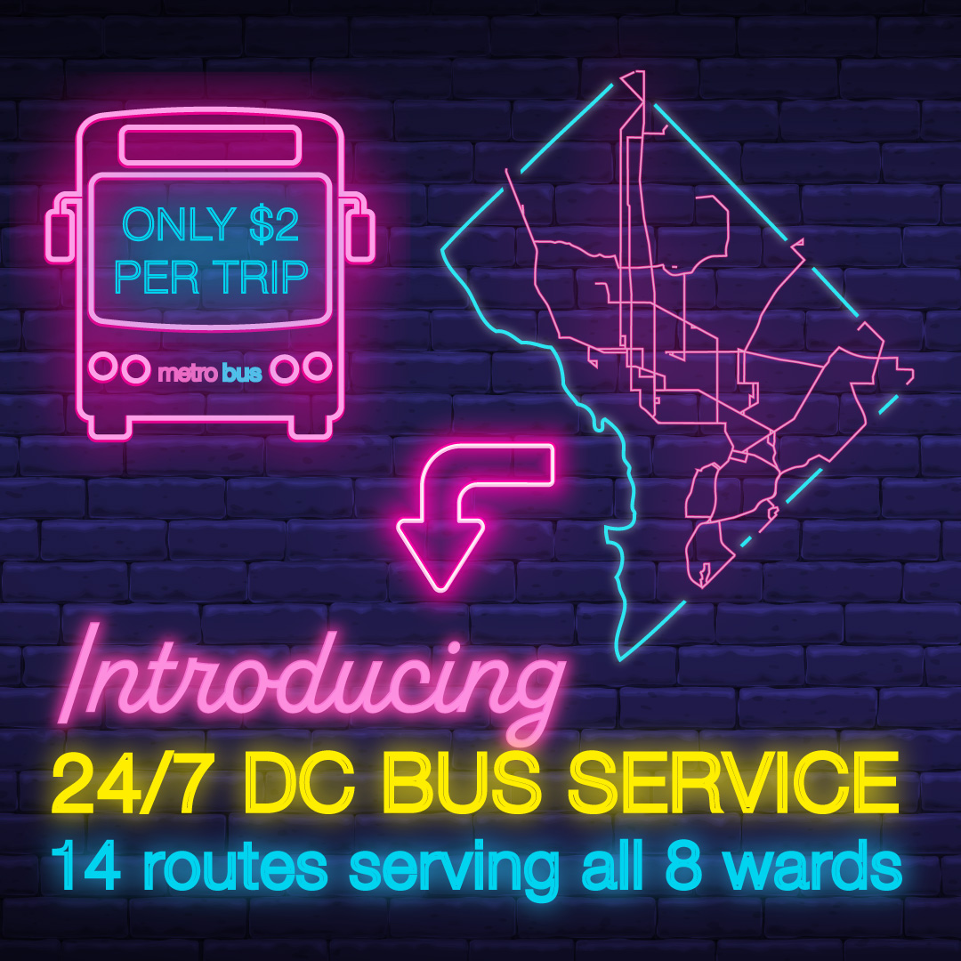
Starting December 17, 2023, Metro will begin operating overnight bus service on 14 routes, including route 80. Between 9 p.m. and 7 a.m., bus service will operate every 20 minutes or better on the following routes:
When boarding, let our Bus Operator know you’ll be requesting a Courtesy Stop
In approach to your desired drop-off, pull the Stop Requested cord to signal to the Operator
Walk to the front and inform the Bus Operator of your Courtesy Stop location
A Courtesy Stop may only be made at the front of the bus and not through the rear doors. Courtesy stops are at the discretion of the Bus Operator to ensure the safety of our customers and to not interfere with any other traffic or road conditions when stopping the bus.
In her recent newsletter, Ward 4 Councilmember Janeese Lewis George shared news that DC School Connect has launched a new pilot that will transport neighborhood students to Ida B. Wells Middle School. Councilmember Lewis George notes that the walk from Riggs Park to the feeder middle school is roughly 1.5 miles (longer from certain parts of the neighborhood) and involves crossing busy roads. The DC School Connect shuttle will pick up students near LaSalle-Backus Elementary School in the morning and drop them off back there after school. More info and sign-up at https://www.dcschoolconnect.com.
From the District Department of Transportation (DDOT)
DDOT is giving away 170 bikes at Open Streets Georgia Avenue on Saturday, October 7th! 50% of the bikes will go to low-income families, and the rest will be raffled off to lucky DC residents! Enter the raffle here: https://forms.office.com/g/fUn2rFgwUq
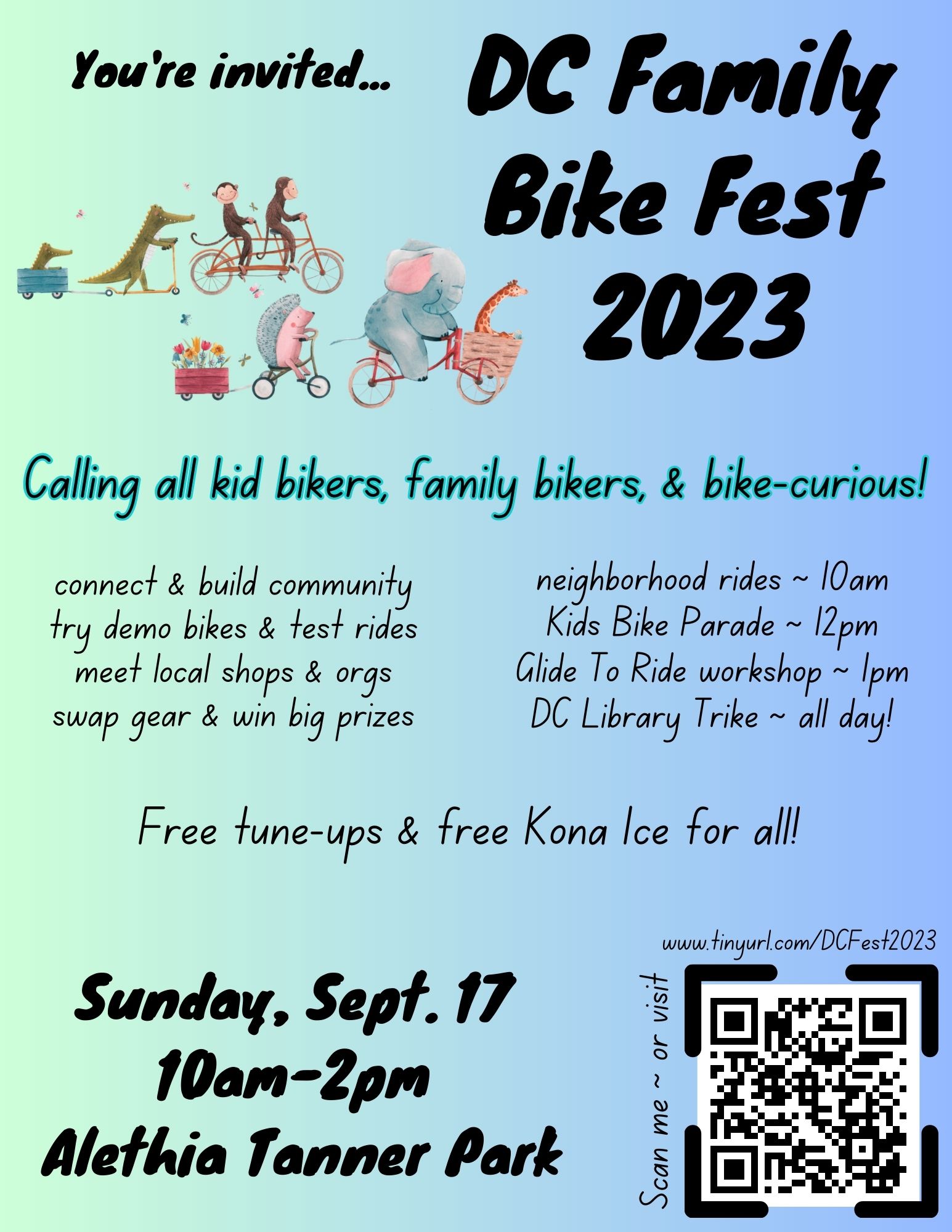
DC Family Bike Fest 2023 is happening this Sunday, September 17, 10:00 am-2:00 pm at Alethia Tanner Park.
Ward 5 Biking will be celebrating completion of the 8th Street NE cycletrack at 10:00 am at Brookland Arts Walk before heading down the Met Branch Trail to the park. The cycletrack is quite lovely (hats off to the Ward 5 ANC commissioners who worked with DDOT to close this gap along the MBT).
[Ed. Note: For those neighbors who may be interested in potential changes at Brookland Metro station, Metro passed along the following information about tonight’s hearing.]
Under the proposal, Metro would reconfigure the bus loop, relocate the Kiss & Ride lot to an on-street facility and reduce the exiting 34 Kiss & Ride spaces to eight spaces. This would improve bicycle and pedestrian access and safety and allow a mix of housing and retail on Metro’s existing property with a future joint development partner.
Customers are encouraged to provide feedback and learn more about the proposed changes during an open house and public hearing:
WHEN: Tuesday, Sept. 12, 2023 Open House begins at 6 p.m. and Public Hearing begins at 6:30 p.m.
WHERE: Luke C. Moore High School Auditorium, 1001 Monroe St. NE, Washington, DC 20017
PHONE: Dial 206-899-2028 and enter meeting code 337 433 234 #
VIDEO: Email speak@wmata.com by 5 p.m. Monday, Sept. 11, to register.
The hearing will also be available live at YouTube.com/MetroForward, or by calling the phone number above and entering the meeting code. Testimony is not required to attend or listen. Video of the hearings will also be archived at YouTube.com/MetroForward.
Those unable to participate in the public hearing may provide feedback through 5 p.m., Friday, September 22:
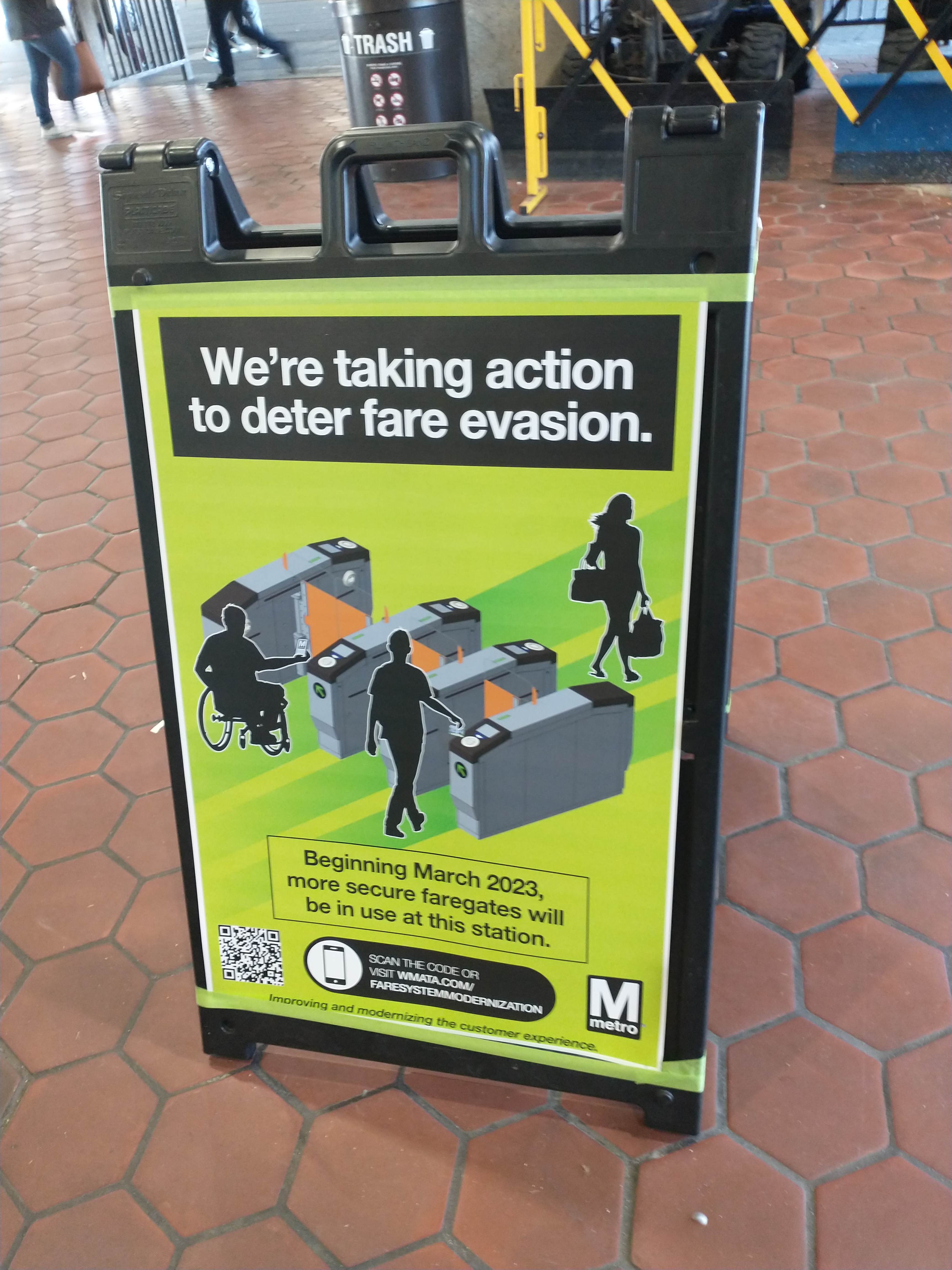
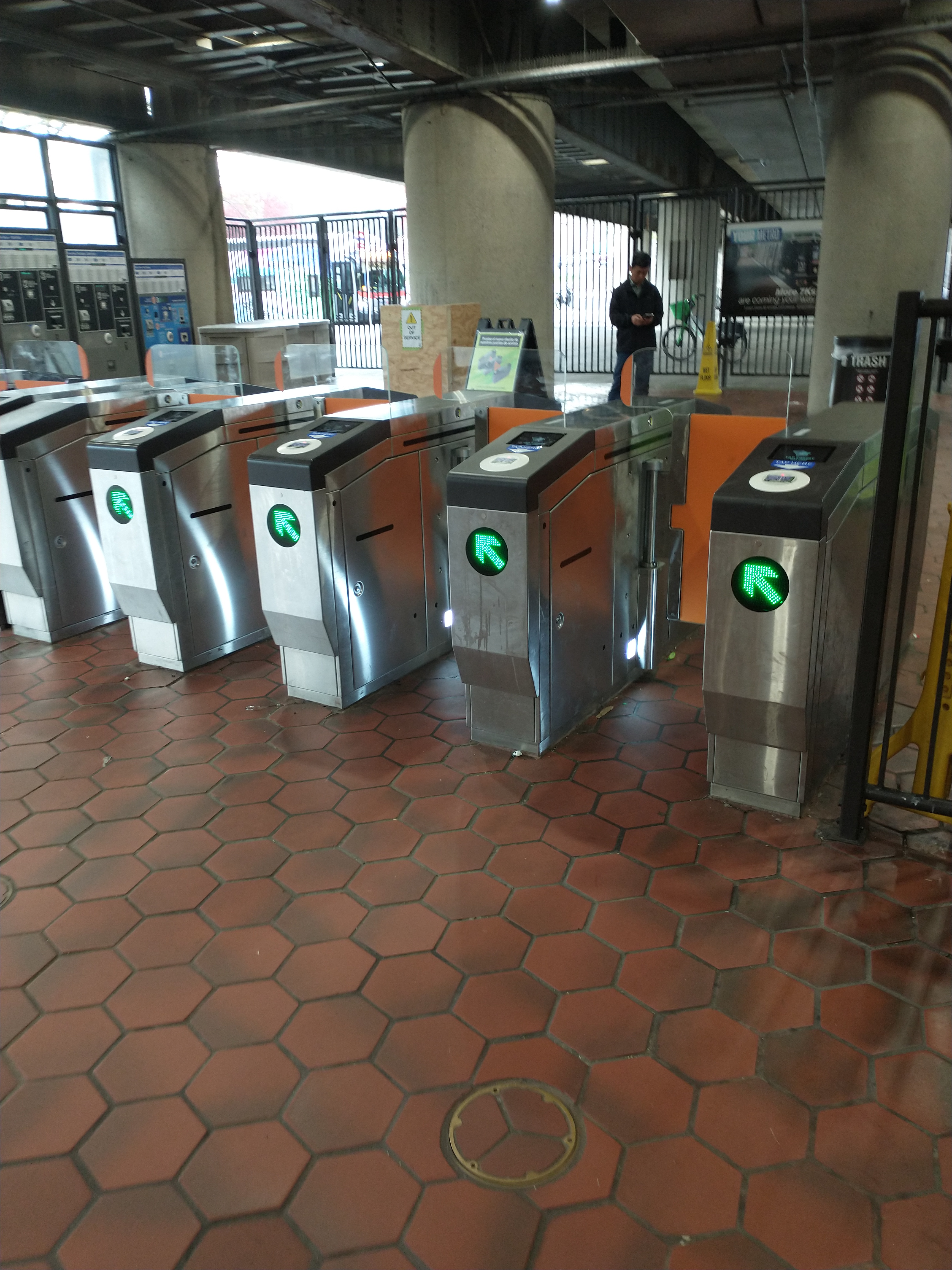
Metro has installed another set of faregates at Fort Totten station, settling on a final design after tworounds of prototype testing that started around November 2022. People are still finding ways around the taller, stronger gates. This final installation follows several weeks of stepped up security presence at the station to deter people from entering the gates without paying. During morning and evening rush hour, a row of officers has been lined up just inside the faregates.
A reader sent in a picture of Metro transit police standing near new faregates at Fort Totten Metro station.
In other Metro news, last week local news reported that a special police officer shot a teen at Fort Totten station after responding to a fight between a group of people. The teen allegedly fired a gun at another individual. News reports state that the teen has been charged with assault with intent to kill and carrying a pistol without a license. A few months ago in March, a special police officer apparently chased a “suspect” fleeing towards Fort Totten station and discharged his weapon, according to MPD. No more details have been provided about that particular incident.
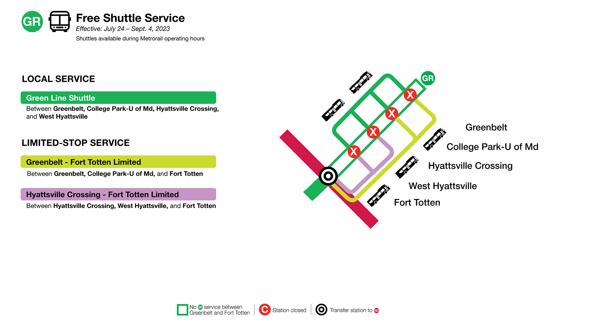
Free local and limited-stop shuttles available during Metrorail operating hours.
Local Service
Green Line Shuttle: Local service every 10 minutes between Greenbelt, College Park, Hyattsville Crossing, West Hyattsville, and Fort Totten.
Limited Service
Greenbelt-Georgia Ave Limited: Limited-stop service every 8 minutes between Greenbelt, College Park-U of Md, Fort Totten, and Georgia Ave-Petworth.
Hyattsville Crossing-Georgia Ave Limited: Limited-stop service every 8 minutes between Hyattsville Crossing, West Hyattsville, Fort Totten, and Georgia Ave-Petworth.
Due to the volume of customers, wait times can be up to 20 minutes during rush hours.
Service July 24 – September 4, 2023
Station Closures: Greenbelt, College Park-U of Md, Hyattsville Crossing, West Hyattsville
Free local and limited-stop shuttles available during Metrorail operating hours.
Local Service
Green Line Shuttle: Local service every 10 minutes between Greenbelt, College Park-U of Md, Hyattsville Crossing, and West Hyattsville.
Limited-stop Service
Greenbelt-Fort Totten Limited: Limited-stop service every 10 minutes between Greenbelt, College Park-U of Md, and Fort Totten.
Hyattsville Crossing-Fort Totten Limited: Limited-stop service every 10 minutes between Hyattsville Crossing, West Hyattsville, and Fort Totten.
Due to the volume of customers, wait times can be up to 20 minutes during rush hours.
Rail Service
Green Line trains every 8 minutes between Fort Totten and Branch Ave.
Rail Options
The Maryland Area Regional Commuter Train (MARC) MARC has stations at Greenbelt, College Park-U of Md, and New Carrollton, where customers can easily connect with Metro at Union Station. Additional MARC service will be available at Greenbelt and College Park-U of Md stations during this time.
Bus Options
Greenbelt
Metrobus C2 Service to Takoma Langley Transit Center & Wheaton
Shuttles will operate using a combination of standard Metrobus and coach buses.
Accessible shuttles will be available at all closed stations.
MetroAccess paratransit is available for customers who cannot use the accessible shuttles. For MetroAccess eligibility, an expedited process is available at the Transit Accessibility Center.
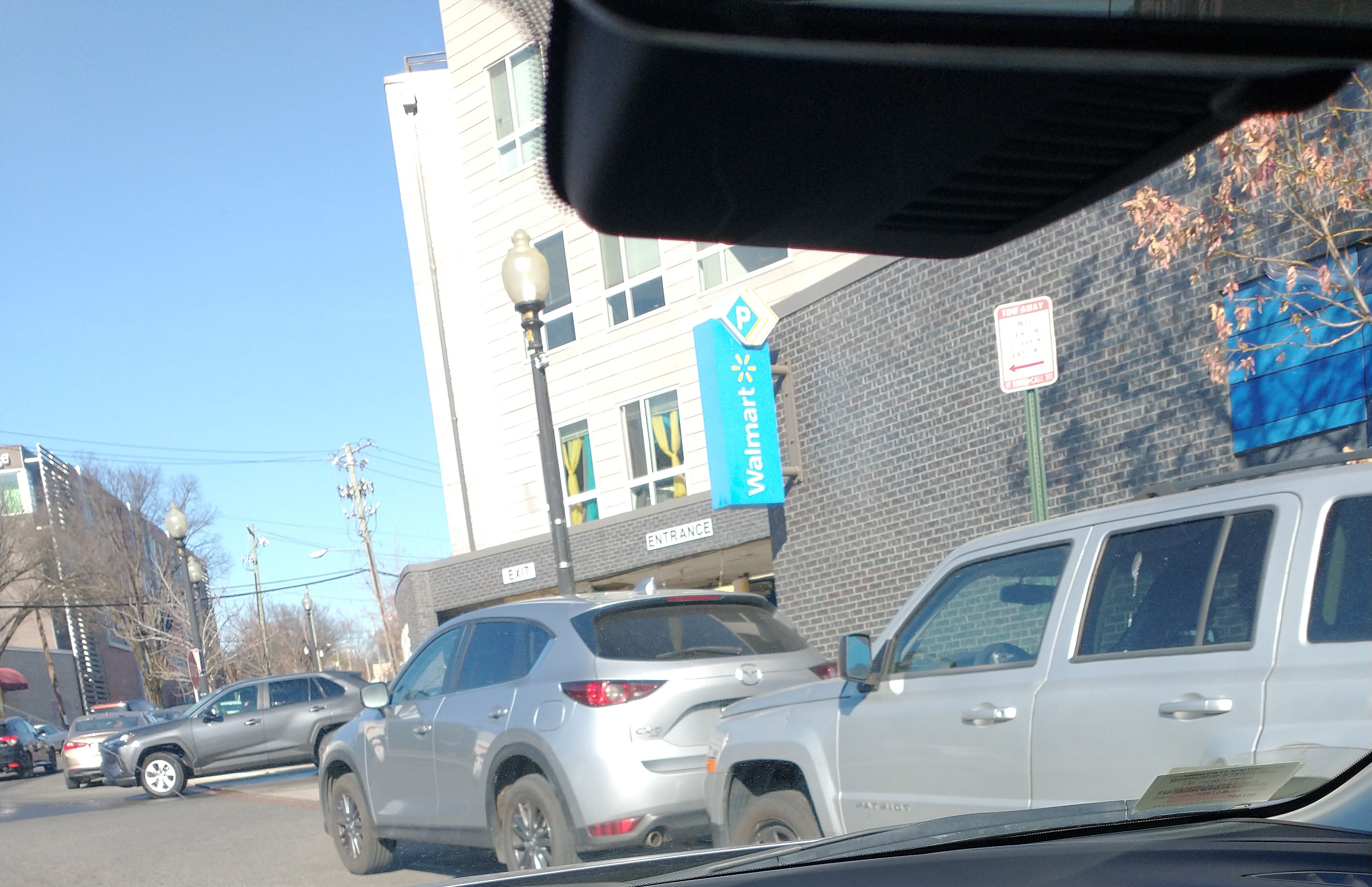
The District Department of Transportation (DDOT) is considering placing a roundabout at the 2nd Street/3rd Street NE intersection just north of Riggs Road NE, along with a few other modifications, to deal with the longstanding issues of U-turns and left turns out of Walmart’s parking garage on 3rd Street. (View NOI-23-110-TESD). Submit comments on the proposal to kornelius.anderson@dc.gov by July 7, 2023.
DDOT proposes the following modifications:
Conversion of the intersection of 2nd and 3rd Streets NE to a roundabout configuration;
Installation of a raised lane separator with vertical flexible posts on 3rd Street NE between 2nd Street NE and the 310 Riggs Road NE (Walmart) parking garage on 3rd Street NW; and,
Installation of crosswalks at the intersection of 2nd and 3rd Streets NE.
The Notice of Intent (NOI) states:
[F]ield observations indicate that motorists frequently turn left from the Walmart garage or make U-turns to access southbound 3rd Street NE. In support of Washington DC’s commitment to the Vision Zero goal, DDOT conducted a safety and operations study of 3rd Street NE between Riggs Road and 2nd Street NE, to develop the proposed recommendations identified above and improve safety for all users.
As a result of the study, DDOT determined that the most effective way to address the mid-block safety issues is to install a raised lane separator with vertical posts from the raised median on 3rd Street NE to the intersection of 2nd and 3rd Street NE. To facilitate U-turns, DDOT will convert the intersection of 2nd and 3rd Streets NE to a roundabout configuration. Following the conversion, approximately 19 parking spaces will be removed from 2nd and 3rd Streets NE to accommodate the roundabout. Figure 1 shows the proposed signs, pavement markings and the raised lane separator along 3rd St NE.
Background
A bit of background on this proposal. Back in early 2018 when I served as president of the Lamond-Riggs Citizens Association, I created a spreadsheet of issues along the Riggs Road/South Dakota Avenue NE corridor and arranged a walkthrough of the corridor with representatives from DDOT, MOCRs, ANC commissioners, and representatives from councilmember offices. I suggested the idea of a roundabout for the 2nd/3rd Street intersection (even though roundabouts make me nervous) and asked for a bunch of other longstanding requests, such as crosswalks at 2nd/3rd Street, removal of parking near Walmart’s driveway, blocking left turns out of Walmart’s driveway, all-way stop at 3rd & Chillum Place NE, and blocking parking near the southwest corner of 3rd and Chillum. I opened service requests for all of these issues, kept track of communications with District officials, and gave that information to ANC 4B. ANC 4B in turn created resolutions regarding these issues.
So it has taken some years to get to this point and several issues remain unaddressed. DDOT did install a no parking sign close to Walmart’s driveway last year, but of course people ignore the sign and still park right up to the driveway. I think DDOT needs to physically prevent the ability to park there because right now drivers exiting the driveway still need to pull out pretty far to see if there is oncoming traffic. We also need a way to prevent people from parking right near the intersection close to 300 Riggs Road NE where a Wing Stop will replace the coffee shop. The parking shenanigans will only get worse once that restaurant opens. And the intersection at 3rd & Chillum needs to be addressed.
As for this NOI, with respect to the proposed lengthy raised lane separator, I was told that DDOT is taking this action because it is faster to install this separator than to actually extend the median. I was told that perhaps in the future the separator could be converted into an extended median.
The only other thing I will say about this is that it really does highlight the deficiencies in the large tract review process for projects that do not go through the planned unit development process. Much of this should have been taken care of during the design and construction of Fort Totten Square when we raised these issues. I raise shortcomings with the large tract review process whenever I can with District officials, also to point out why the constant changes to the traffic safety investigation process are kind of bogus.
In any case, ANC 4B has developed a draft resolution in support of the proposed modifications in this NOI.
Be sure to submit comments on the proposed modifications for NOI-23-110-TESD to kornelius.anderson@dc.gov by July 7, 2023.
Share your input on Metro’s Better Bus Visionary Framework of redesigned bus routes by June 18, 2023. Metro officials explained that this visionary framework is what Metro would implement if it had about 35 percent more funding. Some pieces of the framework may be implemented in the short term.
We previously covered several of the proposed routes around the Riggs Park neighborhood in this Better Bus post. Check out that post for details about proposed routes.
A few things worth mentioning to Metro:
Do not shorten the E4 crosstown route to Riggs Park (draft DC200 and DC203 routes). The routes should run more frequently than every 15 or 20 minutes. The existing E4 route on the Better Bus site does not even show the route to Riggs Park (and yes they are aware, I have mentioned this to Metro). Traveling east from Fort Totten metro, the existing route crosses South Dakota Avenue with stops at the Lamond-Riggs Library, South Dakota Avenue & Riggs Road across from Walmart, and then travels along Chillum Place to Eastern Avenue. The westbound route takes a different path through the neighborhood. Tell Metro to keep the northern east-west crosstown route all the way to the Riggs Park neighborhood rather than cutting it off at Fort Totten metro station as contemplated in both the DC200 and DC203 routes.
Metro already cut the 80 route to Kennedy Center. The draft DC110 route likewise ends at McPherson Square. Metro officials said they are not bringing the Kennedy Center route back, but they should. It is good that this route would run 24 hours.
Support the new DC207. This route is stylized on the Better Bus site as a variant of the existing E2 route, but it is really an entirely new route altogether. The route would run from Fort Totten metro station down South Dakota Avenue to Fort Lincoln and continue on to Deanwood. It should run more frequently than every 20 minutes.
Support the new route between Fort Totten and Union Market (DC302). It should run more frequently than every 30 minutes.
On May 25, 2023, Ward 5 Councilmember Zachary Parker sent a letter to Metro with recommendations on the framework. Read CM Parker Better Bus Letter.
Sat-Sun: Trains operate every 8 minutes between Shady Grove and Rhode Island until 10 p.m., then every 10 minutes until closing; every 12 minutes between Fort Totten and Glenmont all day.
Mon: Trains operate every 8 minutes until approximately 10 p.m., then every 10 minutes until closing.
Scheduled maintenance & service adjustments (Saturday and Sunday)
Shutdown between Rhode Island Ave and Fort Totten due to switch replacement.
Brookland-CUA Station closed.
Shuttle bus service provided between Rhode Island Ave and Fort Totten stations.
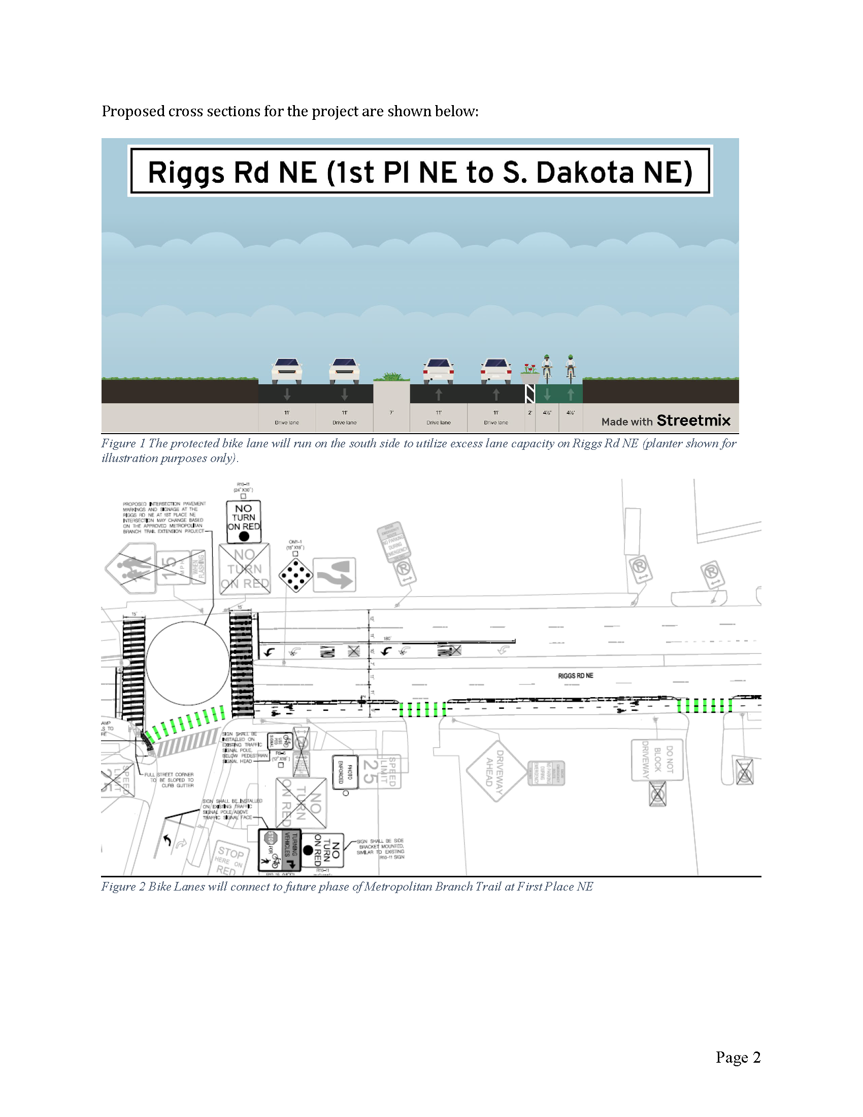
The District Department of Transportation (DDOT) is soliciting public comment on the 30% design of the Riggs Road NE two-way cycletrack (NOI #23-75 PSD; 30% design plan). This is the proposed cycletrack on eastbound Riggs using part of the existing dedicated right-turn only lane between South Dakota Avenue and 1st Place NE that DDOT mentioned at ANC 5A and ANC 4B meetings last year. The project sits in ANC 5A09. Send comments to sean.burnett@dc.gov by May 22, 2023.
Rendering of proposed cycletrack from NOI
According to the notice of intent (NOI), “DDOT proposes to reconfigure the 100 block of Riggs Road between First Place NE and South Dakota Ave NE to remove the curbside eastbound travel lane for 800 feet, and convert that space to a two-way protected bike lane (aka cycletrack).” DDOT says the purpose is to “create a dedicated and safer connection for people biking under the railroad tracks to reach the Metropolitan Branch Trail. This will reduce conflicts between people walking and people biking on the sidewalk.”
The cycletrack is less than 800 feet in length, about 0.13 miles. Traveling eastbound Riggs from 1st Place, it looks like the cycletrack would take up the right-turn only lane to just past Food & Friends’ main entrance/driveway, leading to a bike ramp that DDOT proposes to build that would take the rider to the sidewalk before reaching South Dakota Avenue. So there would still be a dedicated right-turn lane from Riggs to South Dakota Avenue, just a shorter one.
Section from Riggs Road/1st Place NE
Section leading to South Dakota Avenue
I cannot say I have strong feelings either way about this cycletrack. (I really want DDOT to completely overhaul the South Dakota Avenue/Riggs Road NE intersection because it was poorly reconfigured in 2011. This cycletrack is so short I am not sure how useful it will be. And a good chunk of the MBT extension from Fort Totten to Takoma is largely on the sidewalk anyway, including the part leading from 1st Place & Riggs to 1st Street and Riggs).
(Edited to add 5/4/2023: A reader emailed a good point regarding east-west connections to the MBT in Riggs Park. If DDOT is interested in making safe east-west connections, DDOT should work on constructing the Avondale segment approved in the National Capital Trail Network. Also the reader stated DDOT should look at other neighborhood streets to make an east-west connection rather than what is proposed for Riggs.)
But I absolutely think that without any barrier, drivers will “accidentally” drive in the cycletrack to get to South Dakota Avenue. There is a dedicated right turn lane on eastbound Riggs to turn onto 1st Place NE. This right turn lane is useful for all of the buses that go to Fort Totten Metro station. Non-bus drivers, however, often get in this dedicated right turn lane and just keep driving straight to continue on Riggs to turn onto South Dakota. I do not think this practice will change at all just because DDOT puts in a clearly marked cycletrack.
I think DDOT really needs to be careful to have clear signage and road markings directing vehicle traffic on this stretch so that drivers do not use the dedicated right turn lane leading to 1st Place to continue straight onto Riggs only to run into the cycletrack and then have to either keep going (because why not), or swerve into the travel lanes at the last second. It is easiest to see what I am talking about by looking at the Riggs Road/1st Place section in DDOT’s plans.
There is an ever so slight downhill descent on eastbound Riggs from 1st Place to South Dakota Avenue, but it is enough for drivers to pick up quite a bit of speed along this stretch (which is why there is a speed camera on the southeast corner of 1st Place & Riggs). Anyone familiar with this area knows that weekday evening rush hour sees a lot of cars on this stretch and drivers feel entitled to take all sorts of illegal actions and drive at whatever speed they want to get to where they want to go. DDOT really should consider having concrete barriers.
Also, I do not have any data on how often delivery vehicles enter and exit Food & Friends, but I do know that adding this bike facility here will introduce one more thing for delivery drivers to have to watch out for as they enter and exit. Food & Friends drivers have to watch out for pedestrians and bike riders using the sidewalk now. While there is a sign warning drivers not to block the Food & Friends driveway, people often do, so I can see delivery drivers deciding to pull out into the cycletrack and sitting for a bit in order to enter the travel lanes.
All that to say, let’s help DDOT get this right by sending constructive feedback to DDOT.
Send comments to sean.burnett@dc.gov by May 22, 2023.
Metro’s yellow line will reopen on May 7, 2023, but it will not go to Fort Totten. Yellow line service will operate only between Huntington and Mt. Vernon Square. Metro has offered reasons for this change, the main one being to support better headways for the southern end of the green line. Color me skeptical. Maybe we will all be pleasantly surprised if Metro does in fact operate six-minute headways on the green line. We do know those promised six-minute headways will not happen during planned summer construction on the green line.
Image from MetroImage from Metro
Metro is planning a long shutdown of green line stations north of Fort Totten from July 2023 to September 2023, for installation of fiber optic cables.
There will be no green line service at all at Fort Totten station July 22-23. Red line service will be available.
From July 24 to September 4, green line service will operate only between Branch Avenue and Fort Totten. Metro says green line trains will operate with eight-minute headways during this time.
Metro recently released a draft visionary network of redesigned bus routes called the Better Bus Network. Better Bus is just an aspirational vision for redesigned routes. No changes would go into effect before 2024, if at all. Read the fact sheet and FAQs. View the draft Better Bus maps & route profiles for DC, Maryland, and Virginia and play around with the Better Bus trip planner.
Metro is seeking input on the draft redesign and is holding a pop-up Better Bus event at Fort Totten Metro station on April 25, 2023, from 3:00 pm to 7:00 pm. Metro is also holding informational webinars focusing on specific jurisdictions (MD is April 27; Virginia is May 4; DC is May 9).
The Share Input page is probably the best way to get a handle on how specific routes could be impacted. Using the “Comment on Your Route” tab, you can enter a particular route and see how the redesign compares to the existing route. It is not completely accurate, but if you know your bus routes, it is still a fairly easy way to see how routes may change. For example, the current E4 route has two route options, one ending at Fort Totten station and one ending in Riggs Park. The existing route shown on the Better Bus comment map shows only the route that ends at Fort Totten station. In any case, on the “Comment on Your Route” tab, you can comment on specific changes and also see comments from other riders.
I have not looked at impacts to all neighborhood bus routes in any detail just yet, but neighbor Gavin has and passed along some info. You will notice routes are renumbered for purposes of this redesign; Metro is also seeking feedback on this renumbering/renaming. I have not double checked everything but this is a great start to looking at the network so that we can talk to the Metro team tomorrow. Note, the information below does not include routes that only come into the neighborhood via 1st Place NE and end at Ft. Totten, or the routes north of New Hampshire.
There would be three routes roughly equivalent to the E2, which currently runs between Ft. Totten and Ivy City. One routing (provisionally called DC208) would still go to Ft. Totten. Another (DC209) would go on Sargent, Eastern, Chillum Pl., and Riggs to West Hyattsville. Another variant (DC207) would go from Ft. Totten to Deanwood (rather than Ivy City).
Aside from losing the Riggs Park loop, there would be changes to the E4 outside our neighborhood. There would be two routes roughly equivalent. One routing (DC203) would still go to Friendship Heights, but staying on Missouri/Military the whole way for a more direct route. The other routing (DC200) would keep the detour onto Kennedy St. NW, and turn left when it reaches Nebraska to go to Tenleytown and Sibley Hospital.
There’s also a new route, provisionally named DC302, which would go to Fort Totten through the Riggs/South Dakota Avenue intersection (unlike all the other Ft. Totten buses which either go on Galloway or 1st Pl.), which would give a bus connection to residents near that intersection and to the Walmart and library. From there, it goes west on Riggs to North Capitol, then south on Harewood to Edgewood and eventually Eckington and Union Market, more or less overlapping with part of the current P6 route on the southern end.
The K6 and K9 currently take different routes through the neighborhood: the K9 currently goes from Ft. Totten to the east on Riggs, whereas the K6 goes on 1st Pl. west to North Capitol, then north to New Hampshire. Their routes in the neighborhood would be consolidated into the current K6 route, and instead would have two different routings on the Maryland end (MD 144 and MD243).
The R1 and R2 would be consolidated into one route (MD 244) very similar to the current R2, with the same routing through our neighborhood (from Ft. Totten to the east on Riggs).
The 80 equivalent (DC110) (goes from Ft. Totten east on Galloway, then turns south on South Dakota) would take the same routing through our neighborhood, and keep a similar route until some changes past Union Station.
The F6 equivalent (MD245) (from Ft. Totten to Gallatin, then north on Sargent) would take the same routing in our area, with some changes later, ultimately ending at College Park rather than New Carrollton.
Metrorail weekend service for Saturday, April 22 through Sunday, April 23
Advisory Effective: 4/22/23 – 4/23/23
Saturday, April 22 – Sunday, April 23
Hours: Sat 7 a.m. – 1 a.m.; Sun 7 a.m. – midnight
Service:Blue Line Orange Line Silver Line Blue Line+ Normal service
Red Line Trains operate every 8-10 minutes between Shady Grove and Judiciary Square and between Rhode Island Ave and Glenmont
Green Line Trains operate every 8 minutes between Greenbelt and Mt. Vernon Sq, and every 16 minutes between Mt. Vernon Sq and Branch Ave
Yellow Line No service through May 6, 2023, reopening on Sunday, May 7, 2023.
Maintenance:
Red Line Shutdown between Judiciary Square and Rhode Island Ave for switch machine replacement
Green Line Single tracking between Mt. Vernon Sq and L’Enfant Plaza due to cable installation
This weekend, Metrorail will serve 97 of 97 stations with scheduled switch machine replacement on the Red Line and cable installation on the Green Line. At stations served by multiple lines in the central core of the system, trains will arrive on average every 3-4 minutes.
The Yellow Line Bridge over the Potomac River is closed for construction as part of the Yellow Line Tunnel and Bridge Rehabilitation Project to replace the steel liner in the decades old tunnel and repair the bridge due to excessive wear, corrosion and water infiltration issues. Additional Blue Plus and Green line train service is available as an alternative. Yellow Line service will resume on Sunday, May 7, 2023.
Service Information:
Red Line
Trains operate every 8 minutes between Shady Grove and Judiciary Square until approximately 10 p.m., then transitions to every 10 minutes.
Trains operate every 8 minutes between Rhode Island Ave and Glenmont until approximately 10 p.m., then transitions to every 10 minutes.
Scheduled maintenance & service adjustments
Shutdown between Judiciary Square and Rhode Island Ave
If traveling downtown, you can transfer to the Green Line at Fort Totten Station.
Shuttle bus services provided between Judiciary Square and Rhode Island Ave.
Green Line
Trains operate every 8 minutes between Greenbelt and Mt. Vernon Sq with every other train continuing on to Branch Ave providing service every 16 minutes between Mt. Vernon Sq and Branch Ave.
Scheduled maintenance and service adjustments
Single tracking between Mt. Vernon Sq and L’Enfant Plaza due to cable installation.
Metro has replaced the faregates at Fort Totten Metro station with a new prototype, as Metro explains in this release. A lot has already been written about these new faregates. They certainly stop some folks from jumping over the gates. Now people can simply push the swing gates open and walk through the gap. Or some just walk through or jump over the emergency gate. Anyhow, updates on Metro’s fare modernization efforts are available at https://wmata.com/faresystemmodernization.
Metro is soliciting public input on its proposed FY24 budget. View details at wmata.com/budget. Provide input by completing a survey or by participating in an upcoming public hearing.
Take the survey
Take the survey, provide written comments, or upload documents here. The survey closes at 5:00 pm on March 15, 2023.
All public hearings will be streamed online on this page, YouTube.com/MetroForward or by calling 855-925-2801, meeting code 7756.
Ways to participate in public hearing:
By video: Email speak@wmata.com by 5 p.m. the day before the public hearing.
By phone: Dial 855-925-2801, enter meeting code 7756
In-person: Register on-site, email speak@wmata.com or call 202-962-2511 by 5 p.m. the day before the public hearing.
All in-person public hearings will start at 6:00 p.m. Metro will host an Open House prior to in-person public hearings starting at 5:00 p.m. All locations are accessible via Metrorail or Metrobus.
Monday, March 6, 2023
Metro Headquarters 300 7th Street SW Washington, DC 20024 Green Line Blue Line Orange Line Silver LineL’Enfant Plaza Metrobus routes: 32, 36, 52, 74, P6
Tuesday, March 7, 2023
New Carrollton Metro Offices 4100 Garden City Dr Hyattsville, MD 20785 Orange Line Blue LineNew Carrollton Metrobus routes: B24, B27, F4, F6, G12, G14, F14, T14, T18
Wednesday, March 8, 2023
Meridian High School 121 Mustang Alley Falls Church, VA 22043 Orange LineWest Falls Church Metrobus route: 28A
Friday, March 10, 2023
12 p.m. Virtual only
According to Metro, the proposed budget aims to:
Enhance safety through support of our police force, including new crisis intervention specialists
Ensure more frequent & reliable service, including increased train service and a complete redesign of the bus network
Create a more simplified & equitable fare system, including a low-income fare program
Improve customer service and communications with a new integrated communications center
Advance sustainability, including investments in our zero-emission bus program
Continue capital improvements for a better Metro, including major construction and maintenance projects
It is worth taking a look at the proposals regarding fares and rail service and bus service. Note the yellow line proposal. Also note that the Metro for DC Amendment Act of 2021 listed under the bus service proposal is currently the subject of a funding tussle between the DC Council and the District’s Chief Financial Officer (see DCist article on subject).
This proposal will make our weekday Metrorail pricing easier to understand and improve the customer experience. Adjustments include:
Eliminate peak and off-peak pricing on weekdays before 9:30 p.m.
The base fare would lower from $2.25 to $2 to align with bus, weekend, & late-night service
Late-night and weekend fares would stay the same at $2
Maximum fares would increase from $6.00 to $6.50
The seven-day short-trip pass would be adjusted to cover trips up to $4. The price would stay the same.
Monthly unlimited pass options would reflect the $6.50 maximum fare adjustment.
Low-Income Fare Program
Our new Low-Income Fare Program would offer a 50% discount on Metrorail & Metrobus trips to eligible customers. This program would be accessible to customers enrolled in the Supplemental Nutrition Assistance Program (SNAP).
Rail Service Proposals
Our FY24 budget rail service proposal provides more trains to reduce travel times, expand destination access and grow ridership. Take a look at the details below.
Frequency Increases for Green and Yellow lines
Opening until 9:30 p.m. – From every 10-12 min to every 6 min
After 9:30 p.m. From every 15 min to every 10 min
Yellow Line begins new service pattern. Terminal change from Greenbelt to Mt Vernon Sq; operating between Huntington and Mt Vernon Sq only
Frequency Increases for Orange line
Opening until 9:30 p.m. – From every 12 min to every 10 min
Weekday rush hour only (6:30-9:30 a.m., 3-7 p.m.). From every 10 min to every 7 ½ min
Red, Blue and Silver lines frequencies remain the same
With this level of service, trains would arrive every 3-6 minutes in the downtown stations and every 8-12 minutes at stations served by a single line. After 9:30 p.m., trains would operate every 5-10 minutes downtown and every 10-15 minutes elsewhere.
Bus Service Proposals
We’re also working hard to expand access, advance equity and optimize bus routes for our Metrobus customers through these proposals.
DC
B2 Bladensburg Road-Anacostia Increase Route B2 service to every 12 minutes between 7 a.m. – 9 p.m., 7 days a week, adding to Metro’s Frequent Service Network.
Metro for D.C. Amendment Act of 2021
The Council of the District of Columbia passed the “Metro for DC Amendment Act of 2021” which includes:
Free Metrobus trips for customers within the District of Columbia
All-night Metrobus service every 20 minutes on the following routes: 32, 33, 52, 70, 90, A6, A8, B2, H4, S2, V2, W4, X2 – View Map
Maryland
A12 Martin Luther King Jr. Highway | View Map Add more service by splitting the A12 route into two routes, expanding to new connections to (BL) Downtown Largo and (OR) New Carrollton stations. Both routes would operate every 20 minutes from 7 a.m. – 9 p.m., 7 days a week, and every 30 minutes otherwise.
Virginia
16G & 16H Columbia Pike | View Map The proposed new 16M would combine the former 16G and 16H with a new connection to Crystal City station and would operate every 12 minutes from 7 a.m. to 9 p.m., 7 days a week, and every 15-30 minutes otherwise. The western loop at Arlington Mill will be covered by Arlington Transit (ART).
11Y Mt. Vernon Express | View Map Reinstate the 11Y express route from Mt. Vernon to Potomac Park, replacing the 11C and DC3 shuttle. Would operate every 30 minutes, northbound in the AM peak and southbound in the PM peak. Express fare would be charged
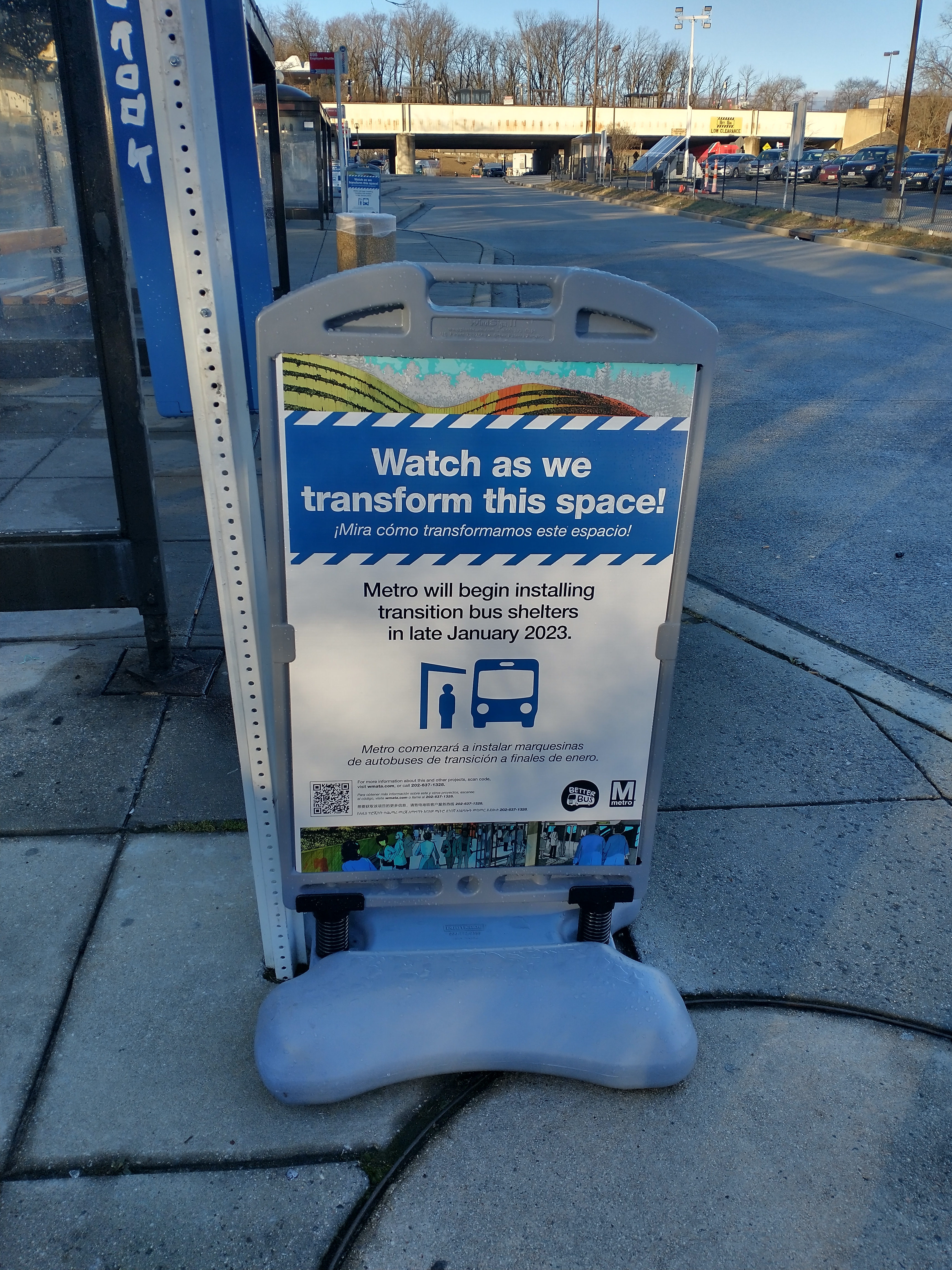
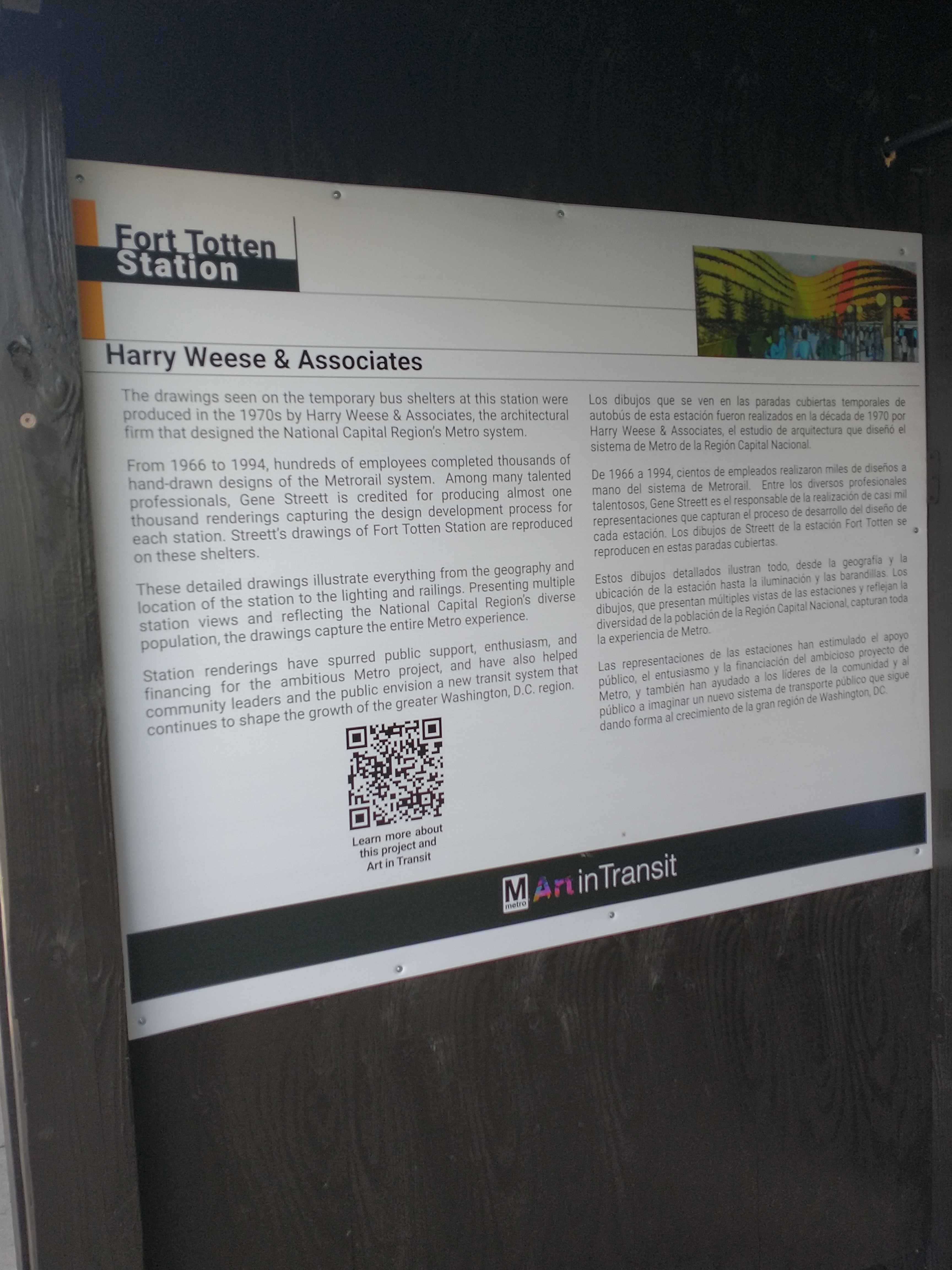
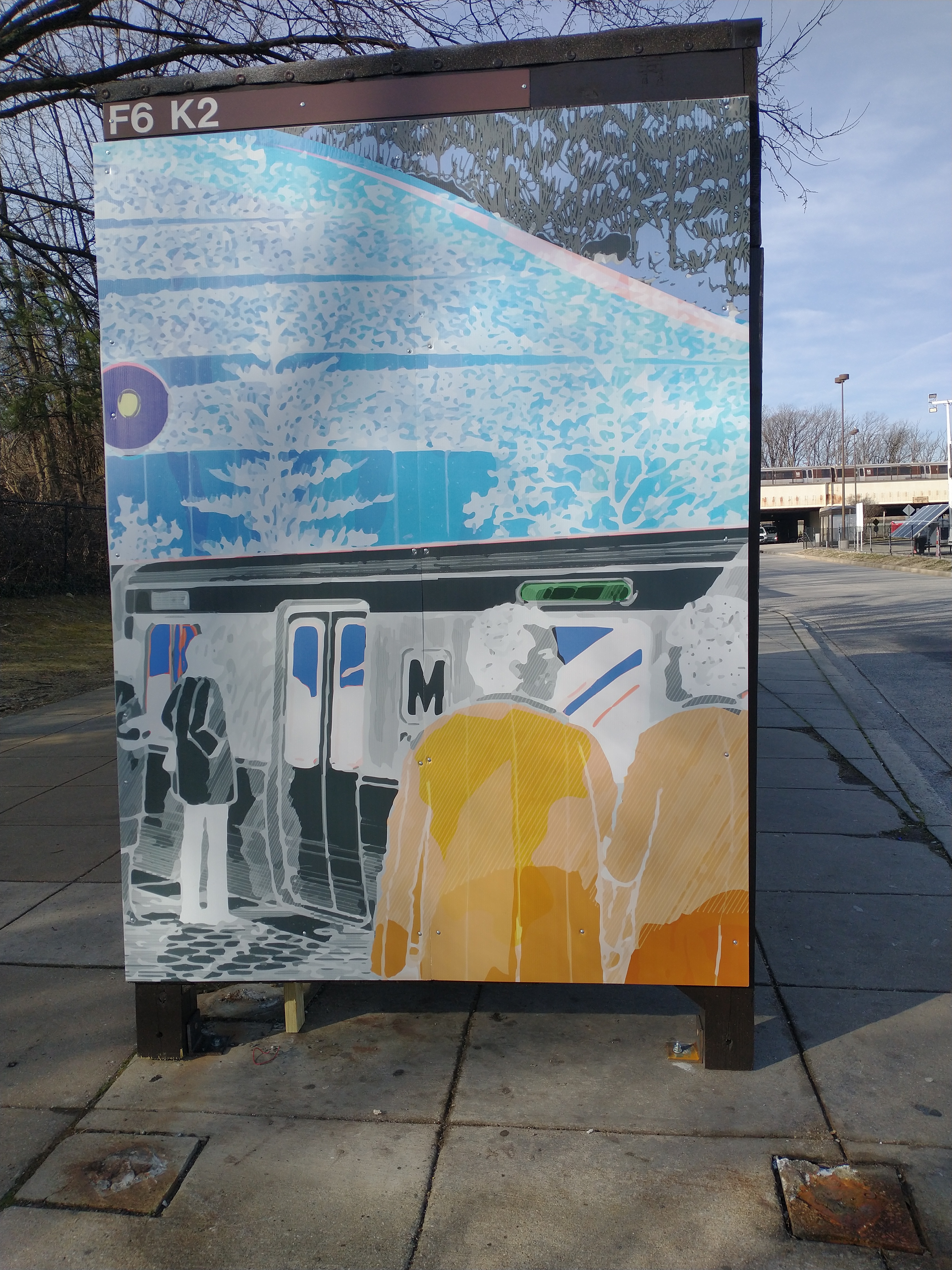
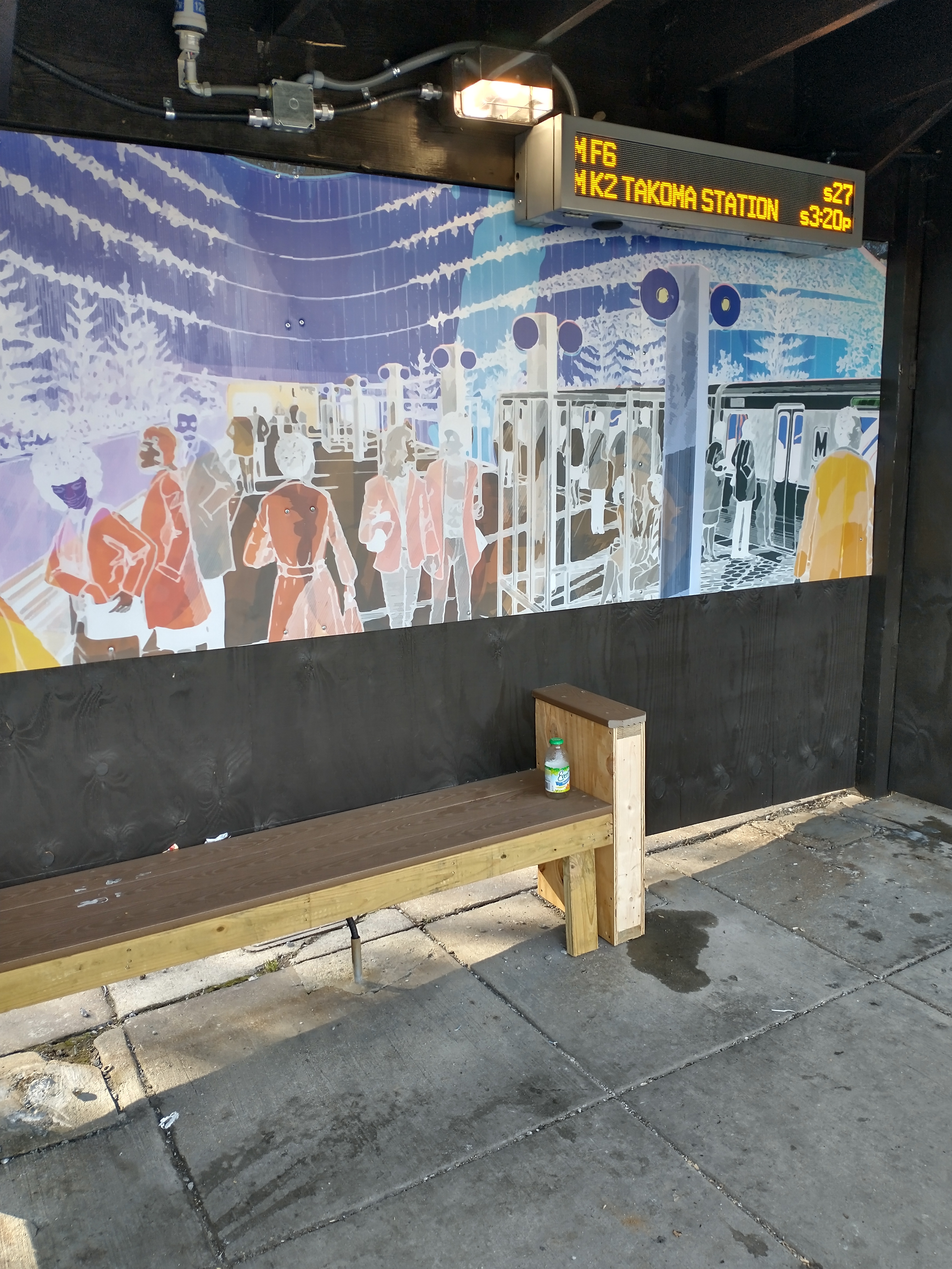
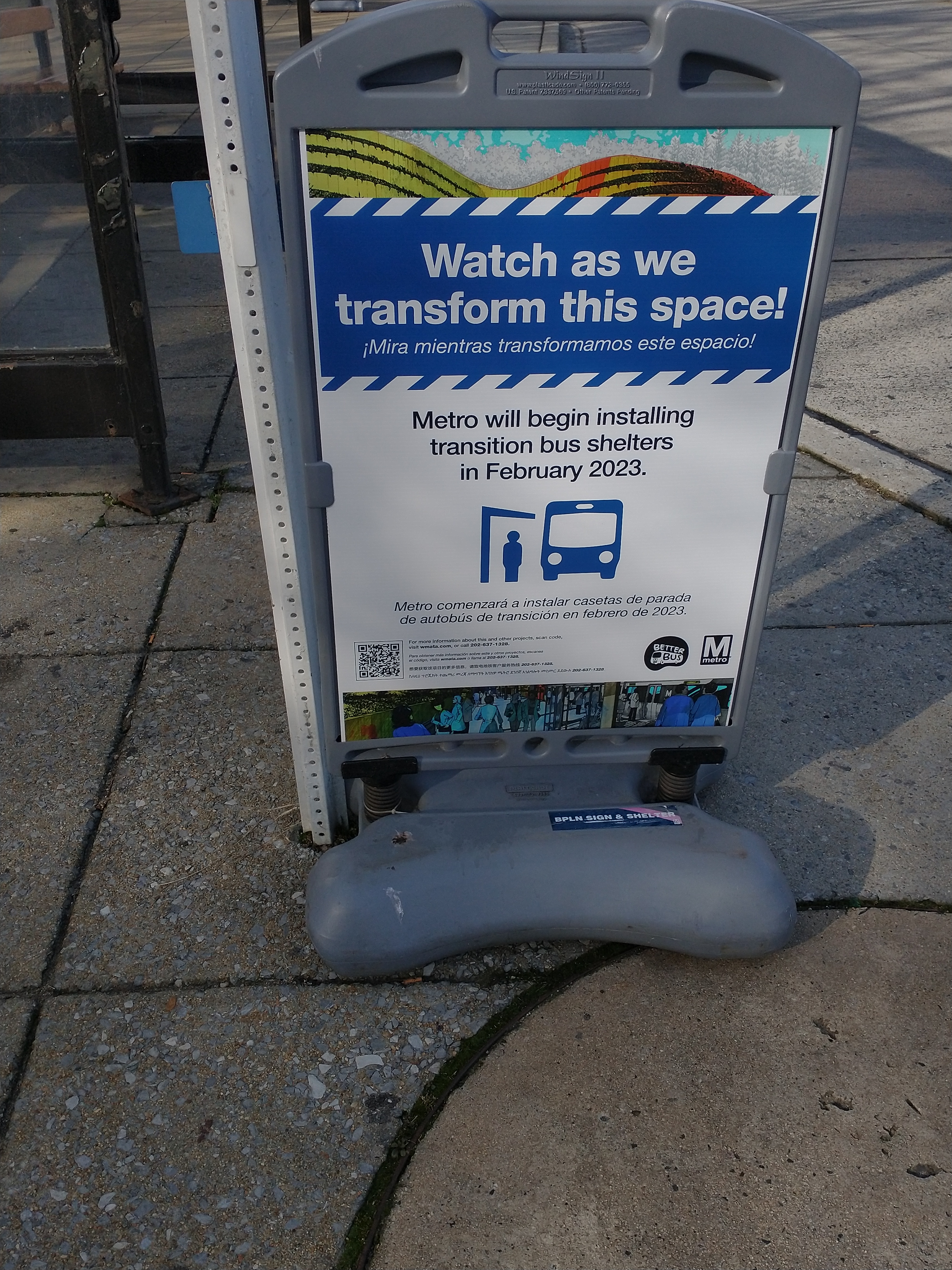
Over the next several months, Metro will be replacing the bus shelters at Fort Totten Metro station. Metro is installing transition bus shelters as part of this process. These are temporary shelters wrapped in artistic images. The temporary shelters still have electronic bus arrival signs and there is a small bench in each shelter.
Signage at the transition shelters explains that the artistic designs are based on hand-drawn renderings of the Metro system by employees of the architectural firm that designed the Metrorail system, including an individual named Gene Streett. See more about the images at https://www.wmata.com/initiatives/art-in-transit/ait-fort-totten.cfm.
ANC Commissioner Duvalier Malone (5A01) asked to share DDOT’s survey on truck/bus routes and signage. Message from DDOT with survey link below.
The District Department of Transportation (DDOT) is conducting a Positive Truck/Bus Signage Study to understand the benefits and costs of installing new signage in support of a potential mandatory truck/bus route system, and develop recommendations for next steps.
As part of this study, DDOT would like to hear from you and your constituents! Please open the linked survey below to let us know what you think of the District’s truck and bus routes and signage.
Your input will inform the study’s recommendations and next steps, which will be developed by the end of the year. Please help spread the word by sharing with your constituents!
The District Department of Transportation (DDOT) rolled out a new “Traffic Safety Input (TSI)” process for handling what were previously known as traffic safety investigation requests. (DDOT informed ANC commisssioners of this change in December 2022).
Use Traffic Safety Input requests in 311 to identify:
Safety concerns for pedestrians, people biking, or taking transit.
Unmarked or marked crosswalks that appear unsafe (Maintenance for existing markings should be put in under the 311 request , Roadway Striping / Markings).
Traffic safety issues around schools.
Concerns about speeding drivers or speed limits in general (Note: DDOT’s policy on speed limits is 20 MPH for local roads and may vary for Arterial and Collector roadways).
Do Not use Traffic Safety Input requests in 311 for:
EMERGENCIES: Dial 9-1-1 for immediate fire, police, or medical response.
URGENT MAINTENANCE: Call 311 for immediate response to matters requiring urgent maintenance.
MAINTENANCE OF EXISTING INFRASTRUCTURE: Use the 311 maintenance request type for issues related to existing Roadway Signs, Traffic Signal Issues, Sidewalk Repair, Roadway Markings, Tree Pruning, or Roadway Repair (including speed hump repair requests).
DDOT will prioritize around 200 traffic safety input requests each quarter for further investigation.
According to DDOT’s website:
Residents should not request maintenance of existing assets through the Traffic Safety Input program; instead, please use the appropriate 311 categories (e.g. Roadway Signs, Roadway Striping/Markings, Sidewalk Repair, Traffic Signal Issue). Maintenance requests submitted as Traffic Safety Inputs will not be addressed.
A Traffic Safety Input can be submitted via 311 by a resident, ANC, or other community member or organization and will be prioritized based on objective factors such as roadway characteristics, crash patterns, equity, proximity to Vision Zero High Injury Network corridors, and locations utilized by vulnerable road users such as schools, Metro rails stations, and bus stops. Based on these factors, DDOT’s Traffic Safety Branch will develop a work plan for 800 prioritized locations per year (200 each quarter) to evaluate the safety concerns expressed and determine if any action is needed. All TSI submissions that are not included in the quarterly work plan will remain in the system for prioritization in following quarters.
Once a request is selected for prioritization, DDOT can take up to 130 days for further action. From DDOT’s website:
TSI evaluation and production of the corresponding engineering design (work order) for prioritized TSIs takes approximately 130 business days to complete following prioritization. DDOT’s findings for each prioritized TSI will be posted on the TSI Dashboard. If a safety treatment is necessary, DDOT will provide the details of the proposed improvements. If no changes are recommended, we will provide an explanation for our decision.
Upon evaluation, if the proposed recommendations change existing traffic control and/or on-street parking, a Notice of Intent (NOI) will be issued by DDOT, which includes a 30 business-day public comment period.
The timeline for installation of improvements varies based on the safety treatment identified.
For most treatments that do not require an NOI, installation typically occurs in the next calendar quarter after the TSI is completed; for example, a TSI evaluation that is completed in Quarter 1 will be implemented in Quarter 2.
For more information about vertical traffic calming infrastructure (e.g., speed humps, speed tables, raised crosswalks), including criteria used by DDOT to evaluate implementation on roadways within the District, as well as design specifications for these devices, please refer to DDOT Vertical Traffic Calming Guidelines.
On the TSI dashboard, you can filter by ANC/SMD to see the requests that are being priortized for first quarter 2023. Looks like fewer than 10 requests were prioritized for the Lamond-Riggs area for the first quarter. Without knowing how many were submitted in the first place or what the nonprioritized requests were for, hard to say much else about DDOT’s prioritization for this area.
The next set of prioritizations will be posted in April 2023.


