
Metro’s Better Bus revamped bus network goes into effect June 29, 2025, meaning lots of changes to bus routes across the region.
Metro has some really handy tools and information to help riders get acclimated to the new changes, including maps, trip planner information, route information, and other resources. Visit wmata.com/betterbus for details.
Naming Convention
All bus routes will be renamed. Routes will begin with a letter to indicate the area served:
- “A” for Arlington/Alexandria
- “C” (crosstown) or “D” (downtown) for DC
- “F” for Fairfax City, Fairfax County, and Falls Church
- “M” for Montgomery County
- “P” for Prince George’s County
- Limited-stop Routes are indicated by an “X” at the end of their names
Bus Stop Elimination
As part of this initiative, Metro will be eliminating hundreds of bus stops. View the list of stops being eliminated.
Neighborhood Impacts
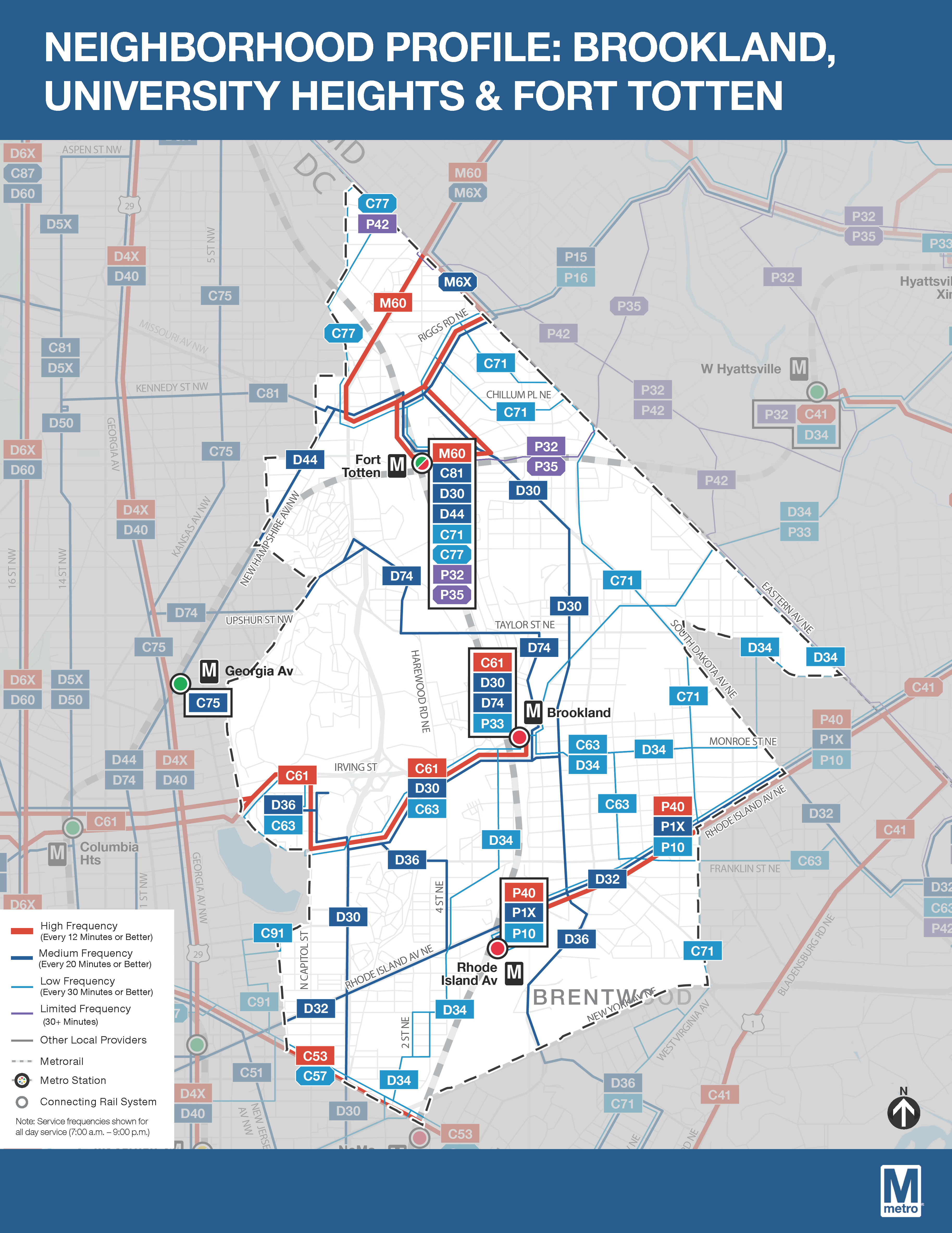
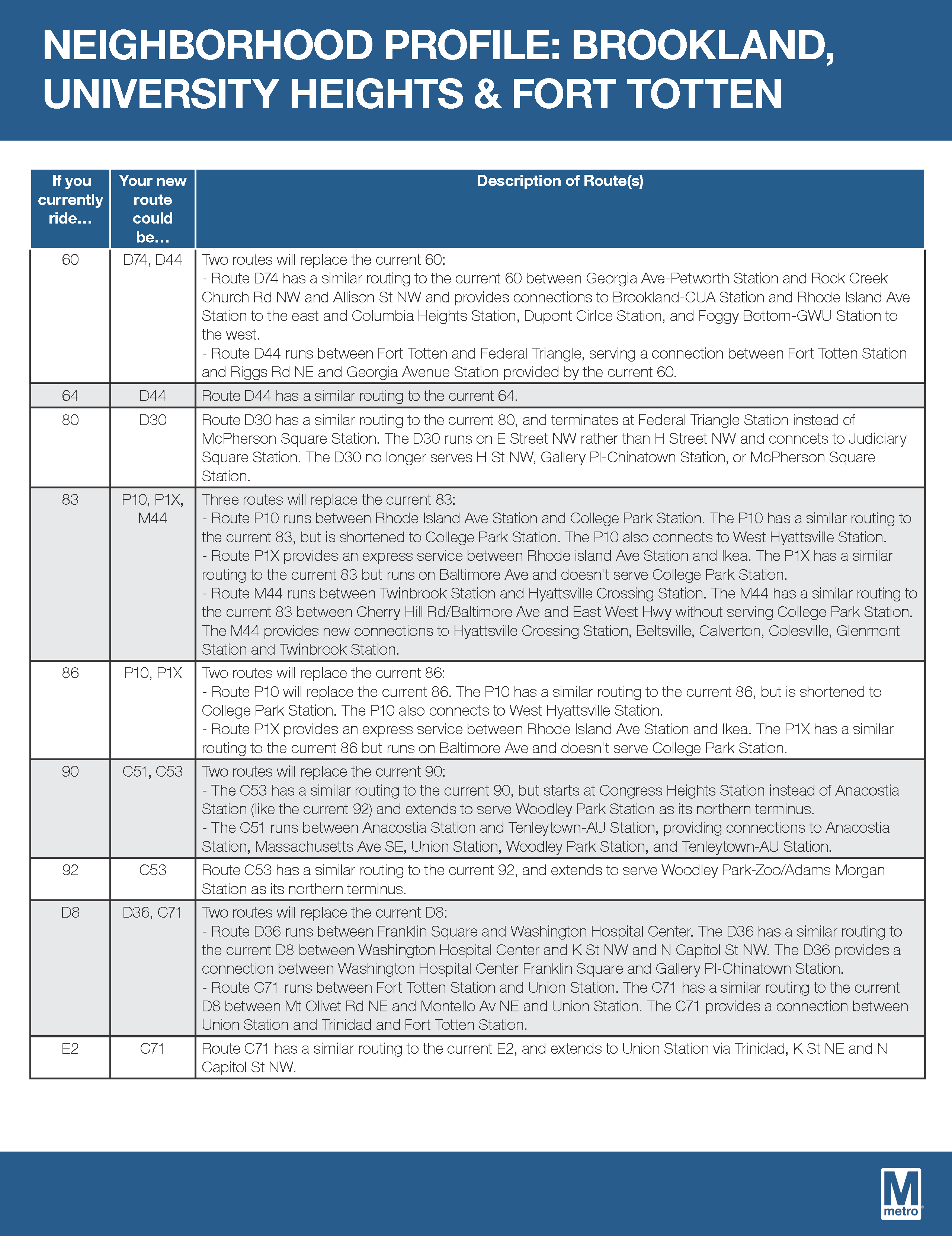
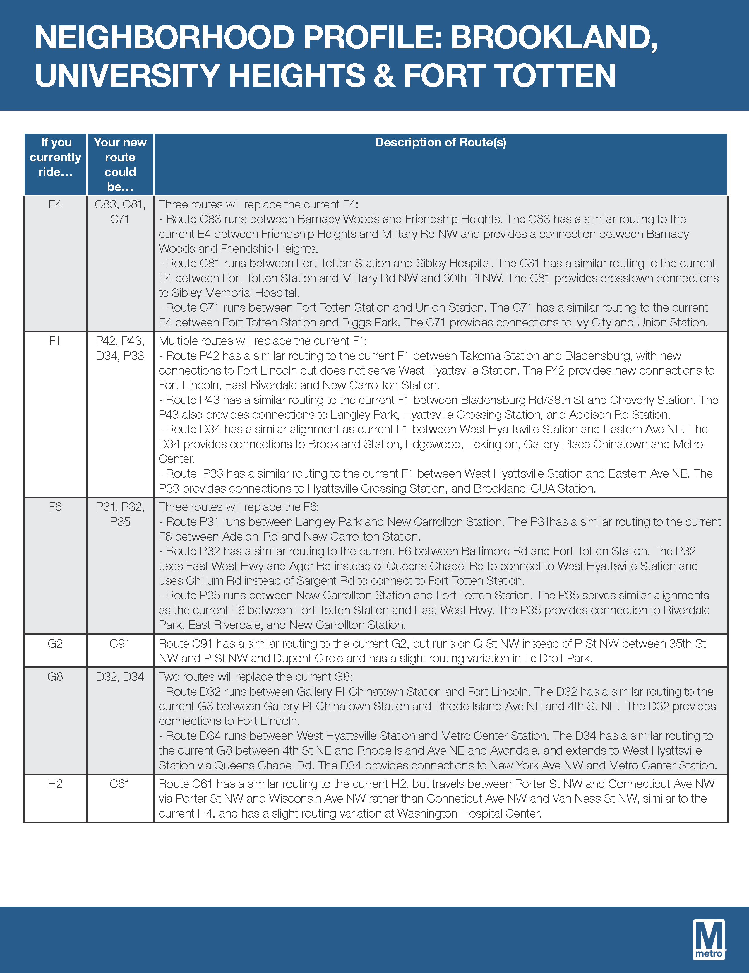
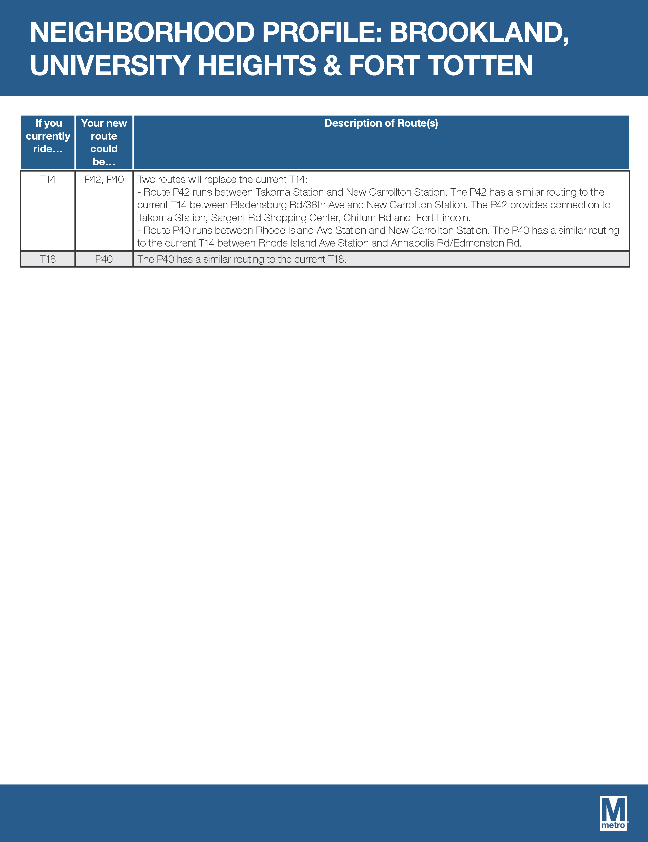
Metro has produced really handy neighborhood profiles, which provide a sort of crosswalk between existing routes and new routes. Routes serving the Riggs Park neighborhood are included in the Brookland, University Heights, & Fort Totten profile.

Bus stops being eliminated in and near the neighborhood.
| Stop Location | Current Route | Stop ID Number |
| SOUTH DAKOTA AVE NE + 8TH ST NE | 80 | 1002518 |
| SOUTH DAKOTA AVE NE + 8TH ST NE | 80 | 1002520 |
| GALLOWAY ST NE + SOUTH DAKOTA AVE NE | 80 E2 F6 | 1002556 |
| GALLOWAY ST NE + SOUTH DAKOTA AVE NE | 80 E2 F6 | 1002556 |
| NEW HAMPSHIRE AV NW+INGRAHAM ST NW | 64 | 1002583 |
| RIGGS RD NE + NORTH CAPITOL ST NE | 64 E4 K2 K6 | 1002584 |
| RIGGS RD NE + NORTH CAPITOL ST NE | 60 64 E4 K2 K6 | 1002586 |
| MISSOURI AVE NW + NEW HAMPSHIRE AVE NW | E4 | 1002587 |
| MISSOURI AVE NW + NEW HAMPSHIRE AVE NW | E4 | 1002589 |
| NEW HAMPSHIRE AVE NE + LONGFELLOW ST NE | K6 | 1002634 |
| NEW HAMPSHIRE AVE NE + LONGFELLOW ST NE | K6 | 1002637 |
| NICHOLSON ST NE + RIGGS RD NE | E4 | 1002668 |
| NEW HAMPSHIRE AVE NE + ONEIDA ST NE | K6 | 1002692 |
| NEW HAMPSHIRE AVE NE + ONEIDA ST NE | K6 | 1002693 |
| NEW HAMPSHIRE AVE NE + QUACKENBOS ST NE | K6 | 1002711 |
| NEW HAMPSHIRE AVE NE + QUACKENBOS ST NE | K6 | 1002712 |

This is a CF. Why should it take three bus lines to get to Friendship Heights when the E4 was one bus line that took you straight there. I live on the 5200 block of Chillum Place. From I what see on the new line. I would have to catch the C71 at Eastern Avenue and Jamaica Street to get to Fort Totten to catch a bus to Friendship Heights. Coming back I would have to catch C whatever to Fort Totten. Then catch the C71 to Union Station that goes thru Riggs Park. It would still stop 4 houses from my house but this truly is an inconvenience.