
Guest post by Gavin Baker
Take my survey to tell me what you think, or read on for more information.
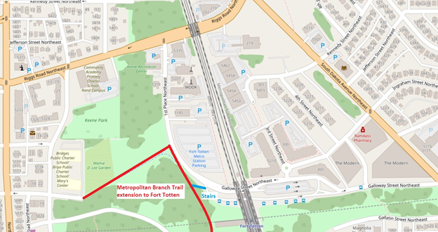
The Metropolitan Branch Trail (MBT) is a multi-use trail that will run from Silver Spring to Union Station when completed. Today, the trail segment connecting Fort Totten to the south is under construction and expected to open in 2020. When it opens, Lamond-Riggs and adjacent neighborhoods will have access to a great facility for walking, jogging, and biking. To access the MBT, the Fort Totten trailhead will be located on 1st Place NE, just west of the Fort Totten Metro station. The trailhead will connect to the sidewalk network, as well as the trail spur that connects west to Gallatin Street NE (which will be repaved as part of this project).
But for those of us who live in Lamond-Riggs, the question is: How are you going to bike there?
Bicycling is one of the primary purposes of the MBT, whether for recreation or commuting. However, Lamond-Riggs currently has no bike facilities, other than a single bike lane on Kansas Avenue, a mile away from Fort Totten. (Michigan Park and North Michigan Park also have no bike facilities.)
Biking on sidewalks is legal in this area, but not recommended. (Bicyclists on sidewalks have to yield to pedestrians, and are at greater risk of being struck by drivers at road crossings.)
Since there are no bike facilities and we don’t want to bike on the sidewalk, then that leaves biking in the street. Four streets provide access to the Fort Totten trailhead from Lamond-Riggs: Riggs Road, Galloway Street, Ingraham Street, or Kennedy Street (via 3rd Street). Riggs Road is a difficult option for cyclists because of high traffic speeds and volumes, so let’s look at the others. Galloway, Ingraham, and Kennedy streets all share another challenge for bicycling: a big hill. The climb on Galloway Street from South Dakota Avenue to the Fort Totten trailhead is comparable to Meridian Hill! I’ve watched many bicyclists humping up that hill, and none looked like they were having fun.
|
Up a big hill |
|||
|
Route |
Distance |
Climb |
Incline |
|
Galloway Street NE from South Dakota Avenue to the Fort Totten trailhead |
2,255′ |
85′ |
3.8% |
|
16th Street NW from U St. to Euclid St. (Meridian Hill) |
2,284′ |
85′ |
3.7% |
|
(Data from Google Maps) |
|||
Of course, that hill is exactly why Fort Totten is where it is: to have a commanding view of Confederate advances. While that topography served the Union Army well, it’s not so great for a leisurely ride.
Combine topography with traffic and this will be a frustrating spot. Drivers don’t want to be behind an exhausted bicyclist going uphill . . . and that bicyclist doesn’t want to be in front of drivers. Notably, Galloway Street is the route for several Metrobuses, as well as parking and kiss-and-ride for the Fort Totten Metro station.
The MBT is meant to be enjoyed by people of all ages and ability levels. But under the current conditions, reaching the MBT by bike from Lamond-Riggs may be an unpleasant experience for many people.
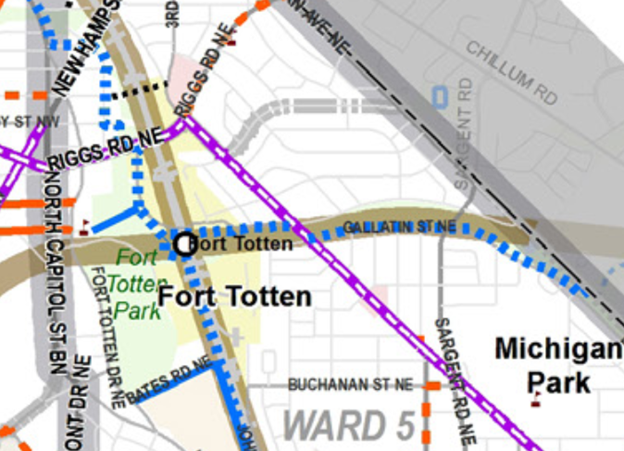
However, there may be opportunities to make some improvements so our neighborhood can have better access. There have been various plans for bike facilities on or next to Galloway Street. The District Department of Transportation’s (DDOT) 2014 moveDC plan includes a future trail along Galloway St. from the Fort Totten trailhead to South Dakota Avenue. That trail segment would continue along Gallatin St. to the District line, to a connection with the Northwest Branch Trail in Maryland. If built, that segment would connect our neighborhoods to many more miles of trails. However, at this time there seems to be no concrete plan for building it.
More modestly, last year DDOT listed a climbing lane as a “possible 2018 installation” on the lower portion of Galloway Street, from South Dakota Avenue to 4th St. NE (the alley through the Modern). A climbing lane is an on-street bike lane in the uphill direction only. While that would be a start, bicyclists would still have to mix with vehicular traffic the rest of the way uphill, and all the way downhill from the trailhead. More to the point, 2018 is now over and it didn’t happen yet. (However, the recent February Lamond-Riggs Citizens Association, a DDOT representative said that the planned sidewalk would be installed on the south side of Galloway Street in this location some time in 2019. Maybe the sidewalk and the bike facility are related?)
Looking north, the Cafritz Foundation’s Art Place development sits between Ingraham and Kennedy streets. Maybe new bike facilities could be built as part of any transportation changes arising from that development. In fact, the developers have stated that they would like to realign Kennedy Street in a future development phase. Realignment would involve new paving and curbs: if appropriate, maybe new bike facilities could be included.
These are some of the issues and ideas as I see them. How about you? Take my survey to tell me what you think, and let’s work together to find solutions for our neighborhood. If folks respond to the survey, I’ll share the responses out with the community.

Great write up.
The are allot of spots in the neighborhood that could have bicycle Lanes without removing parking or much cost. Like Sargent road or 12th St near the hospital.
The climbing Lane on Galloway is a real necessity I think. Whenever I bike up that hill cars aggressively pass and pass dangerously close as the road is narrow and they have to cross into oncoming traffic.