
As noted in this post, the DC Council is undertaking a redistricting process to adjust the ward boundaries. Find information at https://www.elissasilverman.com/redistricting. The Redistricting Subcommittee consists of At-large Councilmembers Elissa Silverman (chair), Anita Bonds, and Christina Henderson. Today, the subcommittee released three “‘discussion maps,’ to foster a productive dialogue on the choices facing the Subcommittee.” You can read about the discussion maps here. Two of the maps make no adjustment to the northern Ward 5 boundary, while one map, Map 3, does. And not in a way that makes sense.
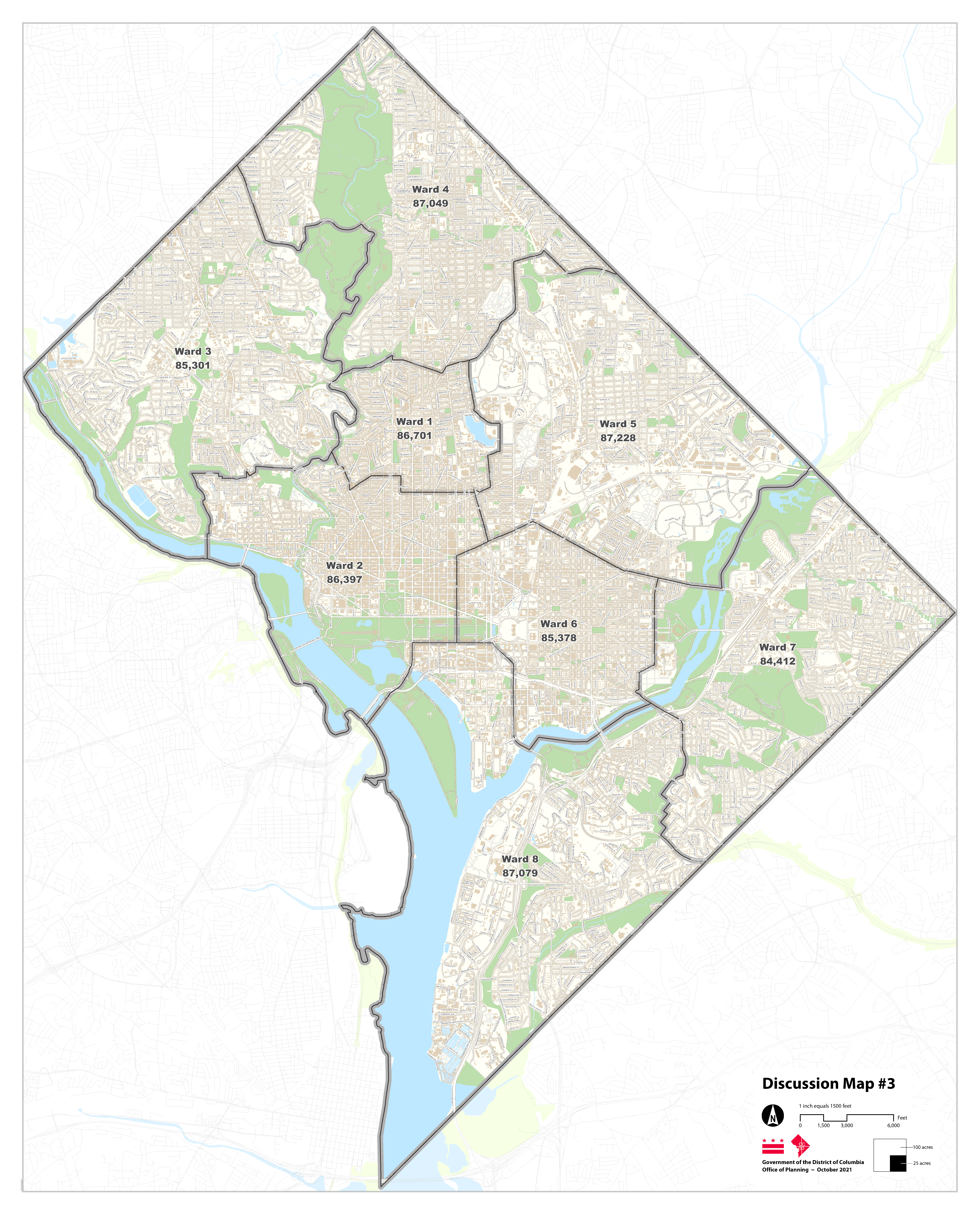
Map 3 shifts the Ward 5 boundary east of South Dakota Avenue NE from Kennedy Street NE to Galloway Street NE. The boundary west of South Dakota Avenue would remain at Riggs Road NE. My first concern about tinkering with the northern boundary in this way is that it is clearly being done as an afterthought without intentionality. This is clear from the fact that a description of this change was not even provided in the discussion points for the map until I reached out CM Silverman’s office earlier today. They then updated the discussion points, but the discussion points stated the change would shift residents from Ward 5 to Ward 1, which is obviously not correct. It is also clear that Map 3 is an update from a map presented during the Ward 5 roundtable that shifted the boundary to Hamilton Street NE, discussed in this post. So now it moves the boundary to Galloway Street after the point was made that the census tract boundary is not at Hamilton Street.
Second, this change still leaves the neighborhood split between Wards 4 and 5, except with this proposal, the split would be even more incongruous than it currently is. For reference, below is a map of Lamond-Riggs.
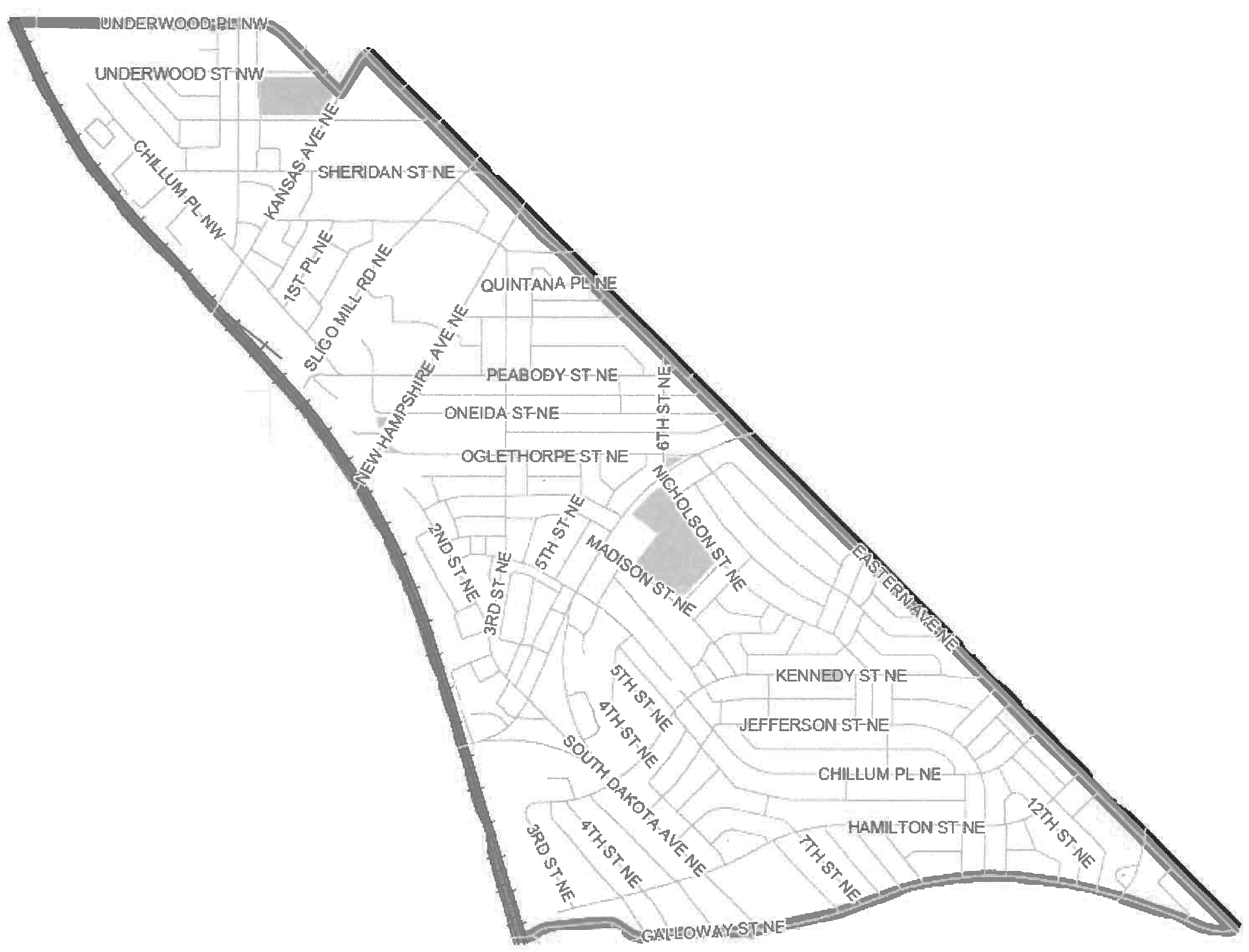
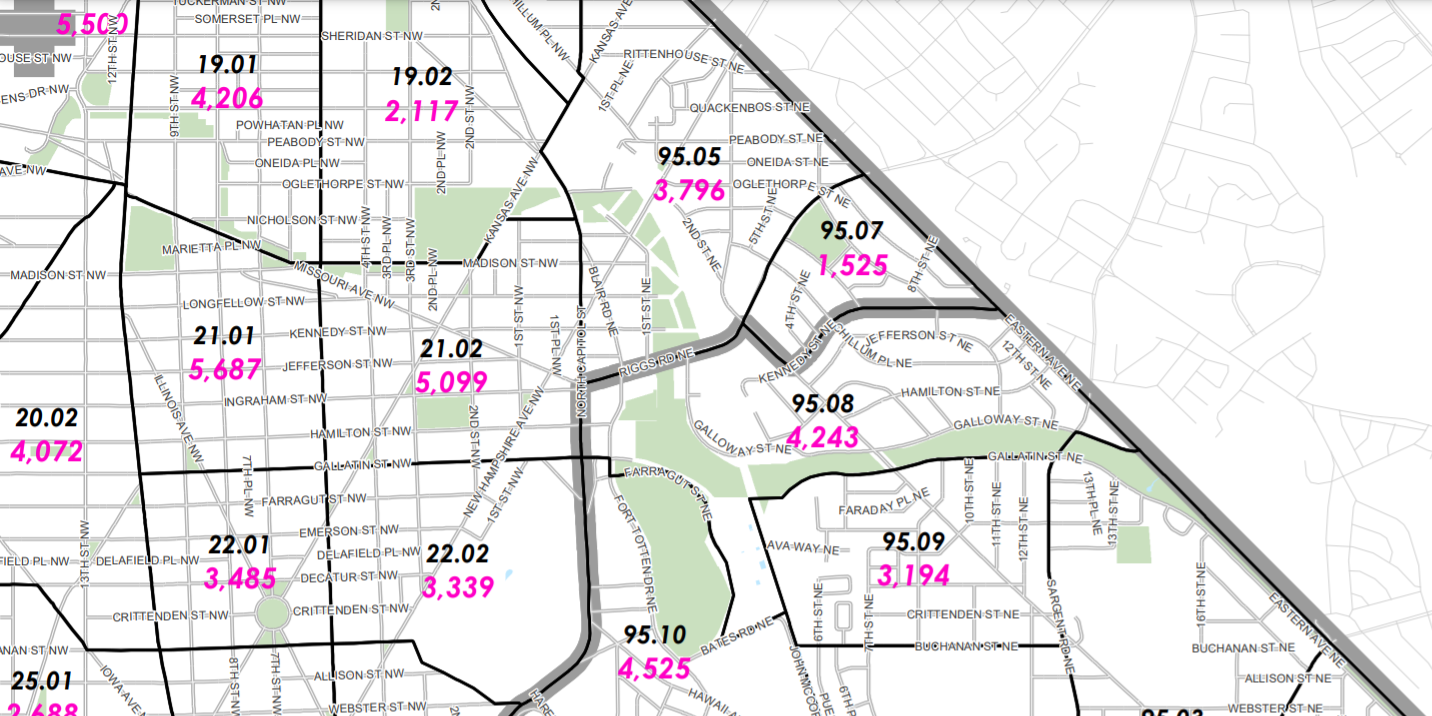
So for those who think Map 3 somehow unifies Lamond-Riggs, it does not. And this change would split census tract 95.08. If for some reason, the subcommittee really really feels like it has to adjust the northern boundary, to me it makes a lot more sense to use the park as the boundary, both east and west of South Dakota Avenue, as I noted in this post. That way, everyone north of Galloway both east and west of South Dakota Avenue would shift to Ward 4 and Riggs Park would actually be intact. The one thing I did not fully appreciate when first thinking about the neighborhood split is that while students on the Ward 5 side of Riggs Park (both east and west of South Dakota Avenue) are zoned for Ward 4 schools, these families are still voting for the Ward 5 State Board of Education representative, which probably does not make a ton of sense. That would be the one argument to support shifting the boundary so that these families are in Ward 4. But school boundaries are not aligned with ward boundaries because as we see ward boundaries can shift with some regularity especially around the edges of the ward, so this electoral feature is always a possibility (not to mention we barely have a functioning school boundary system as it is).
This whole exercise though leads me to think that the subcommittee should just leave the northern boundary alone. It is not necessary to adjust it. Changing it in the way being contemplated by this discussion map serves no purpose and seems to be a complete afterthought with no regard to either neighborhood boundaries or census tracts. People are already trying to do too much with this redistricting process as it is. This is one change that does not need to be made in my view.
Next Steps
The citywide hearing is on November 5. Sign up to testify at that hearing by 5:00 pm on November 3.
Written testimony can be submitted by Friday, November 12 at 5 p.m. to redistricting@dccouncil.us. Testimony can also be transcribed by calling (202) 350-1521. Map proposals can also be submitted to the subcommittee through dcredistricting.esriemcs.com.
CM Silverman’s office will be present at tonight’s LRCA meeting to discuss the redistricting process.

Without actually saying I think the suggested map is a good idea, I think it deserves more credit than you’re giving it. It isn’t as random a division of Riggs Park as it might seem. The part that would remain in Ward 5 is all of the multifamily buildings (The Aventine, The Modern), whereas all of the single-family homes would be united into Ward 4.
Riggs Park is essentially a single-family home neighborhood. One could argue (I am not arguing but I think it is somewhat reasonable to argue) that those multifamily buildings don’t really belong in Riggs Park and should be separated away.
Oh I know what the map ostensibly is supposed to be doing, which is unifying Lamond-Riggs and my point is simply that it does not. I included a map of the Lamond-Riggs boundaries for a reason. These are established neighborhood boundaries that have existed for over 70 years, so it’s not something I’m just making up on my own. The Riggs Plaza apartments that were torn down to make way for Art Place were pretty much built around the same time as the single family homes on the other side of South Dakota Avenue. It’s all one community and one neighborhood, even if people who do not live in this neighborhood do not know that. So if the neighborhood is already split between two wards, it’s pointless to tinker with the line in a way that still leaves the neighborhood split and that also splits the census tract when currently this census tract is not split. This is all being done as an afterthought without intentionality by the same mapmaker who originally suggested putting the boundary at Hamilton Street 🙂 But I always like to say I am one person with an opinion and everyone can write to the subcommittee with their own opinions.
As you have alluded to, I can’t imagine that the population of the area between Kennedy and Galloway is in any way significant enough that it would make any difference whatsoever. It does beg the question why